Tabango
Tabango | |
|---|---|
| Municipality of Tabango | |
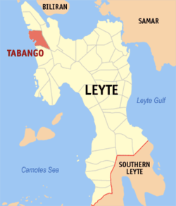 Map of Leyte with Tabango highlighted | |
show OpenStreetMap | |
 Tabango Location within the Philippines | |
| Coordinates: 11°19′N 124°22′E / 11.32°N 124.37°ECoordinates: 11°19′N 124°22′E / 11.32°N 124.37°E | |
| Country | Philippines |
| Region | Eastern Visayas |
| Province | Leyte |
| District | 3rd district |
| Barangays | 13 (see Barangays) |
| Government | |
| • Type | Sangguniang Bayan |
| • Mayor | Bernard Jonathan "Benjo" M. Remandaban |
| • Vice Mayor | Roslie D. Omega |
| • Representative | Vicente Sofronio E. Veloso III |
| • Councilors | show
List |
| • Electorate | 23,099 voters (2019) |
| Area | |
| • Total | 96.62 km2 (37.31 sq mi) |
| Elevation | 31 m (102 ft) |
| Highest elevation | 598 m (1,962 ft) |
| Lowest elevation | 0 m (0 ft) |
| Population (2020 census) [3] | |
| • Total | 33,868 |
| • Density | 350/km2 (910/sq mi) |
| • Households | 8,183 |
| Economy | |
| • Income class | 4th municipal income class |
| • Poverty incidence | 42.61% (2015)[4] |
| • Revenue | ₱83,803,787.44 (2016) |
| Service provider | |
| • Electricity | Leyte 5 Electric Cooperative (LEYECO 5) |
| Time zone | UTC+8 (PST) |
| ZIP code | 6536 |
| PSGC | |
| IDD : area code | +63 (0)53 |
| Climate type | tropical rainforest climate |
| Native languages | Cebuano Tagalog |


Tabango, officially the Municipality of Tabango (Cebuano: Lungsod sa Tabango; Waray: Bungto han Tabango; Tagalog: Bayan ng Tabango), is a 4th class municipality in the province of Leyte, Philippines. According to the 2020 census, it has a population of 33,868 people. [3]
Tabango, with annual income of P 34 million, has 13 barangays (villages), with 26 elementary schools, 4 high schools and one satellite school, the Palompon Institute of Technology.
Geography[]
Barangays[]
Tabango is politically subdivided into 13 barangays. [5]
- Butason I
- Butason II
- Campokpok
- Catmon
- Gimarco
- Gibacungan
- Inangatan
- Manlawaan
- Omaganhan
- Poblacion
- Santa Rosa
- Tabing
- Tugas
Climate[]
| hideClimate data for Tabango, Leyte | |||||||||||||
|---|---|---|---|---|---|---|---|---|---|---|---|---|---|
| Month | Jan | Feb | Mar | Apr | May | Jun | Jul | Aug | Sep | Oct | Nov | Dec | Year |
| Average high °C (°F) | 28 (82) |
29 (84) |
29 (84) |
31 (88) |
31 (88) |
30 (86) |
30 (86) |
30 (86) |
30 (86) |
29 (84) |
29 (84) |
29 (84) |
30 (85) |
| Average low °C (°F) | 22 (72) |
22 (72) |
22 (72) |
23 (73) |
24 (75) |
25 (77) |
25 (77) |
25 (77) |
25 (77) |
24 (75) |
24 (75) |
23 (73) |
24 (75) |
| Average precipitation mm (inches) | 73 (2.9) |
56 (2.2) |
75 (3.0) |
71 (2.8) |
114 (4.5) |
174 (6.9) |
172 (6.8) |
163 (6.4) |
167 (6.6) |
161 (6.3) |
158 (6.2) |
125 (4.9) |
1,509 (59.5) |
| Average rainy days | 15.2 | 12.5 | 16.2 | 17.3 | 23.9 | 27.3 | 28.4 | 26.9 | 26.9 | 27.1 | 23.8 | 19.3 | 264.8 |
| Source: Meteoblue [6] | |||||||||||||
History[]
In 1957 the sitios of Gibacungan, Catmon and Manlawa-an were converted into barrios.[7]
On January 17, 2008, Tabango Mayor Bernard Jonathan Remandaban opened (soft) the almost complete P 5.8 million modern, fully air-conditioned library: “It took us 6 years to construct our municipal library.” The library can accommodate 20,000 books, has 5 computer units with Internet access and a flat television set that only carries the National Geographic and Discovery Channels. Students can use the computers for 10 hours monthly, free of charge.[8]
Tabango was a barrio of San Isidro, Leyte. Its early settlers came from the islands of Cebu and Bohol and from the towns of Villaba and Palompon. Later as the transportation improved same personage from the eastern side of Leyte Province found fortune in the place. These people were responsible in molding its culture.
During the Second World War, the Barrio of Tabango was made as the seat of the Civil Government of the Municipality of San Isidro, Leyte, the civil authorities returned the seat of the Local Government to the Poblacion of San Isidro, Leyte
In 1948, prominent residents of Tabango, took the opportunity offered by the late Jose L. Alvarez to work out in Manila thru Senate President Mariano Jesus Cuenco, the establishment of a new political unit. Documentation were initiated with the assistance of the Late Rosendo Homerez of Tacloban City, whose wife was native of Tugas, now a barangay of Tabango. Eventually, Executive Order No. 284 was signed by His Excellency President Elpidio Quirino on October 15, 1949, creating the Municipality of Tabango, Leyte. The first set of officials were appointed and sworn to office on January 16, 1950, to wit: Francisco Pastor (Municipal Mayor); Felomino Ocubillo (Municipal Vice Mayor); Adolfo Alvarez, Honofre Damayo, Potenciano Pijo, Mauricio Sevilles, Mateo Pastor (Councilmen).
The doctrine in the case of Pelaez vs. the Auditor General, G.R. No. L-23825 promulgated on December 24, 1965, placed the Municipality of Tabango in a great dilemma. It was in this case that the Supreme Court ruled and declared certain orders creating municipalities unconstitutional on the ground that the creation of municipalities is an exercise of the legislative power. On this premise, creation and exercise of the Municipality of Tabango, Leyte was illegal. However, the cloud that darkened the juridical personality of Tabango as a municipal corporation disappeared with the introduction of House Bill No. 2042 during the seventh congress by the Congressman Marcelino R. Veloso, Representative of the 3rd District Leyte. The bill proposed to create the municipalities of Almeria, Cabucgayan, Tabango and Culaba, with retroactive effect in order to validate the existence of the aforementioned municipal corporations. The bill was finally approved into law on June 17, 1972, as Republic Act 6488 retroactive on October 15, 1949.[9]
Origin of Tabango[]
Tabango was originally a barrio named Tandaya. Most of its inhabitants lived near the seashore. One day, a man living in the barrio went to catch some crabs as swamps surrounded the place and crabs were abundant. Although he was an expert in catching crabs, he was accidentally bitten by a big one. A Spanish soldier happened to be near the place where the man was, so he came near and asked for the name of the place. The man bitten by the crab looked up and saw the soldier. Feeling the pain caused by the biting of the crab, he cried, “ Tabang mo,” which means help me. The soldier, thinking it was the name of then place, said, “ Ah, Tabango. “ The soldier repeated the word Tabango to his superiors and from that time on, the settlement was called Tabango. When the barrio was created a municipality, it retained its name.[10]
Demographics[]
|
| ||||||||||||||||||||||||||||||||||||
| Source: Philippine Statistics Authority [11] [12] [13][14] | |||||||||||||||||||||||||||||||||||||
In the 2020 census, the population of Tabango was 33,868 people, [3] with a density of 350 inhabitants per square kilometre or 910 inhabitants per square mile.
Economy[]
| Poverty Incidence of Tabango | |
| Source: Philippine Statistics Authority[15][16][17][18][19][20] | |
Tourism[]
Among sites that is visited by tourist are:
- Boho Beach & Bat Cave - A stretch of white sand, quaint native cottages, and a fresh water spring; marvel at thousands of fruit-eating bats in an out of the way bat cave where folklore says that the cave tunnel connects with another cave entrance in the San Vincente Ferrer Pilgrimage Site.[21]
- San Vicente Ferrer Pilgrimage Site & Pangpang Cave - Said to be miraculous, pilgrims from all over the Philippines flock to this religious site to pray, give thanks and pay homage.[22]
- Ocean Pearl Cove Resort - Belt out a song at any of the three Videoke Bars, jet ski to the sunset, experience the thrill of the banana boat ride, speedboat or pedal boat to an adjacent island, loll out on floating cottages, frolic in the swimming pool, relax in luxurious digs, and enjoy sumptuous meals and exotic drinks from the restaurant and the bar.[23]
- Dawahon Isle - A rocky promontory of secluded alcoves, tiny white beaches and crystal clear waters teeming with spectacular and colorful marine life.[24]
- Sunset Canturaw - Highest peak hereabouts, landmark for fishermen at sea, with a 500-step climb to the site of the Tabango Observatory Point Summit (TOPS).[25]
Education[]
Tabango has 26 elementary schools, 4 high schools and one satellite school, the Palompon Institute of Technology.[26]
Elementary Schools[]
- Butason I Elementary School
- Butason II Primary School
- Campokpok CS
- Caramcam Primary School
- Catmon Elementary School
- Colonia Elementary School
- Don Bernardo Elementary School
- Gibacungan Elementary School
- Gimarco Elementary School
- Inangatan Primary School
- Kawayan Primary School
- Leon-ito Primary School
- Leoncio Erejer MPS
- Manlawaan Elementary School
- Omaganhan Elementary School
- Pining Paglingap Elementary School
- Sambulawan Elementary School
- Santa Rosa Elementary School
- Tabango North CS
- Tabayla Elementary School
- Tabing Elementary School
- Tahad Primary School
- Tugas Elementary School
- Ybanez Elementary School
Secondary School[]
- Gibacungan National High School
- Marcelino R. Veloso NHS (Marcelino R. Veloso NHS)
- Pastor Salazar National High School
- Tabango National High School
College[]
- Palompon Institute of Technology-Tabango Campus
References[]
- ^ Municipality of Tabango | (DILG)
- ^ "2015 Census of Population, Report No. 3 – Population, Land Area, and Population Density" (PDF). Philippine Statistics Authority. Quezon City, Philippines. August 2016. ISSN 0117-1453. Archived (PDF) from the original on May 25, 2021. Retrieved July 16, 2021.
- ^ Jump up to: a b c Census of Population (2020). "Region VIII (Eastern Visayas)". Total Population by Province, City, Municipality and Barangay. PSA. Retrieved 8 July 2021.
- ^ https://psa.gov.ph/sites/default/files/City%20and%20Municipal-level%20Small%20Area%20Poverty%20Estimates_%202009%2C%202012%20and%202015_0.xlsx; publication date: 10 July 2019; publisher: Philippine Statistics Authority.
- ^ "Province: Leyte". PSGC Interactive. Quezon City, Philippines: Philippine Statistics Authority. Retrieved 12 November 2016.
- ^ "Tabango: Average Temperatures and Rainfall". Meteoblue. Retrieved 29 February 2020.
- ^ "An Act Creating Certain Barrios in the Municipality of Tabango, Province of Leyte". LawPH.com. Retrieved 2011-04-12.
- ^ Inquirer.net, Poor town has modern library
- ^ [1]
- ^ "History of Tabango". Retrieved September 27, 2018.
- ^ Census of Population (2015). "Region VIII (Eastern Visayas)". Total Population by Province, City, Municipality and Barangay. PSA. Retrieved 20 June 2016.
- ^ Census of Population and Housing (2010). "Region VIII (Eastern Visayas)". Total Population by Province, City, Municipality and Barangay. NSO. Retrieved 29 June 2016.
- ^ Censuses of Population (1903–2007). "Region VIII (Eastern Visayas)". Table 1. Population Enumerated in Various Censuses by Province/Highly Urbanized City: 1903 to 2007. NSO.
- ^ "Province of Leyte". Municipality Population Data. Local Water Utilities Administration Research Division. Retrieved 17 December 2016.
- ^ "Poverty incidence (PI):". Philippine Statistics Authority. Retrieved 28 December 2020.
- ^ https://psa.gov.ph/sites/default/files/NSCB_LocalPovertyPhilippines_0.pdf; publication date: 29 November 2005; publisher: Philippine Statistics Authority.
- ^ https://psa.gov.ph/sites/default/files/2003%20SAE%20of%20poverty%20%28Full%20Report%29_1.pdf; publication date: 23 March 2009; publisher: Philippine Statistics Authority.
- ^ https://psa.gov.ph/sites/default/files/2006%20and%202009%20City%20and%20Municipal%20Level%20Poverty%20Estimates_0_1.pdf; publication date: 3 August 2012; publisher: Philippine Statistics Authority.
- ^ https://psa.gov.ph/sites/default/files/2012%20Municipal%20and%20City%20Level%20Poverty%20Estima7tes%20Publication%20%281%29.pdf; publication date: 31 May 2016; publisher: Philippine Statistics Authority.
- ^ https://psa.gov.ph/sites/default/files/City%20and%20Municipal-level%20Small%20Area%20Poverty%20Estimates_%202009%2C%202012%20and%202015_0.xlsx; publication date: 10 July 2019; publisher: Philippine Statistics Authority.
- ^ "Tourism". Retrieved December 11, 2018.
- ^ "Tourism". Retrieved December 12, 2018.
- ^ "Tourism". Retrieved December 11, 2018.
- ^ "Tourism". Retrieved December 11, 2018.
- ^ "Tourism". Retrieved December 11, 2018.
- ^ "Education". Retrieved September 28, 2018.
External links[]
- Tabango Profile at PhilAtlas.com
- Philippine Standard Geographic Code
- Philippine Census Information
- Local Governance Performance Management System
| show Places adjacent to Tabango |
|---|
| show Authority control |
|---|
- Municipalities of Leyte (province)