Pan de Guajaibón
| Pan de Guajaibón | |
|---|---|
 | |
| Highest point | |
| Elevation | 699 m (2,293 ft) |
| Prominence | 699 m (2,293 ft) |
| Coordinates | 22°47′20″N 83°21′52″W / 22.78889°N 83.36444°WCoordinates: 22°47′20″N 83°21′52″W / 22.78889°N 83.36444°W |
| Geography | |
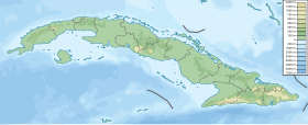 Pan de Guajaibón Guaniguanico range, western Cuba | |
| Parent range | Guaniguanico |

Pan de Guajaibón is a mountain in the Guaniguanico range of western Cuba. It has two peaks, the highest of which is 699 metres above sea level.[1] It is the highest mountain in the Guaniguanico range.[2]
A bust of Antonio Maceo Grajales is situated at the top of the mountain.[3][4]
There are also cave systems at the mountain which contain archeological artifacts.[4]
References[]
- ^ Administrator. "cuba naturaleza .org - Pan de Guajaibon, Sierra Rosario, Pinar del Rio". cubanaturaleza.org.
- ^ "Pan de Guajaibon". peakery.com.
- ^ "Archivo - CUBARTE". CUBARTE.[permanent dead link]
- ^ a b "Explorarán Pan de Guajaibón, mayor altura del occidente cubano". Periódico Guerrillero - Pinar del Río, Cuba.
External links[]
 Media related to Pan de Guajaibón at Wikimedia Commons
This Cuban location article is a stub. You can help Wikipedia by . |
Categories:
- Mountains of Cuba
- Cuba geography stubs