Phillips County, Arkansas
Phillips County | |
|---|---|
U.S. county | |
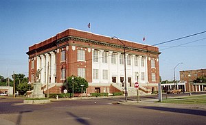 Phillips County courthouse in Helena-West Helena | |
 Location within the U.S. state of Arkansas | |
 Arkansas's location within the U.S. | |
| Coordinates: 34°23′25″N 90°52′11″W / 34.390277777778°N 90.869722222222°W | |
| Country | |
| State | |
| Founded | May 1, 1820 |
| Named for | Sylvanus Phillips |
| Seat | Helena-West Helena |
| Largest city | Helena-West Helena |
| Area | |
| • Total | 727 sq mi (1,880 km2) |
| • Land | 696 sq mi (1,800 km2) |
| • Water | 32 sq mi (80 km2) 4.4%% |
| Population (2010) | |
| • Total | 21,757 |
| • Estimate (2019) | 17,782 |
| • Density | 30/sq mi (12/km2) |
| Time zone | UTC−6 (Central) |
| • Summer (DST) | UTC−5 (CDT) |
| Congressional district | 1st |
| Website | phillipscounty |

Phillips County is a county located in the eastern part of the U.S. state of Arkansas, in what is known as the Arkansas Delta along the Mississippi River. As of the 2010 census, the population was 21,757.[1] The county seat is Helena–West Helena.[2] Phillips County is Arkansas's seventh (7th) county, formed on May 1, 1820, and named for , the area's first-known white settler and representative to the first Territorial Legislature of the Arkansas Territory. This lowland area was developed for cotton plantations in the antebellum area and is still largely rural.
The Helena-West Helena, AR Micropolitan Statistical Area includes all of Phillips County.
From September 30-October 1, 1919 during the Elaine race riot in Phillips County, 237 African Americans were killed, attacked at large by armed whites trying to suppress the Progressive Farmers and Household Union of America which was organizing in the county. Because the white mob actions were racial terrorism against African Americans, the deaths were classified as lynchings by the Equal Justice Initiative in its 2015 report on lynchings in the South. Based on this, Phillips County ranks as the county with the highest number of lynchings in U.S. history.[3]
Geography[]
According to the U.S. Census Bureau, the county has a total area of 727 square miles (1,880 km2), of which 696 square miles (1,800 km2) is land and 32 square miles (83 km2) (4.4%) is water.[4]
Major highways[]
 U.S. Highway 49
 Highway 1
 Highway 39
 Highway 85
Adjacent counties[]
- Lee County (north)
- Tunica County, Mississippi (northeast)
- Coahoma County, Mississippi (east)
- Bolivar County, Mississippi (southeast)
- Desha County (south)
- Arkansas County (southwest)
- Monroe County (northwest)
National protected areas[]
- St. Francis National Forest (part)
- White River National Wildlife Refuge (part)
Demographics[]
| Historical population | |||
|---|---|---|---|
| Census | Pop. | %± | |
| 1830 | 1,152 | — | |
| 1840 | 3,547 | 207.9% | |
| 1850 | 6,935 | 95.5% | |
| 1860 | 14,877 | 114.5% | |
| 1870 | 15,372 | 3.3% | |
| 1880 | 21,262 | 38.3% | |
| 1890 | 25,341 | 19.2% | |
| 1900 | 26,561 | 4.8% | |
| 1910 | 33,535 | 26.3% | |
| 1920 | 44,530 | 32.8% | |
| 1930 | 40,683 | −8.6% | |
| 1940 | 45,970 | 13.0% | |
| 1950 | 46,254 | 0.6% | |
| 1960 | 43,997 | −4.9% | |
| 1970 | 40,046 | −9.0% | |
| 1980 | 34,772 | −13.2% | |
| 1990 | 28,838 | −17.1% | |
| 2000 | 26,445 | −8.3% | |
| 2010 | 21,757 | −17.7% | |
| 2019 (est.) | 17,782 | [5] | −18.3% |
| U.S. Decennial Census[6] 1790–1960[7] 1900–1990[8] 1990–2000[9] 2010–2016[1] | |||

As of the 2010 census, there were 21,757 people living in the county. 63.1% were Black or African American, 35.0% White, 0.3% Asian, 0.2% Native American, 0.4% of some other race and 0.9% of two or more races. 1.3% were Hispanic or Latino (of any race).
As of the 2000 census,[11] there were 26,445 people, 9,711 households, and 6,768 families living in the county. The population density was 38 people per square mile (15/km2). There were 10,859 housing units at an average density of 16 per square mile (6/km2). The racial makeup of the county was 59.04% Black or African American, 39.25% White, 0.43% from other races, 0.32% Asian, 0.17% Native American, 0.01% Pacific Islander, and 0.78% from two or more races. 1.44% of the population were Hispanic or Latino of any race. At over 58% of the county's population, Phillips County has the highest percentage of African Americans in the state of Arkansas.[12]
There were 9,711 households, out of which 34.20% had children under the age of 18 living with them, 40.30% were married couples living together, 25.10% had a female householder with no husband present, and 30.30% were non-families. 27.60% of all households were made up of individuals, and 13.00% had someone living alone who was 65 years of age or older. The average household size was 2.69 and the average family size was 3.29.
In the county, the population was spread out, with 32.20% under the age of 18, 9.40% from 18 to 24, 23.20% from 25 to 44, 21.20% from 45 to 64, and 13.90% who were 65 years of age or older. The median age was 33 years. For every 100 females there were 84.70 males. For every 100 females age 18 and over, there were 77.70 males.
The median income for a household in the county was $22,231, and the median income for a family was $26,570. Males had a median income of $24,675 versus $17,520 for females. The per capita income for the county was $12,288. About 28.70% of families and 32.70% of the population were below the poverty line, including 45.50% of those under age 18 and 26.20% of those age 65 or over.
For the period 2000–2009, the Helena-West Helena statistical area lost 20.89% of its population, the largest decline of any statistical area in the country.
Government[]
As a majority-Black county, Phillips County is strongly Democratic. It has voted for the Democratic presidential candidate in all but two elections in the last century (Strom Thurmond's whites-only Dixiecrat effort in 1948 and Richard Nixon's 1972 landslide).
Education[]
School districts serving Phillips County include the Helena-West Helena School District, the Marvell–Elaine School District, and the Barton–Lexa School District.
Previously the Lake View School District served a portion of the county. On July 1, 2004, the Lake View district merged into the Barton–Lexa district. Previously the Elaine School District served another portion of the county. On July 1, 2006, the Elaine district merged into the Marvell district.[14][15]
Marvell Academy, a private school founded in 1966[16] as a segregation academy.,[17] is in unincorporated Phillips County, near Marvell.[18]
Communities[]
Cities[]
- Elaine
- Helena–West Helena (county seat)
- Lake View
- Marvell
Town[]
Unincorporated places[]
Townships[]

Townships in Arkansas are the divisions of a county. Each township includes unincorporated areas; some may have incorporated cities or towns within part of their boundaries. Arkansas townships have limited purposes in modern times. However, the United States census does list Arkansas population based on townships (sometimes referred to as "county subdivisions" or "minor civil divisions"). Townships are also of value for historical purposes in terms of genealogical research. Each town or city is within one or more townships in an Arkansas county based on census maps and publications. The townships of Phillips County are listed below; listed in parentheses are the cities, towns, and/or census-designated places that are fully or partially inside the township. [19][20]
| Township | FIPS code | ANSI code (GNIS ID) |
Population center(s) |
Pop. (2010) |
Pop. density (/mi2) |
Pop. density (/km2) |
Total area (mi2) |
Total area (km2) |
Land area (mi2) |
Land area (km2) |
Water area (mi2) |
Water area (km2) |
Geographic coordinates |
|---|---|---|---|---|---|---|---|---|---|---|---|---|---|
| 05-90273 | 00068945 | 425 | 11.05 | 4.26 | 38.474 | 99.65 | 38.474 | 99.65 | 0 | 0.000 | 34°29′04″N 90°53′36″W / 34.484468°N 90.893231°W | ||
| 05-90849 | 00068946 | 660 | 29.12 | 11.24 | 22.692 | 58.77 | 22.665 | 58.70 | 0.027 | 0.06993 | 34°36′32″N 90°41′27″W / 34.608847°N 90.690904°W | ||
| 05-90870 | 00068947 | 198 | 8.01 | 3.09 | 24.731 | 64.05 | 24.722 | 64.03 | 0.009 | 0.02331 | 34°28′46″N 90°58′19″W / 34.479487°N 90.971919°W | ||
| 05-91005 | 00068948 | 152 | 9.54 | 3.68 | 15.938 | 41.28 | 15.938 | 41.28 | 0 | 0.000 | 34°28′35″N 91°01′08″W / 34.476511°N 91.018900°W | ||
| 05-91704 | 00068949 | Marvell | 1,550 | 49.89 | 19.26 | 31.10 | 80.55 | 31.066 | 80.46 | 0.034 | 0.08806 | 34°35′11″N 90°56′11″W / 34.586411°N 90.936268°W | |
| 05-91707 | 00068950 | 231 | 6.99 | 2.70 | 33.046 | 85.59 | 33.046 | 85.59 | 0 | 0.000 | 34°35′11″N 91°01′00″W / 34.586511°N 91.016744°W | ||
| 05-91767 | 00068951 | part of Helena-West Helena | 9,697 | 265.48 | 102.51 | 36.526 | 94.60 | 36.526 | 94.60 | 0 | 0.000 | 34°32′24″N 90°40′45″W / 34.539980°N 90.679052°W | |
| 05-92094 | 00068953 | 41 | 0.91 | 0.35 | 50.741 | 131.4 | 44.870 | 116.2 | 5.871 | 15.21 | 34°24′38″N 90°40′36″W / 34.410535°N 90.676788°W | ||
| 05-92391 | 00068955 | 589 | 14.42 | 5.57 | 40.865 | 105.8 | 40.846 | 105.8 | 0.019 | 0.04921 | 34°35′51″N 90°52′13″W / 34.597488°N 90.870256°W | ||
| 05-92547 | 00078865 | 179 | 1.70 | 0.66 | 115.059 | 298.0 | 105.231 | 272.5 | 9.828 | 25.45 | 34°11′30″N 90°58′10″W / 34.191547°N 90.969308°W | ||
| 05-93276 | 00068956 | most of Helena-West Helena | 4,746 | 103.10 | 39.82 | 53.971 | 139.8 | 46.034 | 119.2 | 7.937 | 20.56 | 34°32′21″N 90°36′13″W / 34.539209°N 90.603521°W | |
| 05-93462 | 00068958 | Lexa, small part of Lake View | 1,789 | 22.46 | 8.67 | 79.694 | 206.4 | 79.648 | 206.3 | 0.046 | 0.1191 | 34°31′40″N 90°45′56″W / 34.527768°N 90.765687°W | |
| 05-93573 | 00068959 | Elaine, most of Lake View | 1,500 | 8.49 | 3.28 | 184.506 | 477.9 | 176.595 | 457.4 | 7.911 | 20.49 | 34°20′37″N 90°52′49″W / 34.343723°N 90.880168°W | |
| Source: "Census 2010 U.S. Gazetteer Files: County Subdivisions in Arkansas". U.S. Census Bureau, Geography Division. Archived from the original on May 31, 2014.
Source: "Census 2010 U.S. Gazetteer Files". U.S. Census Bureau, Geography Division. | |||||||||||||
Notable people[]
- ,[21] Arkansas Attorney General
- Barry Williamson, attorney and member of the Texas Railroad Commission
- Blanche Lincoln, U.S. Senator
- Mark Lavon "Levon" Helm, drummer and singer for The Band
- Robert Lockwood Jr., blues guitarist and
- Alex or , known later in his career as Sonny Boy Williamson, was an American blues harmonica player, singer and songwriter.
- Elias Camp Morris, African-American baptist minister, also known as Dr. E.C. Morris. Founder of the National Baptist Convention & Morris - Booker College.
- , African-American physician and politician, first black doctor of , first black mayor of Helena.
- , African-American educator, businesswoman, and philanthropist.
- Mauricelm-Lei Millere, African-American political & religious movement, human rights activist, psychiatric clinician, and independent scientist (See also Black Coffee Party, Louis Farrakhan, Khalid Abdul Muhammad).
See also[]
- List of lakes in Phillips County, Arkansas
- National Register of Historic Places listings in Phillips County, Arkansas
References[]
- ^ Jump up to: a b "State & County QuickFacts". United States Census Bureau. Archived from the original on June 7, 2011. Retrieved May 19, 2014.
- ^ "Find a County". National Association of Counties. Retrieved June 7, 2011.
- ^ Robertson, Campbell (February 10, 2015). "History of Lynchings in the South Documents Nearly 4,000 Names". The New York Times.
- ^ "2010 Census Gazetteer Files". United States Census Bureau. August 22, 2012. Retrieved August 27, 2015.
- ^ "Population and Housing Unit Estimates". Retrieved September 28, 2019.
- ^ "U.S. Decennial Census". United States Census Bureau. Retrieved August 27, 2015.
- ^ "Historical Census Browser". University of Virginia Library. Retrieved August 27, 2015.
- ^ Forstall, Richard L., ed. (March 27, 1995). "Population of Counties by Decennial Census: 1900 to 1990". United States Census Bureau. Retrieved August 27, 2015.
- ^ "Census 2000 PHC-T-4. Ranking Tables for Counties: 1990 and 2000" (PDF). United States Census Bureau. April 2, 2001. Retrieved August 27, 2015.
- ^ Based on 2000 census data
- ^ "U.S. Census website". United States Census Bureau. Retrieved May 14, 2011.
- ^ "Arkansas Black Population Percentage by County". www.indexmundi.com. Retrieved April 17, 2021.
- ^ "Dave Leip's Atlas of U.S. Presidential Elections". Retrieved November 18, 2016.
- ^ "Consolidation/Annexations of LEA's (1983-2010) Archived 2010-09-24 at the Wayback Machine." Arkansas Department of Education. Retrieved on March 2, 2011.
- ^ "Education Board approves mergers, removes Greenland from fiscal distress". March 13, 2006. Archived from the original on September 12, 2014. Retrieved September 12, 2014.
- ^ "About Archived 2011-07-14 at the Wayback Machine." Marvell Academy. Retrieved on March 2, 2011.
- ^ "Private Schools: The Last Refuge." TIME. Friday November 14, 1969. Retrieved on March 2, 2011.
- ^ "Marvell Academy Principals." Manta. Retrieved on March 2, 2011. "645 Highway 243 Marvell, AR 72366."
- ^ 2011 Boundary and Annexation Survey (BAS): Phillips County, AR (PDF) (Map). U. S. Census Bureau. Archived from the original (PDF) on October 19, 2012. Retrieved August 21, 2011.
- ^ "Arkansas: 2010 Census Block Maps - County Subdivision". United States Census Bureau. Retrieved June 28, 2014.
- ^ "Bruce Bennett (1917-1979)". encyclopediaofarkansas.net. Retrieved May 10, 2010.
| Wikimedia Commons has media related to Phillips County, Arkansas. |
External links[]
| show Places adjacent to Phillips County, Arkansas |
|---|
| show Municipalities and communities of Phillips County, Arkansas, United States |
|---|


Coordinates: 34°23′25″N 90°52′11″W / 34.39028°N 90.86972°W
| show Authority control |
|---|
- Arkansas counties
- Phillips County, Arkansas
- 1820 establishments in Arkansas Territory
- Populated places established in 1820
- Arkansas counties on the Mississippi River