Quimby Island
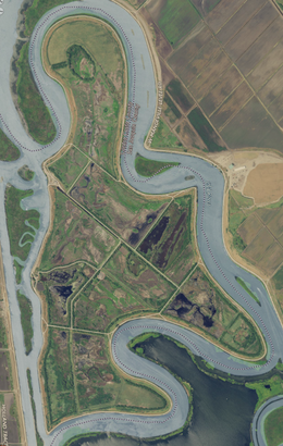 USGS aerial imagery of the island. | |
 Quimby Island | |
| Geography | |
|---|---|
| Location | Northern California |
| Coordinates | 38°01′31″N 121°34′17″W / 38.0251993°N 121.5713413°W[1]Coordinates: 38°01′31″N 121°34′17″W / 38.0251993°N 121.5713413°W[1] |
| Adjacent bodies of water | Sacramento–San Joaquin River Delta |
| Area | 789 acres (319 ha) |
| Length | 2.25 mi (3.62 km)[1] |
| Highest elevation | −10 ft (-3 m)[1] |
| Administration | |
United States | |
| State | |
| County | Contra Costa |


Quimby Island is a small island in the Sacramento–San Joaquin River Delta,[2][3] whose coordinates are 38°01′31″N 121°34′17″W / 38.0251993°N 121.5713413°W[1]. It is in Contra Costa County, and managed by Reclamation District 2090.[4]
References[]
- ^ a b c d U.S. Geological Survey Geographic Names Information System: Quimby Island
- ^ "New Floods Sweep Valleys". Oakland Tribune. Oakland, California. 1938-02-14. p. 1.
- ^ "Thor Kofod Buys Quimby Island For $34,000". Contra Costa Gazette. Martinez, California. 1943-12-04. p. 1.
- ^ "Countywide Reclamation Services: Municipal Service Review/Sphere of Influence Update (2nd Round) – FINAL" (PDF). Contra Costa Local Agency Formation Commission. 18 November 2015. Archived (PDF) from the original on 1 March 2017. Retrieved 23 February 2021.
Map: Islands of Suisun Bay and the Sacramento–San Joaquin River Delta | |
|---|---|
 Victoria Upper Jones Lower Jones Winter Van Sickle Venice Bradford Twitchell Roe Simmons Wheeler Merritt Rough and Ready (islands of the San Francisco Bay Area) |
San Francisco Bay watershed | ||
|---|---|---|
| Outline |
|  |
| Subdivisions |
| |
| Waterways |
| |
| Parks and protected areas |
| |
| Islands and peninsulas |
| |
| Wetlands |
| |
| Bridges and tubes |
| |
| Ferries | ||
| Ports and marinas |
| |
| Other |
| |
| ||
This Contra Costa County, California–related article is a stub. You can help Wikipedia by . |
Categories:
- Islands of Contra Costa County, California
- Islands of the Sacramento–San Joaquin River Delta
- Islands of Northern California
- Contra Costa County, California geography stubs