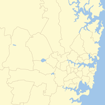
Regions of Sydney

The metropolis of Sydney in New South Wales, Australia, is informally subdivided into a number of geographic regions. These areas sometimes, but not always, roughly coincide with official boundaries of suburbs, local government authorities, or cadastral units (used for land title purposes), and some of the customary regions do not have well defined boundaries at all. Some commonly referred to regions overlap: for example, "Canterbury-Bankstown" is often referred to as a region, but it is also part of the "South Western Sydney" region. The regions themselves are not used as a formal jurisdiction, and generally do not have administrative or legislative bodies, although some regions are coterminous with a local government area, and in a number of regions that include multiple local government areas, Regional Organisations of Councils have been established that represent the councils in the region.
For government planning purposes, the metropolis of Sydney is divided in other ways, including into "districts" or "cities".[1]
History[]
Described as the City of Suburbs, many suburbs have dominated the cultural landscape of regional and metropolitan Sydney for generations. In much of the 20th century, suburban phenomenon became the result of the expansion of suburbs due to the progress of detached houses.
City[]
The City is composed of the inner parts of the local government area of the City of Sydney.[2] The core of the region known as "City" is the Sydney CBD, and this is the "City" region in the narrow sense. However, "City" is often also used in a wider sense to include other inner suburbs within the City of Sydney local government area, such as Haymarket, The Rocks and Pyrmont.[2] In this wider sense, the City region roughly corresponds with the four cadastral parishes of St Andrews, St Philip, St James and St Lawrence.
Eastern suburbs[]
The suburbs to the east and southeast of the City, bounded by Sydney Harbour to the north, the Pacific Ocean to the east, and Botany Bay to the south, are often referred to as the Eastern suburbs. In a narrower sense, "Eastern Suburbs" refers only to the approximately northern part of this area, directly to the east of the City, and the southern part of the area is referred to as "South-Eastern Sydney". By contrast, when used in the wider sense the “Eastern suburbs” are composed of the local government areas of the entirety of the Randwick, Waverley, Bayside Council (eastern part), Woollahra and the eastern parts of the City of Sydney.[3]
Eastern Suburbs[]
When used in the narrow sense, Sydney's Eastern Suburbs is centred on the Waverley and Woollahra council areas, sometimes extending south to include the northern part of the City of Randwick and west to include the eastern part of the City of Sydney. Suburbs located within the Eastern Suburbs in this narrower sense include Bronte, Bellevue Hill, Point Piper, and the inner suburbs of Paddington, Surry Hills and Darlinghurst.[3] In this narrower sense, the Eastern Suburbs roughly correspond with the cadastral Parish of Alexandria.
South-Eastern Sydney[]
South-Eastern Sydney usually refers to the Bayside Council (sometimes eastern part only) and Randwick local government areas, as well as the southern part of the City of Sydney. South-Eastern Sydney roughly correspond with the cadastral Parish of Botany.
Western suburbs[]
The Western suburbs of Sydney is a large region, starting from the western boundary of the city centre and stretching some 60 kilometres to the west to the foothills of the Blue Mountains. This large area is conventionally divided into a number of regions (some of which overlap).
Inner West[]
The Inner West is primarily composed of the Inner West Council, Burwood Council, Municipality of Strathfield, and the City of Canada Bay local government areas. It may also be regarded as including small parts of nearby local government areas such as the northeastern part of the City of Canterbury-Bankstown and the western part of the City of Sydney. The region is approximately bounded by the Parramatta River in the north, Cooks River in the south, and in the west by the A3 arterial road (Centenary Drive / Homebush Bay Drive) and parklands adjacent to that road.
Suburbs usually regarded as being in the Inner West region include Abbotsford, Ashbury, Ashfield, Balmain, Burwood, Concord, Dulwich Hill, Five Dock, Homebush, Hurlstone Park, Leichhardt, Lilyfield, Newtown, Marrickville, Rozelle, Strathfield and Summer Hill. The Inner West roughly corresponds to the two cadastral parishes of Petersham (in the east) and Concord (in the west).
(Greater) Western Sydney[]
Western Sydney is generally regarded as the local government areas within metropolitan Sydney west of the Inner West. The region of Canterbury-Bankstown may or may not be regarded as part of Western Sydney, depending on context. The councils of these local government areas participate in the Western Sydney Regional Organisation of Councils, whose members are: the City of Blacktown, Cumberland, Fairfield, Hawkesbury, Liverpool, and parts of the Parramatta local government areas. Canterbury-Bankstown, Hills Shire and Penrith are no longer WSROC members, although these local government areas are still often regarded as part of Greater Western Sydney.
The New South Wales government's Office of Western Sydney uses the term "Greater Western Sydney", which extends further west to also include the Blue Mountains and Wollondilly Shire.
The primary regional centre of Western Sydney is Parramatta. Some notable suburbs across different local government areas in this region include Granville, Doonside, Cabramatta, Windsor, Wentworthville, Glenorie, Westmead, St Marys, Kellyville and Edmondson Park. Liverpool is another major centre within Western Sydney, usually regarded by the locals as the third largest CBD in Sydney, behind Sydney CBD and Parramatta.
Canterbury-Bankstown[]
The Canterbury-Bankstown region is centered on the City of Canterbury-Bankstown local government area but is not coextensive with it. It is generally regarded as the area bounded approximately by the Cooks River to the north and east, Wolli Creek to the south, and Salt Pan Creek and Duck River to the west. It covers the suburbs extending north-west from southern Canterbury, to the south of Lidcombe and north-east from Bankstown. The part of the City of Canterbury-Bankstown that lies north of the Cooks River is generally regarded as part of the Inner West region. The Canterbury-Bankstown region is a subset of South Western Sydney and Greater Western Sydney, and sometimes with some overlap with the Inner West and St George regions.
The primary centre of Canterbury-Bankstown is Bankstown. Some other notable suburbs in this LGA include Lakemba, Campsie, and Revesby.
Hills District[]
Suburbs in the Hills District are generally located within The Hills Shire local government area and parts of the City of Parramatta Council and Hornsby Shire are also included in the area. Suburbs include Castle Hill, West Pennant Hills, Glenhaven, Kenthurst, Annangrove, Dural, Beaumont Hills Kellyville, Baulkham Hills, and Rouse Hill.
Macarthur[]
The Macarthur region is located to the south-west of Sydney that includes the City of Campbelltown, Camden Council and Wollondilly Shire local government areas.
South Western Sydney[]
South Western Sydney is a customary region that includes the south-western part of metropolitan Sydney. When used in the narrow sense, "South Western Sydney" refers to the southern portion of Western Sydney, roughly including Liverpool, Campbelltown, Fairfield and some parts of the Canterbury-Bankstown local government areas.
The boundaries of this region are often imprecise, as it is sometimes also extended further north to include the Camden local government area, and sometimes even the Wollondilly Shire, in which usage the whole of the Macarthur region is included.
South Western Sydney, or "Sydney's southwest" as the media often calls it, is a subset of Greater Western Sydney.
Northern suburbs[]
The part of Sydney north of Sydney Harbour and the Parramatta River generally referred to as the Northern suburbs or Northern Sydney.
Northern Sydney includes suburbs in the local government areas of Hornsby Shire, City of Ryde, City of Willoughby, North Sydney Council, Municipality of Mosman, Municipality of Lane Cove, Northern Beaches Council, Ku-ring-gai Council, Municipality of Hunters Hill and the eastern parts of the City of Parramatta Council. Suburbs include Epping, Chatswood, Dee Why, Ryde and Manly.
The Northern Sydney Regional Organisation of Councils represents the northern Sydney councils, other than Northern Beaches council.
Northern Beaches[]
The Northern Beaches generally correlates with the Northern Beaches Council local government area. Suburbs include Manly, Palm Beach and Seaforth.
Forest district[]
Sydney's Forest district is located within the Northern Beaches Council local government area and is also often included in the Northern Beaches or Upper North Shore regions. Suburbs include Frenchs Forest, Terrey Hills and Belrose.
Lower North Shore[]
The Lower North Shore, when used in a narrow sense, refers to the peninsula formed by the Lane Cove River on its western side, Sydney Harbour on its south side, and Middle Harbour on its east. It roughly corresponds with the cadastral Parish of Willoughby. Suburbs include Mosman and Cremorne Point. The Lower North Shore is a subset of the Northern Sydney regions. North Sydney is the regional centre of the Lower North Shore.
However, the regional name is also sometimes used in a wider sense to cover nearby suburbs to the west of the Lane Cove River but north of the Parramatta River. In this wider sense, the Lower North Shore includes the local government areas of the City of Willoughby, North Sydney Council, Municipality of Mosman, Municipality of Lane Cove, Municipality of Hunters Hill and parts of City of Ryde. The cadastral Parish of Hunters Hill is in the Lower North Shore in this wider sense.
Upper North Shore[]
The Upper North Shore refers to suburbs adjoining the upper section of Lane Cove National Park, or suburbs between Roseville and Hornsby. The region is composed of the local government areas of the Ku-ring-gai Council and the Hornsby Shire. Suburbs include Gordon, Pymble and Thornleigh. The Lower North Shore and Upper North Shore are sometimes together referred to as the North Shore. The Upper North Shore is a subset of the Northern Sydney region.
Southern suburbs[]
The suburbs approximately to the south of Wolli Creek and the Sydney Airport are generally referred to as the southern suburbs or Southern Sydney.
Southern Sydney is composed of the Bayside Council (part), Georges River Council and the Sutherland Shire local government areas. Suburbs include Kyle Bay, Kangaroo Point and Cronulla.
In addition, an area to the south and southwest of the Sydney CBD, within the City of Sydney local government area and immediately to the north of the Bayside Council local government area, have an imprecise regional identity. These suburbs include Alexandria, Beaconsfield and Zetland. They are sometimes identified as part of the, sometimes as part of the Southern suburbs, sometimes as part of the Eastern suburbs. In other contexts, they are identified as part of an "inner City" region or an "inner South" sub-region.
St George[]
The St George area includes all the suburbs in the Georges River Council and part of the Bayside Council government areas. This area corresponds to the eastern part of the cadastral Parish of St George, from which the region derives its name. The western part of the Parish of St George was formerly in the City of Canterbury and now within Canterbury-Bankstown council.
Sutherland Shire[]
The Shire generally correlates with the Sutherland Shire local government area. Suburbs include Miranda, Cronulla and Taren Point.
Blue Mountains[]
The region is mainly composed of the City of Blue Mountains, which borders on Sydney's metropolitan area, its foothills starting about 50 kilometres (31 mi) west of the state capital. Major towns in this local government area include Katoomba, Blackheath and Springwood.[4]
Greater Sydney Commission subdivisions[]
The Greater Sydney Commission's regional plan for Sydney divide the metropolis into three "cities", with approximately defined boundaries. Alternatively, the metropolis is divided into more precisely defined "districts", each of which comprises multiple local government areas.[1] This scheme of division is also followed for metropolis-wide planning purposes by other New South Wales government bodies, such as in the government's "Future Transport Strategy".[5]
The three cities[]
The "metropolis of three cities" comprises:
- Eastern Harbour City: approximately including the City, the Inner West, the Eastern Suburbs, the North Shore, the Northern Beaches, St George, Sutherland and Canterbury-Bankstown. The Sydney CBD is the centre of this city.
- Central River City: approximately including the Greater Western Sydney suburbs bounded by Hornsby, Rouse Hill, Blacktown, Fairfield, Bankstown and Sydney Olympic Park. Parramatta is the centre of this city.
- Western Parkland City: approximately including the remainder of Greater Western Sydney, to the west of the Central River City. This expansive city has multiple centres, including Penrith, Liverpool, Campbelltown-Macarthur and the future Western Sydney Airport Aerotropolis.
The districts[]
The more precisely defined "districts" are the following:
- Central City District: including the northwestern local government areas of Blacktown, Cumberland, Parramatta and the Hills Shire.
- Eastern City District: including the eastern, central and inner western local government areas of Bayside, Burwood, Canada Bay, City of Sydney, Inner West, Randwick, Strathfield, Waverley and Woollahra.
- North District: including the northeastern local government areas of Hornsby, Hunter's Hill, Ku-ring-gai, Lane Cove, Mosman, North Sydney, Northern Beaches, Ryde and Willoughby
- South District: including the southern local government areas of Canterbury-Bankstown, Georges River and Sutherland
- Western City District: including the western local government areas of Blue Mountains, Camden, Campbelltown, Fairfield, Hawkesbury, Liverpool, Penrith and Wollondilly.
A district plan has been formulated for each district, and local government authorities are required to align their planning instruments to the priorities listed in the Metropolis of Three Cities (Regional Plan) and the relevant District Plan.
References[]
- ^ a b Greater Sydney Commission, Greater Sydney Region Plan, March 2018, p.25
- ^ a b http://www.cityofsydney.nsw.gov.au/council/our-responsibilities/areas-of-service website]
- ^ a b National Regional Profile : Eastern Suburbs (Statistical Subdivision).
- ^ Gregory's New South Wales State Road Map, Map 220, 11th Edition, Gregory's Publishing Company
- ^ NSW Government - Future Transport Strategy
Bibliography[]
- List of Sydney regions from the Sydney Visitors Bureau
- Regions of Sydney