River Dunsop
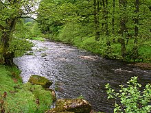
River Dunsop near Dunsop Bridge
The River Dunsop is a river in the Forest of Bowland in Northern England. It flows into the River Hodder at Dunsop Bridge.[1]
It begins at the confluence of the Brennand River and Whitendale River, both of which rise high up in the surrounding moorland. It then flows through the steep-sided Dunsop Valley before meeting the Hodder.[1] An aqueduct carrying water to Blackburn runs alongside.
On 8 August 1967 Dunsop Valley entered the UK Weather Records with the Highest 90-min total rainfall at 117 mm. As of July 2006 this record remains.
See also[]
References[]
External links[]
![]() Media related to River Dunsop at Wikimedia Commons
Media related to River Dunsop at Wikimedia Commons

Coordinates: 53°56′42″N 2°30′57″W / 53.945°N 2.5158°W

This Lancashire location article is a stub. You can help Wikipedia by . |
Categories:
- Rivers of Lancashire
- Rivers of Ribble Valley
- Forest of Bowland
- Hodder catchment
- Lancashire geography stubs
- England river stubs