Balderstone, Lancashire
| Balderstone | |
|---|---|
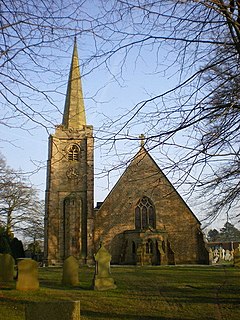 St Leonard's church | |
 Balderstone Shown within Ribble Valley | |
| Population | 410 (2011)[1] |
| OS grid reference | SD631323 |
| Civil parish |
|
| District | |
| Shire county | |
| Region | |
| Country | England |
| Sovereign state | United Kingdom |
| Post town | BLACKBURN |
| Postcode district | BB2 |
| Dialling code | 01254 |
| Police | Lancashire |
| Fire | Lancashire |
| Ambulance | North West |
| UK Parliament | |


Balderstone is a village and civil parish in the Ribble Valley district of Lancashire, England.[2] The population of the Civil Parish taken at the 2011 census was 410.[1]
Geography[]
It is located north-east of Preston and north-west of Blackburn.[3]
Community[]
In the village are the Anglican Church of St Leonard,[4] a primary school,[5] and a community centre.[6] According to the 2001 census it had a population of 379. The parish is the officially recognised address of Samlesbury Aerodrome.
See also[]
Notes[]
- ^ a b UK Census (2011). "Local Area Report – Balderstone Parish (1170215093)". Nomis. Office for National Statistics. Retrieved 1 March 2018.
- ^ Genuki details
- ^ Parish council web site Archived 28 August 2008 at the Wayback Machine
- ^ Church history
- ^ Ofsted report
- ^ Building details Archived 24 July 2008 at the Wayback Machine
External links[]
![]() Media related to Balderstone, Lancashire at Wikimedia Commons
Media related to Balderstone, Lancashire at Wikimedia Commons
Categories:
- Villages in Lancashire
- Civil parishes in Lancashire
- Geography of Ribble Valley