Royal Oak Charter Township, Michigan
Royal Oak Township, Michigan | |
|---|---|
| Charter Township of Royal Oak | |
 Royal Oak Township Administrative Offices | |
 Seal | |
 Location within Oakland County | |
 Royal Oak Township Location within the state of Michigan | |
| Coordinates: 42°27′11″N 83°10′13″W / 42.45306°N 83.17028°WCoordinates: 42°27′11″N 83°10′13″W / 42.45306°N 83.17028°W | |
| Country | United States |
| State | Michigan |
| County | Oakland |
| Established | 1833 |
| Chartered | 1972 |
| Government | |
| • Supervisor | Donna Squalls |
| • Clerk | Gwendolyn Turner |
| Area | |
| • Charter township | 0.55 sq mi (1.42 km2) |
| • Land | 0.55 sq mi (1.42 km2) |
| • Water | 0.0 sq mi (0.0 km2) |
| Elevation | 659 ft (201 m) |
| Population (2010) | |
| • Charter township | 2,419 |
| • Density | 4,376.5/sq mi (1,689.8/km2) |
| • Metro | 4,296,250 (Metro Detroit) |
| Time zone | UTC-5 (EST) |
| • Summer (DST) | UTC-4 (EDT) |
| ZIP code(s) | 48220 (Ferndale) |
| Area code(s) | 248 |
| FIPS code | 26-70060[1] |
| GNIS feature ID | 1627012[2] |
| Website | Official website |


Royal Oak Charter Township is a charter township in Oakland County in the U.S. state of Michigan. As of the 2010 census, the population was 2,419.[3] The city of Royal Oak is slightly to the north and is administered autonomously.
The township is the only remaining unincorporated portion of the original 36-square-mile (93.2 km2) Royal Oak survey township, which was organized in 1833. With a present-day area of 0.55 square miles (1.42 km2), Royal Oak Charter Township is the state's smallest charter township by area and the second-smallest overall township in the state after Novi Township. At the 2010 census, it was also the most-densely populated township in the state.
History[]
Royal Oak Township was established in 1833 as a regular, 36-square-mile (93 km2) civil township, and at one time consisted of all or parts of the following modern cities: Hazel Park, Ferndale, Oak Park, Madison Heights, Pleasant Ridge, Huntington Woods, Royal Oak, Berkley, and Clawson. The township began to shrink beginning in 1921 with the incorporation of the cities above. To provide greater protection from easy annexation, the township incorporated as a charter township in 1972.[4] Currently, the township has neither its own police department nor a post office. Its police department was disbanded in 1998. For public safety, the township contracts with the Michigan State Police for police services and the Ferndale Fire Department for fire services. For postal purposes, the community records its location as "Ferndale, MI 48220".
Until 2004, the township consisted of two small non-contiguous parcels of land within Oakland County. The larger portion was along Eight Mile Road, adjacent to Detroit, Oak Park, and Ferndale. A second portion, located northwest of the other portion, adjoining Oak Park and Southfield, was annexed to Oak Park as a result of a local referendums held on August 5, 2003 and November 2, 2004.[5][6] The 2003 annexation consisted of the annexation of Crown Pointe Plaza office complex, Lincoln Towers Apartments, and Rue Versailles Apartments, in which the township was estimated to have lost 20% of its property tax value.[6] The 2004 annexation involved the annexation of the Bridgewater Apartments and Lincoln Woods Apartments.[6]
Radio Plaza[]
At the northernmost point of the township lies Radio Plaza, which, bordered by Radio Plaza Street on the west, serves as home to Beasley Broadcast Group, and Salem Media Group's Detroit market headquarters, as well as Motower Multilink Corporation's 993 foot radio tower. WDTK, WLQV, WCSX, WMGC, and WRIF are all based out of Radio Plaza in Royal Oak Township.
Geography[]
According to the United States Census Bureau, the township has a total area of 0.55 square miles (1.42 km2), all land.[3]
Demographics[]
| Historical population | |||
|---|---|---|---|
| Census | Pop. | %± | |
| 1920 | 15,432 | — | |
| 1930 | 26,277 | 70.3% | |
| 1940 | 24,958 | −5.0% | |
| 1950 | 10,508 | −57.9% | |
| 1960 | 8,147 | −22.5% | |
| 1970 | 6,326 | −22.4% | |
| 1980 | 5,784 | −8.6% | |
| 1990 | 5,006 | −13.5% | |
| 2000 | 5,446 | 8.8% | |
| 2010 | 2,419 | −55.6% | |
| 2015 (est.) | 2,454 | 1.4% | |
2010 census[]
As of the census[1] of 2010, there were 2,419 people living in the township. The population density was 4,398.1 people per square mile (1,727.8/km2). There were 1,111 housing units at an average density of 2,020.0 per square mile (793.5/km2). The racial makeup of the township was 1.4% White, 95.3% African American, 0.1% Native American, 0.0% Asian, 0.0% Pacific Islander, 0.3% from other races, and 2.8% from two or more races. Hispanic or Latino of any race were 1.3% of the population.
2000 census[]
There were 1,211 households, out of which 25.2% had children under the age of 18 living with them, 21.1% were married couples living together, 26.7% had a female householder with no husband present, and 48.5% were non-families. 44.1% of all households were made up of individuals, and 17.2% had someone living alone who was 65 years of age or older. The average household size was 2.15 and the average family size was 3.02.
In the township the population was spread out, with 25.0% under the age of 18, 10.1% from 18 to 24, 29.7% from 25 to 44, 18.3% from 45 to 64, and 16.9% who were 65 years of age or older. The median age was 34 years. For every 100 females, there were 78.6 males. For every 100 females age 18 and over, there were 72.2 males.
The median income for a household in the township was $23,710, and the median income for a family was $28,397. Males had a median income of $28,824 versus $26,382 for females. The per capita income for the township was $15,027. About 19.9% of families and 23.5% of the population were below the poverty line, including 25.8% of those under age 18 and 30.4% of those age 65 and over.
Education[]
The township is divided between Oak Park School District and Ferndale Public Schools.[7]
The previously served Royal Oak Township. The majority black George Washington Carver School District separated from the Clinton district in 1945 as more African-Americans moved to the area. In 1960 Governor of Michigan G. Mennen Williams consolidated the Carver School District, along with its elementary school, into the Oak Park School District because the Carver district no longer had sufficient taxes to pay for a senior high school services, and no area school districts voluntarily took its students for high school.[8]
Highways[]
 I-75 runs south–north just to the east of the city boundaries.
 I-696 runs east–west and forms the northernmost boundaries of the township with the junction at I-75.
 M-1, known locally as Woodward Avenue, runs south–north through the center of the township.
 M-108, known locally as East Eight Mile Road, runs east–west as the southern border of the township with the city of Detroit.
Images[]

Motower Multilink Corporation's radio tower in Radio Plaza 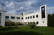
Greater Media's Detroit complex, home to WCSX, WMGC, and WRIF prior to its purchase by Beasley Broadcast Group 
Carver Elementary School, a Michigan State Historic Site and current recreational center 
Royal Oak Towers senior citizens apartment tower


References[]
- ^ a b "U.S. Census website". United States Census Bureau. Retrieved 2008-01-31.
- ^ U.S. Geological Survey Geographic Names Information System: Royal Oak Charter Township, Michigan
- ^ a b "Michigan: 2010 Population and Housing Unit Counts 2010 Census of Population and Housing" (PDF). 2010 United States Census. United States Census Bureau. September 2012. p. 37 Michigan. Retrieved June 1, 2021.
- ^ Population Estimates Geographic Change Notes:
- ^ "OAKLAND COUNTY GENERAL ELECTION - NOVEMBER 2, 2004 OFFICIAL ELECTION RESULTS JURISDICTION SUMMARY" (PDF). OakGov. Oakland County Clerk. Retrieved 10 August 2021.
- ^ a b c Carr, Robert. "Annexation Ballot for 3 Properties Set for Aug. 5". GlobeSt.com. ALM Real Estate Media Group. Retrieved 23 August 2021.
- ^ "SCHOOL DISTRICT REFERENCE MAP (2010 CENSUS): Oakland County, MI" (Archive). U.S. Census Bureau. Retrieved on June 29, 2015.
- ^ State of Michigan. "Carver Elementary School" In: Ashlee, Laura Rose (editor). Traveling Through Time: A Guide to Michigan's Historical Markers. University of Michigan Press, 2005. ISBN 0472030663, 9780472030668. p. [https://books.google.com/books?id=Xd-mh9r0zEkC&pg=PA327 327.
External links[]
Municipalities and communities of Oakland County, Michigan, United States | ||
|---|---|---|
| Cities |
|  |
| Villages | ||
| Charter townships | ||
| Civil townships | ||
| Unincorporated communities |
| |
| Footnotes | ‡This populated place also has portions in an adjacent county or counties | |
| ||

- Townships in Oakland County, Michigan
- Charter townships in Michigan
- Metro Detroit
- Populated places established in 1833
- 1833 establishments in Michigan Territory