Saint-Gondon
Saint-Gondon | |
|---|---|
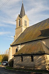 The church in Saint-Gondon | |
 Coat of arms | |
show Location of Saint-Gondon | |
 Saint-Gondon | |
| Coordinates: 47°41′59″N 2°32′32″E / 47.6997°N 2.5422°ECoordinates: 47°41′59″N 2°32′32″E / 47.6997°N 2.5422°E | |
| Country | France |
| Region | Centre-Val de Loire |
| Department | Loiret |
| Arrondissement | Montargis |
| Canton | Sully-sur-Loire |
| Intercommunality | |
| Area 1 | 22.40 km2 (8.65 sq mi) |
| Population (Jan. 2018)[1] | 1,100 |
| • Density | 49/km2 (130/sq mi) |
| Time zone | UTC+01:00 (CET) |
| • Summer (DST) | UTC+02:00 (CEST) |
| INSEE/Postal code | 45280 /45500 |
| Elevation | 117–164 m (384–538 ft) |
| 1 French Land Register data, which excludes lakes, ponds, glaciers > 1 km2 (0.386 sq mi or 247 acres) and river estuaries. | |


Saint-Gondon is a commune in the Loiret department in north-central France.
See also[]
- Communes of the Loiret department
References[]
- ^ "Populations légales 2018". INSEE. 28 December 2020.
| Wikimedia Commons has media related to Saint-Gondon. |
| show Communes of the Loiret department |
|---|
| show Authority control |
|---|
This Loiret geographical article is a stub. You can help Wikipedia by . |
Categories:
- Communes of Loiret
- Loiret geography stubs