Sainte-Anne-des-Plaines
This article may be expanded with text translated from the corresponding article in French. (February 2019) Click [show] for important translation instructions.
|
Sainte-Anne-des-Plaines | |
|---|---|
City | |
 | |
 Location within Thérèse-De Blainville RCM. | |
 Sainte-Anne-des-Plaines Location in central Quebec. | |
| Coordinates: 45°46′N 73°49′W / 45.767°N 73.817°WCoordinates: 45°46′N 73°49′W / 45.767°N 73.817°W[2] | |
| Country | |
| Province | |
| Region | Laurentides |
| RCM | Thérèse-De Blainville |
| Constituted | July 1, 1855 |
| Government | |
| • Mayor | Julie Boivin |
| • Federal riding | Mirabel |
| • Prov. riding | Blainville |
| Area | |
| • Total | 94.40 km2 (36.45 sq mi) |
| • Land | 92.81 km2 (35.83 sq mi) |
| Population (2014)[4] | |
| • Total | 14,990 [1] |
| • Density | 156.6/km2 (406/sq mi) |
| • Pop 2006–2014 | |
| Time zone | UTC−5 (EST) |
| • Summer (DST) | UTC−4 (EDT) |
| Postal code(s) | J5N |
| Area code(s) | 450 and 579 |
| Highways | |
| Website | www |

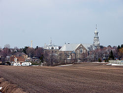
Sainte-Anne-des-Plaines is a city in southwestern Quebec, Canada, 40 km northwest of the city of Montreal in the Thérèse-De Blainville Regional County Municipality, in the region of Laurentides. Its population was 14,990 during the census of 2014.[1]
The city has the Sainte-Anne-des-Plaines Complex of the Correctional Service of Canada, which includes the Regional Reception Centre (multi-level security), housing Special Handling Unit (SHU), Canada's highest-security unit; Sainte-Anne-des-Plaines Institution (maximum security),[5] and the Regional Mental Health Centre (multi). It also has the Archambault Institution.
Education[]
The Commission scolaire de la Seigneurie-des-Mille-Îles (CSSMI) operates French-language schools.[6]
- École primaire de l'Harmonie-Jeunesse[7]
- École primaire des Moissons[8]
- École primaire Du Bois-Joli[9]
Sir Wilfrid Laurier School Board operates the English-language public schools.[10]
- Pierre Elliot Trudeau Elementary School in Blainville[11]
- Rosemere High School in Rosemere[12]
Communities[]
- Domaine des Cyprès - located along Montee Morel with residents north of rue Robert located within Camping Sainte-Anne. Golf Le Champetre located along east side of Morel.
- Domaine Normandie - located along Boulevard Normandie south of Rang LePage the small community is centred around Lac de Normandie
- Lac des Plaines - located northwest of La Plaine and centred around Lac des Plaines. Homes along the lake are mostly trailers with fixed homes to the north. Large forest area found just north of the community.
- Lepage - centred at Rang Lepage and Highway 335 and located just south of Sainte-Anne-des-Plaines.
- Sainte-Anne-des-Plaines - largest of the communities along Highway 335. Commercial and other critical services provided here.
References[]
- ^ a b http://ville.ste-anne-des-plaines.qc.ca/fr/ville-profil-statistiques.php[dead link]
- ^ Reference number 207211 of the Commission de toponymie du Québec (in French)
- ^ a b Geographic code 73035 in the official Répertoire des municipalités (in French)
- ^ a b Statistics Canada 2011 Census - Sainte-Anne-des-Plaines census profile
- ^ Correctional Service of Canada. "Sainte-Anne-des-Plaines Institution". Retrieved 2012-04-30.
- ^ "Admission et inscription Archived 2015-01-31 at the Wayback Machine." Commission scolaire de la Seigneurie-des-Mille-Iles. Retrieved on December 7, 2014. "La Commission scolaire de la Seigneurie-des-Mille-Iles (CSSMI) offre ses services aux résidents des municipalités de : Blainville, Boisbriand, Bois-des-Filion, Deux-Montagnes, Lorraine, Mirabel (Saint-Augustin, Saint-Benoît, Sainte-Scholastique et secteur du Domaine-Vert), Oka, Pointe-Calumet, Rosemère, Sainte-Anne-des-Plaines, Sainte-Marthe-sur-le-Lac, Sainte-Thérèse, Saint-Eustache, Saint-Joseph-du-Lac, Saint-Placide et Terrebonne Ouest."
- ^ "Accueil." École primaire de l'Harmonie-Jeunesse. Retrieved on September 16, 2017.
- ^ "Accueil." École primaire des Moissons. Retrieved on September 16, 2017.
- ^ "Accueil." École primaire Du Bois-Joli. Retrieved on September 16, 2017.
- ^ "Ward #7." Sir Wilfrid Laurier School Board. Retrieved on July 31, 2015.
- ^ "PIERRE ELLIOT TRUDEAU ELEMENTARY ZONE." Sir Wilfrid Laurier School Board. Retrieved on September 16, 2017.
- ^ "Rosemere High School Zone." Sir Wilfrid Laurier School Board. Retrieved on December 8, 2014.
External links[]
 Media related to Sainte-Anne-des-Plaines at Wikimedia Commons
See also[]
- Saint Pierre River (Mascouche), a river
- Rivière des Mille Îles, a river
Places adjacent to Sainte-Anne-des-Plaines | ||||||||||||||||
|---|---|---|---|---|---|---|---|---|---|---|---|---|---|---|---|---|
| ||||||||||||||||
| Cities | |
|---|---|
| |
Authority control | |
|---|---|
| General | |
| National libraries | |
- Cities and towns in Quebec
- Incorporated places in Laurentides
- Greater Montreal