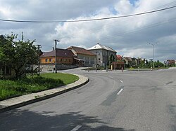
Senetářov
Senetářov | |
|---|---|
Municipality | |
 | |
 Flag  Coat of arms | |
 Senetářov | |
| Coordinates: 49°20′50″N 16°48′32″E / 49.34722°N 16.80889°ECoordinates: 49°20′50″N 16°48′32″E / 49.34722°N 16.80889°E | |
| Country | |
| Region | South Moravian |
| District | Blansko |
| Area | |
| • Total | 13.85 km2 (5.35 sq mi) |
| Elevation | 545 m (1,788 ft) |
| Population (2006) | |
| • Total | 515 |
| • Density | 37/km2 (96/sq mi) |
| Postal code | 679 06 |
| Website | http://www.senetarov.cz |

Senetářov is a village and municipality (obec) in Blansko District in the South Moravian Region of the Czech Republic.
The municipality covers an area of 13.85 square kilometres (5.35 sq mi), and has a population of 515 (as at 28 August 2006).
Senetářov lies approximately 12 kilometres (7 mi) east of Blansko, 22 km (14 mi) north-east of Brno, and 191 km (119 mi) south-east of Prague.
References[]
| Wikimedia Commons has media related to Senetářov. |
| Authority control: National libraries |
|---|
This South Moravian Region location article is a stub. You can help Wikipedia by . |
Categories:
- Villages in Blansko District
- South Moravian Region geography stubs