Shire of Stawell
| Shire of Stawell Victoria | |||||||||||||||
|---|---|---|---|---|---|---|---|---|---|---|---|---|---|---|---|
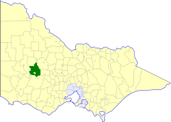 Location in Victoria | |||||||||||||||
| Population | 2,620 (1992)[1] | ||||||||||||||
| • Density | 1.0054/km2 (2.604/sq mi) | ||||||||||||||
| Established | 1861 | ||||||||||||||
| Area | 2,606 km2 (1,006.2 sq mi) | ||||||||||||||
| Council seat | Stawell | ||||||||||||||
| County | Borung, Kara Kara | ||||||||||||||
 | |||||||||||||||
The Shire of Stawell was a local government area about 230 kilometres (143 mi) west-northwest of Melbourne, the state capital of Victoria, Australia. The shire covered an area of 2,606 square kilometres (1,006.2 sq mi), and existed from 1861 until 1995.
Stawell itself was managed by a separate entity; the City of Stawell.
History[]
Stawell was first incorporated as a road district on 29 January 1861, and became a shire on 30 December 1864. On 26 October 1926, it annexed part of the North Riding of the Shire of Ararat.[2]
On 20 January 1995, the Shire of Stawell was abolished, and, along with the City of Stawell, the Town of St Arnaud, most of the Shire of Kara Kara, and parts of the Shires of Ararat, Avoca, Donald and Dunmunkle, and the Grampians National Park within the Shire of Wimmera, was merged into the newly created Shire of Northern Grampians. The Armstrong district was transferred into the Rural City of Ararat.[3]
Wards[]
The Shire of Stawell was divided into four ridings, each of which elected three councillors:
- North Riding
- East Riding
- West Riding
- North-East Riding
Towns and localities[]
- Armstrong
- Bellfield
- Callawadda
- Campbells Bridge
- Deep Lead
- Concongella
- Glenorchy
- Great Western
- Greens Creek
- Halls Gap
- Illawarra
- Kanya
- Lake Fyans
- Landsborough
- Ledcourt
- Marnoo
- Wallaloo
Population[]
| Year | Population |
|---|---|
| 1954 | 2,286 |
| 1958 | 2,370* |
| 1961 | 2,193 |
| 1966 | 2,355 |
| 1971 | 2,034 |
| 1976 | 2,050# |
| 1981 | 2,375 |
| 1986 | 2,552 |
| 1991 | 2,754 |
* Estimate in the 1958 Victorian Year Book.
# 1981 census says 2,306 for 1976.
See also[]
References[]
- ^ Australian Bureau of Statistics, Victoria Office (1994). Victorian Year Book. pp. 49–52. ISSN 0067-1223.
- ^ Victorian Municipal Directory. Brunswick: Arnall & Jackson. 1992. pp. 840–841. Accessed at State Library of Victoria, La Trobe Reading Room.
- ^ Australian Bureau of Statistics (1 August 1995). Victorian local government amalgamations 1994-1995: Changes to the Australian Standard Geographical Classification (PDF). Commonwealth of Australia. p. 4,10. ISBN 0-642-23117-6. Retrieved 5 January 2008.

- Former local government areas of Victoria (Australia)
- 1861 establishments in Australia