Shire of Strathfieldsaye
| Shire of Strathfieldsaye Victoria | |||||||||||||||
|---|---|---|---|---|---|---|---|---|---|---|---|---|---|---|---|
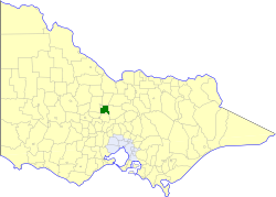 Location in Victoria | |||||||||||||||
 Former Shire of Strathfieldsaye Shire Hall | |||||||||||||||
| Population | 19,760 (1992)[1] | ||||||||||||||
| • Density | 32.860/km2 (85.107/sq mi) | ||||||||||||||
| Established | 1861 | ||||||||||||||
| Area | 601.34 km2 (232.2 sq mi) | ||||||||||||||
| Council seat | Kennington | ||||||||||||||
| County | Bendigo | ||||||||||||||
 | |||||||||||||||
The Shire of Strathfieldsaye was a local government area immediately to the east and southeast of the regional city of Bendigo, Victoria, Australia, and included the eastern suburbs of Bendigo's metropolitan area. The shire covered an area of 601.34 square kilometres (232.2 sq mi), and existed from 1861 until 1994.
History[]
Strathfieldsaye was first incorporated as a road district on 20 August 1861, and became a shire on 17 September 1866.[2]
Strathfieldsaye Council was suspended on 20 July 1993, with a commissioner appointed, after allegations of the council being divided and unworkable.[3]
On 7 April 1994, the Shire of Strathfieldsaye was abolished, and, along with the City of Bendigo, the Borough of Eaglehawk, the Rural City of Marong and the Shire of Huntly, was merged into the newly created City of Greater Bendigo.[4][5]
Wards[]
The Shire of Strathfieldsaye was divided into three wards, each of which elected three councillors:
- Axedale Ward
- Mandurang Ward
- Strathfieldsaye Ward
Towns and localities[]
- Axedale
- Bendigo East
- Diamond Hill
- Emu Creek
- Lake Eppalock
- Junortoun
- Kangaroo Flat
- Kennington
- Longlea
- Mandurang
- Mandurang South
- Mosquito Creek
- Myrtle Creek
- Sedgwick
- Spring Gully
- Strathdale
- Strathfieldsaye
Population[]
| Year | Population |
|---|---|
| 1954 | 4,213 |
| 1958 | 4,870* |
| 1961 | 6,031 |
| 1966 | 6,704 |
| 1971 | 7,711 |
| 1976 | 10,256 |
| 1981 | 12,609 |
| 1986 | 15,011 |
| 1991 | 18,456 |
* Estimate in the 1958 Victorian Year Book.
References[]
- ^ Australian Bureau of Statistics, Victoria Office (1994). Victorian Year Book. p. 52. ISSN 0067-1223.
- ^ Victorian Municipal Directory. Brunswick: Arnall & Jackson. 1992. pp. 843–844. Accessed at State Library of Victoria, La Trobe Reading Room.
- ^ "#33 - The council conundrum". The Age. Fairfax News Store. Retrieved 16 July 2017.
- ^ Municipal Association of Victoria (2006). "Greater Bendigo City Council". Retrieved 8 January 2008. Date cross-checked with the Records Division, Greater Bendigo City Council.
- ^ Taylor, Thomas (6 April 1994). "Marong to fall in line on super council". The Age. p. 6. Accessed via Factiva online.

- Former local government areas of Victoria (Australia)
- 1861 establishments in Australia