Son, Ardennes
show This article may be expanded with text translated from the corresponding article in French. (December 2008) Click [show] for important translation instructions. |
Son | |
|---|---|
Commune | |
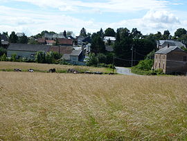 A general view of Son | |
show Location of Son | |
 Son | |
| Coordinates: 49°34′57″N 4°16′37″E / 49.5825°N 4.2769°ECoordinates: 49°34′57″N 4°16′37″E / 49.5825°N 4.2769°E | |
| Country | France |
| Region | Grand Est |
| Department | Ardennes |
| Arrondissement | Rethel |
| Canton | Château-Porcien |
| Government | |
| • Mayor (2008–2014) | Pierre Noël |
| Area 1 | 9.03 km2 (3.49 sq mi) |
| Population (Jan. 2018)[1] | 98 |
| • Density | 11/km2 (28/sq mi) |
| Time zone | UTC+01:00 (CET) |
| • Summer (DST) | UTC+02:00 (CEST) |
| INSEE/Postal code | 08426 /08300 |
| 1 French Land Register data, which excludes lakes, ponds, glaciers > 1 km2 (0.386 sq mi or 247 acres) and river estuaries. | |


Son is a commune in the Ardennes department in northern France.
Population[]
| Year | Pop. | ±% |
|---|---|---|
| 1990 | 110 | — |
| 1999 | 105 | −4.5% |
| 2008 | 94 | −10.5% |
See also[]
References[]
- ^ "Populations légales 2018". INSEE. 28 December 2020.
| Wikimedia Commons has media related to Son, Ardennes. |
| Authority control |
|
|---|
This Ardennes geographical article is a stub. You can help Wikipedia by . |
Categories:
- Communes of Ardennes (department)
- Ardennes (department) geography stubs