Southern Rocky Mountain Front
Southern Rocky Mountain Front | |
|---|---|
 The Wyoming State Capitol in Cheyenne | |
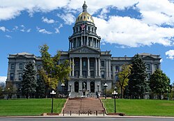 The Colorado State Capitol in Denver | |
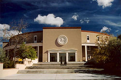 The New Mexico State Capitol in Santa Fe | |
| Country | |
| U.S. states | Wyoming, Colorado, New Mexico |
| Population | 5,467,633 |
The Southern Rocky Mountain Front is a megaregion of the United States, otherwise known as a megalopolis, with population centers consisting mainly of the Front Range Urban Corridor and the Albuquerque–Santa Fe–Las Vegas combined statistical area, located along the eastern and southern face of the Southern Rocky Mountains in the U.S. states of Wyoming, Colorado, and New Mexico. The region comprises the southern portion of the Rocky Mountain Front geographic region of Canada and the United States, extending into the Southwestern United States. The Southern Rocky Mountain Front had a population of 5,467,633 according to the 2010 United States Census.[1] The region is one of the fastest growing regions in the United States and its population is projected to grow by 87% to 10,222,370 by 2050.[2] In 2005 the GDP of the region was $229,202,000,000 making up 2% of the United States GDP.[2]
Extent[]
The Southern Rocky Mountain Front stretches from Albuquerque, New Mexico, north along Interstate Highway 25 to Cheyenne, Wyoming, and includes the Denver-Aurora-Lakewood, CO Metropolitan Statistical Area, the Colorado Springs, CO Metropolitan Statistical Area, the Boulder, CO Metropolitan Statistical Area, the Fort Collins, CO Metropolitan Statistical Area, the Greeley, CO Metropolitan Statistical Area, the Pueblo, CO Metropolitan Statistical Area, the Cheyenne, WY Metropolitan Statistical Area, the Cañon City, CO Micropolitan Statistical Area, the Albuquerque, NM Metropolitan Statistical Area, and the Santa Fe, NM Metropolitan Statistical Area.[2] The region comprises three primary subregions: the South Central Colorado Urban Area, the North Central Colorado Urban Area, and the Cheyenne Metropolitan Area.
The influence of the region extends well beyond its defined boundaries. The Colorado Eastern Plains, Nebraska Panhandle and Albany County, Wyoming, among other areas, are culturally and economically tied to the region, though they are not considered to be a part of it.

| Region | Core Based Statistical Area | 2012 Estimate | County | 2012 Estimate | 2010 Census | Change |
|---|---|---|---|---|---|---|
| Southeast Wyoming | Cheyenne, WY Metropolitan Statistical Area | 94,483 | Laramie County | 94,483 | 91,738 | +2.99% |
| North Central Colorado | Fort Collins, CO Metropolitan Statistical Area | 310,487 | Larimer County | 310,487 | 299,630 | +3.62% |
| Greeley, CO Metropolitan Statistical Area | 263,691 | Weld County | 263,691 | 252,825 | +4.30% | |
| Boulder, CO Metropolitan Statistical Area | 305,318 | Boulder County | 305,318 | 294,567 | +3.65% | |
| Denver-Aurora-Lakewood, CO Metropolitan Statistical Area | 2,645,209 | City and County of Denver | 634,265 | 600,158 | +5.68% | |
| Arapahoe County | 595,546 | 572,003 | +4.12% | |||
| Jefferson County | 545,358 | 534,543 | +2.02% | |||
| Adams County | 459,598 | 441,603 | +4.07% | |||
| Douglas County | 298,215 | 285,465 | +4.47% | |||
| City and County of Broomfield | 58,298 | 55,889 | +4.31% | |||
| Elbert County | 23,383 | 23,086 | +1.29% | |||
| Park County | 16,029 | 16,206 | −1.09% | |||
| Clear Creek County | 9,026 | 9,088 | −0.68% | |||
| Gilpin County | 5,491 | 5,441 | +0.92% | |||
| South Central Colorado | Colorado Springs, CO Metropolitan Statistical Area | 668,353 | El Paso County | 644,964 | 622,263 | +3.65% |
| Teller County | 23,389 | 23,350 | +0.17% | |||
| Cañon City, CO Micropolitan Statistical Area | 46,788 | Fremont County | 46,788 | 46,824 | −0.08% | |
| Pueblo, CO Metropolitan Statistical Area | 160,852 | Pueblo County | 160,852 | 159,063 | +1.12% | |
| Northern New Mexico | Albuquerque, NM Metropolitan Statistical Area | 901,700 | Bernalillo County | 673,460 | 662,564 | +1.64% |
| Sandoval County | 135,588 | 131,561 | +3.06% | |||
| Torrance County | 16,021 | 16,383 | −2.21% | |||
| Valencia County | 76,631 | 76,569 | +0.08% | |||
| Santa Fe, NM Metropolitan Statistical Area | 146,375 | Santa Fe County | 146,375 | 144,170 | +1.53% | |
| Total | 5,543,256 | 5,364,989 | +3.32% | |||
Transportation[]
Rail[]
The region was established, along with ten other megaregions throughout the United States, by America 2050 in response to President Barack Obama’s efforts to improve the country’s infrastructure. The megaregions were initially identified by America 2050 as areas that should have highspeed rail by 2050.[4] According to America 2050’s four phase plan the Front Range would have highspeed rail on Phase 3 of the plan and the line would stretch from Denver, Colorado to Albuquerque, New Mexico.[5]
Interstates and highways[]
Interstate 25 runs through the Southern Rocky Mountain Front north from Albuquerque, NM to Cheyenne, WY. Major east and west routes running through the region are I-40 through Albuquerque, I-70 through Denver, and I-80 through Cheyenne.
 Interstate 25 runs north–south from New Mexico through Denver to Wyoming
 Interstate 70 runs east–west through the region from Utah to Maryland
 Interstate 80 runs east–west through the region from California to New Jersey
 Interstate 40 runs east–west through the region from California to North Carolina
Airports[]
The region has six airports offering passenger services with two of the airports, Albuquerque International Sunport and Denver International Airport, able to handle international flights.
List of airports offering passenger services[]
| Airport | Aircraft Operations | Passengers |
|---|---|---|
| Albuquerque International Sunport | 192,520 | 5,801,641 |
| Cheyenne Regional Airport | 65,163 | |
| Colorado Springs Airport | 153,244 | |
| Denver International Airport | 635,445 | 53,156,278 |
| Pueblo Memorial Airport | 182,119 | |
| Santa Fe Municipal Airport | 78,569 |
Municipalities[]
| Rank | Municipality | State | County | CBSA | 2012 Estimate | 2010 Census | Change |
|---|---|---|---|---|---|---|---|
| 1 | City and County of Denver | Colorado | City and County of Denver | Denver-Aurora-Lakewood, CO Metropolitan Statistical Area | 634,265 | 600,158 | +5.68% |
| 2 | City of Albuquerque | New Mexico | Bernalillo County | Albuquerque, NM Metropolitan Statistical Area | 555,417 | 545,852 | +1.75% |
| 3 | City of Colorado Springs | Colorado | El Paso County | Colorado Springs, CO Metropolitan Statistical Area | 431,834 | 416,427 | +3.70% |
| 4 | City of Aurora | Colorado | Arapahoe County Adams County |
Denver-Aurora-Lakewood, CO Metropolitan Statistical Area | 339,030 | 325,078 | +4.29% |
| 5 | City of Fort Collins | Colorado | Larimer County | Fort Collins, CO Metropolitan Statistical Area | 148,612 | 143,986 | +3.21% |
| 6 | City of Lakewood | Colorado | Jefferson County | Denver-Aurora-Lakewood, CO Metropolitan Statistical Area | 145,516 | 142,980 | +1.77% |
| 7 | City of Thornton | Colorado | Adams County Weld County |
Denver-Aurora-Lakewood, CO Metropolitan Statistical Area Greeley, CO Metropolitan Statistical Area |
124,140 | 118,772 | +4.52% |
| 8 | City of Westminster | Colorado | Adams County Jefferson County |
Denver-Aurora-Lakewood, CO Metropolitan Statistical Area | 109,169 | 106,114 | +2.88% |
| 9 | City of Pueblo | Colorado | Pueblo County | Pueblo, CO Metropolitan Statistical Area | 107,772 | 106,595 | +1.10% |
| 10 | City of Arvada | Colorado | Jefferson County Adams County |
Denver-Aurora-Lakewood, CO Metropolitan Statistical Area | 109,745 | 106,433 | +3.11% |
| 11 | City of Centennial[6] | Colorado | Arapahoe County | Denver-Aurora-Lakewood, CO Metropolitan Statistical Area | 103,743 | 100,377 | +3.35% |
| 12 | City of Boulder | Colorado | Boulder County | Boulder, CO Metropolitan Statistical Area | 101,808 | 97,385 | +4.54% |
| 13 | City of Greeley | Colorado | Weld County | Greeley, CO Metropolitan Statistical Area | 95,357 | 92,889 | +2.66% |
| 14 | City of Rio Rancho | New Mexico | Sandoval County Bernalillo County |
Albuquerque, NM Metropolitan Statistical Area | 90,818 | 87,521 | +3.77% |
| 15 | City of Longmont | Colorado | Boulder County Weld County |
Boulder, CO Metropolitan Statistical Area Greeley, CO Metropolitan Statistical Area |
88,669 | 86,270 | +2.78% |
| 16 | City of Santa Fe | New Mexico | Santa Fe County | Santa Fe, NM Metropolitan Statistical Area | 69,204 | 67,947 | +1.85% |
| 17 | City of Loveland | Colorado | Larimer County | Fort Collins, CO Metropolitan Statistical Area | 70,223 | 66,859 | +5.03% |
| 18 | City of Cheyenne | Wyoming | Laramie County | Cheyenne, WY Metropolitan Statistical Area | 61,537 | 59,466 | +3.48% |
| 19 | City and County of Broomfield | Colorado | City and County of Broomfield | Denver-Aurora-Lakewood, CO Metropolitan Statistical Area | 58,298 | 55,889 | +4.31% |
| 20 | Town of Castle Rock | Colorado | Douglas County | Denver-Aurora-Lakewood, CO Metropolitan Statistical Area | 51,348 | 48,231 | +6.46% |
| 21 | City of Commerce City | Colorado | Adams County | Denver-Aurora-Lakewood, CO Metropolitan Statistical Area | 48,421 | 45,913 | +5.46% |
| 22 | Town of Parker | Colorado | Douglas County | Denver-Aurora-Lakewood, CO Metropolitan Statistical Area | 47,169 | 45,297 | +4.13% |
| 23 | City of Littleton | Colorado | Arapahoe County Jefferson County Douglas County |
Denver-Aurora-Lakewood, CO Metropolitan Statistical Area | 43,775 | 41,737 | +4.88% |
| 24 | City of Northglenn | Colorado | Adams County Weld County |
Denver-Aurora-Lakewood, CO Metropolitan Statistical Area Greeley, CO Metropolitan Statistical Area |
36,891 | 35,789 | +3.08% |
| 25 | City of Brighton | Colorado | Adams County Weld County |
Denver-Aurora-Lakewood, CO Metropolitan Statistical Area Greeley, CO Metropolitan Statistical Area |
34,636 | 33,352 | +3.85% |
See also[]
- Southern Rocky Mountain Front
- Colorado
- Conurbation
- List of census-designated places in Colorado
- List of census-designated places in New Mexico
- List of census-designated places in Wyoming
- List of cities and towns in Colorado
- List of cities and towns in New Mexico
- List of cities and towns in Wyoming
- List of counties in Colorado
- List of counties in New Mexico
- List of counties in Wyoming
- List of places in Colorado
- Megaregions of the United States
- New Mexico
- Rocky Mountain Front
- Southern Rocky Mountains
- United States statistical area
- List of combined statistical areas
- List of core-based statistical areas
- List of metropolitan statistical areas
- List of micropolitan statistical areas
- List of primary statistical areas
- Wyoming
References[]
- ^ Jump up to: a b c "County Totals Datasets: Population, Population Change and Estimated Components of Population Change: April 1, 2010 to July 1, 2012". 2012 Population Estimates. United States Census Bureau, Population Division. March 2013. Archived from the original on July 7, 2013. Retrieved May 23, 2013.
- ^ Jump up to: a b c "Reports".
- ^ "OMB Bulletin No. 10-02: Update of Statistical Area Definitions and Guidance on Their Uses" (PDF). United States Office of Management and Budget. December 1, 2009. Archived (PDF) from the original on January 21, 2017. Retrieved May 5, 2011.
- ^ "Reports".
- ^ "Reports".
- ^ The City of Centennial, Colorado was incorporated on February 7, 2001.
External links[]
 Definitions from Wiktionary
 Media from Wikimedia Commons
 News from Wikinews
 Quotations from Wikiquote
 Texts from Wikisource
 Textbooks from Wikibooks
 Resources from Wikiversity
- United States Census Bureau
- U.S. population estimates at the Library of Congress Web Archives (archived 2006-12-06)


- Megapolitan areas of the United States
- Metropolitan areas of Colorado
- Metropolitan areas of New Mexico
- Metropolitan areas of Wyoming
- Regions of the United States