Swatara Township, Dauphin County, Pennsylvania
Swatara Township, Dauphin County, Pennsylvania | |
|---|---|
 Bressler Bible Church | |
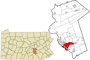 Location in Dauphin County and state of Pennsylvania. | |
| Country | United States |
| State | Pennsylvania |
| County | Dauphin |
| Incorporated | 1799 |
| Government | |
| • Type | Board of Commissioners |
| Area | |
| • Total | 15.53 sq mi (40.22 km2) |
| • Land | 13.05 sq mi (33.80 km2) |
| • Water | 2.48 sq mi (6.42 km2) |
| Population (2010) | |
| • Total | 23,362 |
| • Estimate (2016)[2] | 24,651 |
| • Density | 1,888.82/sq mi (729.30/km2) |
| Time zone | UTC-5 (Eastern (EST)) |
| • Summer (DST) | UTC-4 (EDT) |
| Area code(s) | 717 |
| FIPS code | 42-043-75672 |
| Website | www |
Swatara Township is a township in Dauphin County, Pennsylvania, United States. The population was 23,362 at the 2010 census.[3]
History[]
In 1729 the Paxtang Township of Lancaster County was established. The spelling "Paxtang" is from the original Indian name Peshtank, which meant "standing water".[4]
On March 4, 1785, Dauphin County was formed from Lancaster County, with the word "Dauphin" referring to the Dauphin of France, the heir apparent to the French throne whose country the area government wanted to honor for its assistance in the Revolutionary War. In August 1787 the legislature separated Paxtang Township into Upper Paxtang, Middle Paxtang and Lower Paxtang townships.[5]
Lower Paxtang Township embraced the areas now known as Lower Swatara, Swatara, Lower Paxton, Derry and Susquehanna townships.
In 1799 a court order divided Lower Paxton Township into two equal parts. "Swatara" was the name chosen for the southern part of the area. The word is thought to be from an Iroquois word meaning "Where we fed on eels."[6] Swatara Township was named directly from Swatara Creek.[7]
Within Swatara Township, Calver Island in the Susquehanna River was listed on the National Register of Historic Places in 2007.[8]
Geography[]
According to the United States Census Bureau, the township has a total area of 15.5 square miles (40.2 km2), of which 13.1 square miles (33.8 km2) is land and 2.5 square miles (6.4 km2), or 15.97%, is water.[3]
Census-designated places (unincorporated communities) in Swatara Township:
- Bressler-Enhaut-Oberlin, a CDP in 2000, was split into three CDPs for the 2010 census:
- Lawnton
- Rutherford
Demographics[]
| Historical population | |||
|---|---|---|---|
| Census | Pop. | %± | |
| 2010 | 23,362 | — | |
| 2016 (est.) | 24,651 | [2] | 5.5% |
| U.S. Decennial Census[9] | |||
As of the census[10] of 2000, there were 22,611 people, 8,703 households, and 5,778 families residing in the township. The population density was 1,708.4 people per square mile (659.9/km2). There were 9,068 housing units at an average density of 685.2/sq mi (264.6/km2). The racial makeup of the township was 78.19% White, 15.98% African American, 0.12% Native American, 1.74% Asian, 0.05% Pacific Islander, 1.73% from other races, and 2.18% from two or more races. Hispanic or Latino of any race were 4.74% of the population.
There were 8,703 households, out of which 29.9% had children under the age of 18 living with them, 49.4% were married couples living together, 13.4% had a female householder with no husband present, and 33.6% were non-families. 29.0% of all households were made up of individuals, and 11.2% had someone living alone who was 65 years of age or older. The average household size was 2.37 and the average family size was 2.93.
In the township the population was spread out, with 22.5% under the age of 18, 8.0% from 18 to 24, 31.8% from 25 to 44, 22.2% from 45 to 64, and 15.6% who were 65 years of age or older. The median age was 38 years. For every 100 females, there were 96.5 males. For every 100 females age 18 and over, there were 93.7 males.
The median income for a household in the township was $40,421, and the median income for a family was $49,713. Males had a median income of $36,095 versus $27,594 for females. The per capita income for the township was $20,224. About 6.9% of families and 8.6% of the population were below the poverty line, including 14.4% of those under age 18 and 8.0% of those age 65 or over.
Notable people[]
- Johann Jacob Friedrich Krebs, fraktur painter[11]
References[]
- ^ "2016 U.S. Gazetteer Files". United States Census Bureau. Retrieved Aug 13, 2017.
- ^ Jump up to: a b "Population and Housing Unit Estimates". Retrieved June 9, 2017.
- ^ Jump up to: a b "Geographic Identifiers: 2010 Demographic Profile Data (G001): Swatara township, Dauphin County, Pennsylvania". U.S. Census Bureau, American Factfinder. Archived from the original on February 13, 2020. Retrieved December 21, 2015.
- ^ "Archived copy". Archived from the original on 2012-12-13. Retrieved 2013-05-12.CS1 maint: archived copy as title (link)
- ^ "Archived copy". Archived from the original on 2013-01-30. Retrieved 2013-01-30.CS1 maint: archived copy as title (link)
- ^ http://www.swataratwp.com/
- ^ Notes and Queries, Historical, Biographical and Genealogical, Relating Chiefly to Interior Pennsylvania. Harrisburg Publishing Company. 1895. pp. 14–.
- ^ "National Register Information System". National Register of Historic Places. National Park Service. July 9, 2010.
- ^ "Census of Population and Housing". Census.gov. Retrieved June 4, 2016.
- ^ "U.S. Census website". United States Census Bureau. Retrieved 2008-01-31.
- ^ Gerard C. Wertkin (2 August 2004). Encyclopedia of American Folk Art. Routledge. ISBN 978-1-135-95614-1.
External links[]
| show Municipalities and communities of Dauphin County, Pennsylvania, United States |
|---|

Coordinates: 40°14′59″N 76°48′59″W / 40.24972°N 76.81639°W

| show Authority control |
|---|
- Populated places established in 1799
- Harrisburg–Carlisle metropolitan statistical area
- Townships in Dauphin County, Pennsylvania
- Townships in Pennsylvania