Tannay, Ardennes
show This article may be expanded with text translated from the corresponding article in French. (December 2008) Click [show] for important translation instructions. |
Tannay | |
|---|---|
Commune | |
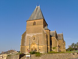 The church in Tannay | |
 Coat of arms | |
show Location of Tannay | |
 Tannay | |
| Coordinates: 49°31′38″N 4°50′01″E / 49.5272°N 4.8336°ECoordinates: 49°31′38″N 4°50′01″E / 49.5272°N 4.8336°E | |
| Country | France |
| Region | Grand Est |
| Department | Ardennes |
| Arrondissement | Vouziers |
| Canton | Vouziers |
| Intercommunality | Argonne Ardennaise |
| Government | |
| • Mayor (2020–2026) | Bruno Valet[1] |
| Area 1 | 14.04 km2 (5.42 sq mi) |
| Population (Jan. 2018)[2] | 153 |
| • Density | 11/km2 (28/sq mi) |
| Time zone | UTC+01:00 (CET) |
| • Summer (DST) | UTC+02:00 (CEST) |
| INSEE/Postal code | 08439 /08390 |
| Elevation | 160–276 m (525–906 ft) (avg. 202 m or 663 ft) |
| 1 French Land Register data, which excludes lakes, ponds, glaciers > 1 km2 (0.386 sq mi or 247 acres) and river estuaries. | |


Tannay (French pronunciation: [tanɛ]) is a commune in the Ardennes department and Grand Est region of north-eastern France.
Population[]
| Year | Pop. | ±% |
|---|---|---|
| 1946 | 221 | — |
| 1954 | 206 | −6.8% |
| 1962 | 192 | −6.8% |
| 1968 | 164 | −14.6% |
| 1975 | 155 | −5.5% |
| 1982 | 145 | −6.5% |
| 1990 | 135 | −6.9% |
| 1999 | 149 | +10.4% |
| 2005 | 151 | +1.3% |
| 2015 | 158 | +4.6% |
See also[]
References[]
- ^ "Répertoire national des élus: les maires". data.gouv.fr, Plateforme ouverte des données publiques françaises (in French). 2 December 2020.
- ^ "Populations légales 2018". INSEE. 28 December 2020.
| Wikimedia Commons has media related to Tannay, Ardennes. |
| Authority control |
|
|---|
This Ardennes geographical article is a stub. You can help Wikipedia by . |
Categories:
- Communes of Ardennes (department)
- Ardennes (department) geography stubs