Tenmile River station
Tenmile River | |||||||||||
|---|---|---|---|---|---|---|---|---|---|---|---|
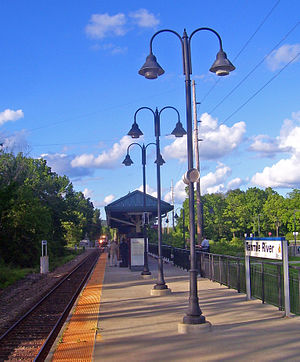 Southeast-bound train approaching station | |||||||||||
| Location | 12 Sinpatch Road, Wassaic, New York | ||||||||||
| Coordinates | 41°46′46″N 73°33′32″W / 41.7795°N 73.5590°WCoordinates: 41°46′46″N 73°33′32″W / 41.7795°N 73.5590°W | ||||||||||
| Line(s) | Harlem Line | ||||||||||
| Platforms | 1 side platform | ||||||||||
| Tracks | 1 | ||||||||||
| Connections | Dutchess County Public Transit: D | ||||||||||
| Construction | |||||||||||
| Disabled access | Yes | ||||||||||
| Other information | |||||||||||
| Fare zone | 10 | ||||||||||
| History | |||||||||||
| Opened | July 9, 2000 | ||||||||||
| Previous names | State School (NYC) | ||||||||||
| Passengers | |||||||||||
| 2007 | 9,716 | ||||||||||
| Services | |||||||||||
| |||||||||||
| Former services | |||||||||||
| |||||||||||

Tenmile River station (formerly State School station) is a commuter rail stop on the Metro-North Railroad's Harlem Line, located in Amenia, New York. Trains depart about every two hours for Southeast which connect to trains for New York City with service to Grand Central Terminal. It is 80 miles (128.7 km) from Grand Central Terminal and travel time to there is approximately two hours, five minutes.
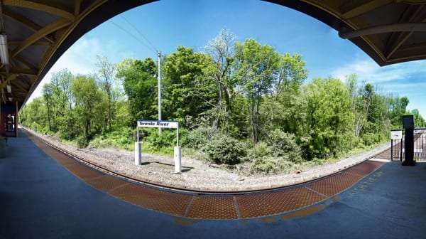
The station is the next northernmost station in the Zone 10 Metro-North fare zone. It is located on Sinpatch Road (Dutchess CR 5), next to the crossing of the creek, a short distance east of NY 22/343. Tenmile River is named for the waterway of the same name adjacent to the station as well as north of the grade crossing with Sinpatch Road, and is in nearly the same spot as the State School station (named for a nearby institution for the developmentally disabled, now Taconic Developmental Center) which was closed with Penn Central's abandonment of passenger service north of Dover Plains in 1972.
History[]
The station was re-opened with the Wassaic train station on July 9, 2000.[1] North of Dover Plains was Penn Central territory in 1972 and was mainly used for freight. After departing Dover, the train would cross the State School station (an area formerly known as "Weebutook") and not far after that, arrive at a small shelter with the sign reading "State School" at Mile Post 78.90. In addition to the few passengers that came to visit the New York State-operated juvenile developmental disability center, the major amount of railroad traffic was involved the shipments of soft coal on a regular basis. On any average day numerous carloads were moved in and empties switched out. Similar to the renaming of the State Facility at Wingdale, reflecting the vogue of the era, the State School was renamed the "Wassaic Developmental Center" in the late 1970s.[citation needed]
Station layout[]
The station has one two-car-long high-level side platform to the east of the track.[2]: 16 Unusually, the MTA has placed identifying signage on concrete pilings opposite the platform to complement the signs on the platform itself.[3]
References[]
- ^ Rowe, Claudia (July 9, 2000). "6 Miles for $6 Million". The New York Times. Retrieved August 15, 2009.
- ^ "Metro-North Railroad Track & Structures Department Track Charts Maintenance Program Interlocking Diagrams & Yard Diagrams 2015" (PDF). Metro-North Railroad. 2015. Retrieved January 28, 2019.
- ^ Image of MTA's Tenmile River signs on concrete pilings (I Ride the Harlem Line.com)
External links[]
 Media related to Tenmile River (Metro-North station) at Wikimedia Commons
- Metro-North Railroad stations in New York (state)
- Former New York Central Railroad stations
- Amenia, New York
- Railway stations in Dutchess County, New York
- Transportation in Dutchess County, New York