Troy, North Carolina
Troy, North Carolina | |
|---|---|
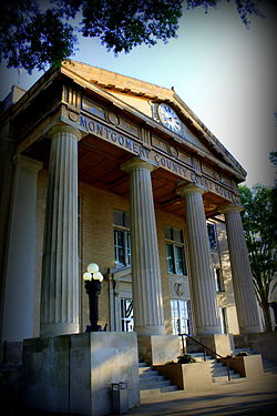 Montgomery County Courthouse, June 2014 | |
| Motto(s): "Gateway to the Uwharries" | |
 Location of Troy, North Carolina. | |
| Coordinates: 35°21′38″N 79°53′47″W / 35.36056°N 79.89639°WCoordinates: 35°21′38″N 79°53′47″W / 35.36056°N 79.89639°W | |
| Country | United States |
| State | North Carolina |
| County | Montgomery |
| Area | |
| • Total | 3.70 sq mi (9.59 km2) |
| • Land | 3.66 sq mi (9.48 km2) |
| • Water | 0.04 sq mi (0.11 km2) |
| Elevation | 659 ft (201 m) |
| Population (2010) | |
| • Total | 3,189 |
| • Estimate (2019)[4] | 3,222 |
| • Density | 880.33/sq mi (339.93/km2) |
| Time zone | UTC-5 (Eastern (EST)) |
| • Summer (DST) | UTC-4 (EDT) |
| ZIP code | 27371 |
| Area code(s) | 910 |
| FIPS code | 37-68520[2] |
| GNIS feature ID | 1024364[3] |
| Website | troy |

Troy is a town in Montgomery County, North Carolina, United States. The population was 3,188 at the 2010 census. It is the county seat of Montgomery County.[5] The short story by Charles W. Chesnutt, called "The Sheriff's Children," is set in Troy.
History[]
The Hotel Troy, Montgomery County Courthouse, and Troy Residential Historic District are listed on the National Register of Historic Places.[6]
The Town of Troy has had 12 mayors. Roy J. Maness served as Mayor of Troy from 1978 until 2018. Sherri Harris Allgood succeeded Maness as Mayor of Troy in December 2018. She is the first female and first African American to serve as Mayor.
Geography[]
Troy is located at 35°21′38″N 79°53′47″W / 35.36056°N 79.89639°W (35.360420, -79.896412).[7]
According to the United States Census Bureau, the town has a total area of 3.0 square miles (7.8 km2), of which, 3.0 square miles (7.8 km2) of it is land and 0.34% is water.
Troy, along with most of Montgomery County, lies within the Uwharrie National Forest.
Demographics[]
| Historical population | |||
|---|---|---|---|
| Census | Pop. | %± | |
| 1870 | 67 | — | |
| 1880 | 130 | 94.0% | |
| 1900 | 878 | — | |
| 1910 | 1,055 | 20.2% | |
| 1920 | 1,102 | 4.5% | |
| 1930 | 1,522 | 38.1% | |
| 1940 | 1,861 | 22.3% | |
| 1950 | 2,213 | 18.9% | |
| 1960 | 2,346 | 6.0% | |
| 1970 | 2,429 | 3.5% | |
| 1980 | 2,702 | 11.2% | |
| 1990 | 3,404 | 26.0% | |
| 2000 | 3,430 | 0.8% | |
| 2010 | 3,189 | −7.0% | |
| 2019 (est.) | 3,222 | [4] | 1.0% |
| U.S. Decennial Census[8] | |||
As of the census[2] of 2010, there were 3,189 people, 1,115 households, and 704 families residing in the town. The population density was 1,156.8 people per square mile (445.9/km2). There were 1,209 housing units at an average density of 407.7 per square mile (157.2/km2). The racial makeup of the town was 58.9% White, 31.8% African American, 0.73% Native American, 1.0% Asian, 3.32% from other races, and 1.5% from two or more races. Hispanic or Latino of any race were 10.3% of the population.
There were 1,108 households, out of which 30.3% had children under the age of 18 living with them, 37.2% were married couples living together, 20.4% had a female householder with no husband present, and 36.9% were non-families. 34.6% of all households were made up of individuals, and 16.0% had someone living alone who was 65 years of age or older. The average household size was 2.38 and the average family size was 3.04.
In the town, the population was spread out, with 21.6% under the age of 18, 11.1% from 18 to 24, 35.0% from 25 to 44, 16.9% from 45 to 64, and 15.4% who were 65 years of age or older. The median age was 36.7 years. Male population makes up 37% with a median age of 34.1 years. The female population makes up 63% with a median age of 37.7 years.
The median income for a household in the town was $22,933, and the median income for a family was $33,984. Males had a median income of $29,500 versus $19,861 for females. The per capita income for the town was $11,420. About 20.9% of families and 24.8% of the population were below the poverty line, including 32.8% of those under age 18 and 26.1% of those age 65 or over. Of the 1,115 occupied housing units, 46.7% are owner-occupied housing units while 53.3% are renter-occupied housing units.
Education[]
- Montgomery Community College
- Montgomery County Central High School (planned completion 2019)
- Montgomery Learning Academy
- Page Street Elementary
Notable person[]
- Henry F. Warner, United States Army soldier and recipient of the Medal of Honor for his actions in World War II[9]
References[]
- ^ "2019 U.S. Gazetteer Files". United States Census Bureau. Retrieved July 27, 2020.
- ^ Jump up to: a b "U.S. Census website". United States Census Bureau. Retrieved 2008-01-31.
- ^ "US Board on Geographic Names". United States Geological Survey. 2007-10-25. Retrieved 2008-01-31.
- ^ Jump up to: a b "Population and Housing Unit Estimates". United States Census Bureau. May 24, 2020. Retrieved May 27, 2020.
- ^ "Find a County". National Association of Counties. Retrieved 2011-06-07.
- ^ "National Register Information System". National Register of Historic Places. National Park Service. July 9, 2010.
- ^ "US Gazetteer files: 2010, 2000, and 1990". United States Census Bureau. 2011-02-12. Retrieved 2011-04-23.
- ^ "Census of Population and Housing". Census.gov. Retrieved June 4, 2015.
- ^ CPL Henry F. Warner | First Division Museum. Retrieved October 25, 2020.
External links[]
| show Municipalities and communities of Montgomery County, North Carolina, United States |
|---|

| show Authority control |
|---|
- Towns in Montgomery County, North Carolina
- Towns in North Carolina
- County seats in North Carolina