Tuiwa
Tuiwa
推瓦村 | |
|---|---|
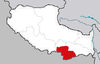
 Tuiwa Location in Tibet Autonomous Region | |
| Coordinates: 28°33′48″N 90°31′52″E / 28.5634°N 90.5310°ECoordinates: 28°33′48″N 90°31′52″E / 28.5634°N 90.5310°E | |
| Country | People's Republic of China |
| Autonomous region | Tibet Autonomous Region |
| Prefecture-level city | Shannan |
| County | Nagarzê |
| Town | |
| Elevation | 5,070 m (16,630 ft) |
| Time zone | UTC+8 (China Standard) |

Tuiwa (Chinese: 推瓦村; pinyin: Tuīwǎ Cūn) is a village located in Town, Nagarzê County, Shannan, Tibet, China, located at the northeast shore of Lake Puma Yumco.[2]
The village is located at an elevation of 5,070 meters above sea level, and is the often referred to as the rooftop of the world. It is the second highest village by elevation in the world.[1]
See also[]
- List of towns and villages in Tibet
- List of highest cities in the world
References[]
- ^ a b 2015-03-24. "Tuiwa Village -Tibet's rooftop village". exploretibet.com. Retrieved 2016-08-01.CS1 maint: numeric names: authors list (link)[unreliable source?]
- ^ 董庆沛. "Life in Tibet's rooftop village". china.org.cn. Retrieved 2016-08-01.
This Shannan, Tibet location article is a stub. You can help Wikipedia by . |
Categories:
- Populated places in Shannan, Tibet
- Nagarzê County
- Shannan, Tibet geography stubs