Verona, Ohio
Verona, Ohio | |
|---|---|
 Main Street in Preble County | |
 Location of Verona, Ohio | |
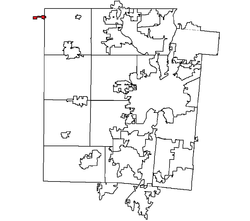 Location within Montgomery County, Ohio | |
| Coordinates: 39°54′12″N 84°29′17″W / 39.90333°N 84.48806°WCoordinates: 39°54′12″N 84°29′17″W / 39.90333°N 84.48806°W | |
| Country | United States |
| State | Ohio |
| Counties | Montgomery, Preble |
| Area | |
| • Total | 0.46 sq mi (1.20 km2) |
| • Land | 0.46 sq mi (1.18 km2) |
| • Water | 0.01 sq mi (0.02 km2) |
| Population | |
| • Total | 494 |
| • Estimate (2019)[3] | 478 |
| • Density | 1,048.25/sq mi (404.73/km2) |
| Time zone | UTC-5 (Eastern (EST)) |
| • Summer (DST) | UTC-4 (EDT) |
| ZIP code | 45378 |
| Area code(s) | 937, 326 |
| FIPS code | 39-79898 |

Verona is a village in Montgomery and Preble counties in the U.S. state of Ohio. The population was 494 at the 2010 census.[4] It is part of the Dayton Metropolitan Statistical Area.
Geography[]
Verona is located at 39°54′12″N 84°29′17″W / 39.90333°N 84.48806°W (39.903451, -84.488175).[5]
According to the United States Census Bureau, the village has a total area of 0.47 square miles (1.22 km2), of which 0.46 square miles (1.19 km2) is land and 0.01 square miles (0.03 km2) is water.[6]
Demographics[]
| Historical population | |||
|---|---|---|---|
| Census | Pop. | %± | |
| 1880 | 221 | — | |
| 1920 | 317 | — | |
| 1930 | 310 | −2.2% | |
| 1940 | 346 | 11.6% | |
| 1950 | 426 | 23.1% | |
| 1960 | 527 | 23.7% | |
| 1970 | 593 | 12.5% | |
| 1980 | 571 | −3.7% | |
| 1990 | 472 | −17.3% | |
| 2000 | 430 | −8.9% | |
| 2010 | 494 | 14.9% | |
| 2019 (est.) | 478 | [3] | −3.2% |
| U.S. Decennial Census[7] | |||
2010 census[]
As of the census[2] of 2010, there were 494 people, 180 households, and 124 families living in the village. The population density was 1,073.9 inhabitants per square mile (414.6/km2). There were 199 housing units at an average density of 432.6 per square mile (167.0/km2). The racial makeup of the village was 98.6% White and 1.4% from two or more races.
There were 180 households, of which 36.7% had children under the age of 18 living with them, 56.1% were married couples living together, 7.2% had a female householder with no husband present, 5.6% had a male householder with no wife present, and 31.1% were non-families. 26.1% of all households were made up of individuals, and 8.9% had someone living alone who was 65 years of age or older. The average household size was 2.74 and the average family size was 3.23.
The median age in the village was 37.3 years. 25.5% of residents were under the age of 18; 9.2% were between the ages of 18 and 24; 28.8% were from 25 to 44; 24.3% were from 45 to 64; and 12.3% were 65 years of age or older. The gender makeup of the village was 50.4% male and 49.6% female.
2000 census[]
As of the census[8] of 2000, there were 430 people, 158 households, and 112 families living in the village. The population density was 2,529.1 people per square mile (976.6/km2). There were 166 housing units at an average density of 976.4 per square mile (377.0/km2). The racial makeup of the village was 99.77% White, and 0.23% from two or more races. Hispanic or Latino of any race were 0.93% of the population.
There were 158 households, out of which 38.0% had children under the age of 18 living with them, 62.7% were married couples living together, 6.3% had a female householder with no husband present, and 28.5% were non-families. 24.7% of all households were made up of individuals, and 5.7% had someone living alone who was 65 years of age or older. The average household size was 2.72 and the average family size was 3.26.
In the village, the population was spread out, with 31.2% under the age of 18, 9.1% from 18 to 24, 30.5% from 25 to 44, 21.2% from 45 to 64, and 8.1% who were 65 years of age or older. The median age was 34 years. For every 100 females there were 101.9 males. For every 100 females age 18 and over, there were 107.0 males.
The median income for a household in the village was $34,107, and the median income for a family was $38,750. Males had a median income of $33,333 versus $24,219 for females. The per capita income for the village was $14,468. About 5.6% of families and 8.4% of the population were below the poverty line, including 11.3% of those under age 18 and none of those age 65 or over.
References[]
- ^ "2019 U.S. Gazetteer Files". United States Census Bureau. Retrieved July 28, 2020.
- ^ a b "U.S. Census website". United States Census Bureau. Retrieved 2013-01-06.
- ^ a b "Population and Housing Unit Estimates". United States Census Bureau. May 24, 2020. Retrieved May 27, 2020.
- ^ "Profile of General Population and Housing Characteristics: 2010 Demographic Profile Data (DP-1): Verona village, Ohio". United States Census Bureau. Retrieved November 28, 2011.
- ^ "US Gazetteer files: 2010, 2000, and 1990". United States Census Bureau. 2011-02-12. Retrieved 2011-04-23.
- ^ "US Gazetteer files 2010". United States Census Bureau. Archived from the original on January 24, 2012. Retrieved January 6, 2013.
- ^ "Census of Population and Housing". Census.gov. Retrieved June 4, 2015.
- ^ "U.S. Census website". United States Census Bureau. Retrieved 2008-01-31.
Municipalities and communities of Montgomery County, Ohio, United States | ||
|---|---|---|
| Cities |  | |
| Villages | ||
| Townships | ||
| CDPs | ||
| Other communities | ||
| Ghost towns | ||
| Footnotes | ‡This populated place also has portions in an adjacent county or counties | |
| ||
Municipalities and communities of Preble County, Ohio, United States | ||
|---|---|---|
| City |  | |
| Villages | ||
| Townships | ||
| CDP | ||
| Unincorporated communities | ||
| Ghost towns | ||
| Footnotes | ‡This populated place also has portions in an adjacent county or counties | |
| ||
- Villages in Montgomery County, Ohio
- Villages in Preble County, Ohio
- Villages in Ohio