Waldolwisheim
Waldolwisheim | |
|---|---|
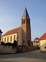 The church in Waldolwisheim | |
 Coat of arms | |
show Location of Waldolwisheim | |
 Waldolwisheim | |
| Coordinates: 48°44′00″N 7°26′20″E / 48.7333°N 7.4389°ECoordinates: 48°44′00″N 7°26′20″E / 48.7333°N 7.4389°E | |
| Country | France |
| Region | Grand Est |
| Department | Bas-Rhin |
| Arrondissement | Saverne |
| Canton | Saverne |
| Intercommunality | |
| Government | |
| • Mayor (2020–2026) | Marc Wintz[1] |
| Area 1 | 5.65 km2 (2.18 sq mi) |
| Population (Jan. 2018)[2] | 573 |
| • Density | 100/km2 (260/sq mi) |
| Time zone | UTC+01:00 (CET) |
| • Summer (DST) | UTC+02:00 (CEST) |
| INSEE/Postal code | 67515 /67700 |
| Elevation | 167–229 m (548–751 ft) (avg. 210 m or 690 ft) |
| 1 French Land Register data, which excludes lakes, ponds, glaciers > 1 km2 (0.386 sq mi or 247 acres) and river estuaries. | |


Waldolwisheim is a commune in the Bas-Rhin department in Grand Est in north-eastern France.
Population[]
| Year | Pop. | ±% |
|---|---|---|
| 2006 | 537 | — |
| 2007 | 538 | +0.2% |
| 2008 | 539 | +0.2% |
| 2009 | 533 | −1.1% |
| 2010 | 535 | +0.4% |
| 2011 | 538 | +0.6% |
| 2012 | 542 | +0.7% |
| 2013 | 545 | +0.6% |
| 2014 | 553 | +1.5% |
| 2015 | 577 | +4.3% |
| 2016 | 576 | −0.2% |
See also[]
References[]
- ^ "Répertoire national des élus: les maires". data.gouv.fr, Plateforme ouverte des données publiques françaises (in French). 2 December 2020.
- ^ "Populations légales 2018". INSEE. 28 December 2020.
| Wikimedia Commons has media related to Waldolwisheim. |
| show Authority control |
|---|
This Bas-Rhin geographical article is a stub. You can help Wikipedia by . |
Categories:
- Communes of Bas-Rhin
- Bas-Rhin geography stubs