Wilga (Garwolin)
This article does not cite any sources. (April 2008) |
| Wilga | |
|---|---|
 | |
| Location | |
| Country | Poland |
| Physical characteristics | |
| Mouth | |
• location | Vistula |
• coordinates | 51°50′14″N 21°21′22″E / 51.837335°N 21.356180°ECoordinates: 51°50′14″N 21°21′22″E / 51.837335°N 21.356180°E |
| Basin features | |
| Progression | Vistula→ Baltic Sea |

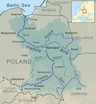
The Wilga is a river of 67 km in eastern Poland south of Warsaw and lies in Garwolin County. It is a tributary of the Vistula.
Improving water quality[]
Changes in land development in Wilga River valley since 1980 has influenced advantageously the present condition of the water environment. The heavy metal concentration in the sediments on the river bed have decreased dramatically.
| hide Tributaries of the Vistula River | ||
|---|---|---|
| Forming rivers |
|  |
| Main tributaries of the left bank | ||
| Main tributaries of the right bank |
| |
| Distributary |
| |
This Masovian Voivodeship location article is a stub. You can help Wikipedia by . |
Categories:
- Tributaries of the Vistula
- Rivers of Poland
- Rivers of Masovian Voivodeship
- Masovian geography stubs
- Poland river stubs