Wintzenbach
Wintzenbach | |
|---|---|
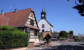 Church of Saint Giles | |
 Coat of arms | |
show Location of Wintzenbach | |
 Wintzenbach | |
| Coordinates: 48°56′08″N 8°06′17″E / 48.9356°N 8.1047°ECoordinates: 48°56′08″N 8°06′17″E / 48.9356°N 8.1047°E | |
| Country | France |
| Region | Grand Est |
| Department | Bas-Rhin |
| Arrondissement | Haguenau-Wissembourg |
| Canton | Wissembourg |
| Intercommunality | |
| Government | |
| • Mayor (2020–2026) | Claude Weber[1] |
| Area 1 | 6.96 km2 (2.69 sq mi) |
| Population (Jan. 2018)[2] | 539 |
| • Density | 77/km2 (200/sq mi) |
| Time zone | UTC+01:00 (CET) |
| • Summer (DST) | UTC+02:00 (CEST) |
| INSEE/Postal code | 67541 /67470 |
| Elevation | 124–189 m (407–620 ft) (avg. 160 m or 520 ft) |
| 1 French Land Register data, which excludes lakes, ponds, glaciers > 1 km2 (0.386 sq mi or 247 acres) and river estuaries. | |


Wintzenbach (German: Winzenbach) is a commune in the Bas-Rhin department in Grand Est in north-eastern France.
Population[]
| Year | Pop. | ±% |
|---|---|---|
| 2006 | 590 | — |
| 2007 | 591 | +0.2% |
| 2008 | 591 | +0.0% |
| 2009 | 592 | +0.2% |
| 2010 | 595 | +0.5% |
| 2011 | 595 | +0.0% |
| 2012 | 583 | −2.0% |
| 2013 | 572 | −1.9% |
| 2014 | 560 | −2.1% |
| 2015 | 555 | −0.9% |
| 2016 | 550 | −0.9% |
See also[]
References[]
- ^ "Répertoire national des élus: les maires". data.gouv.fr, Plateforme ouverte des données publiques françaises (in French). 2 December 2020.
- ^ "Populations légales 2018". INSEE. 28 December 2020.
| Wikimedia Commons has media related to Wintzenbach. |
| show Authority control |
|---|
This Bas-Rhin geographical article is a stub. You can help Wikipedia by . |
Categories:
- Communes of Bas-Rhin
- Bas-Rhin geography stubs