Wittersheim
Wittersheim | |
|---|---|
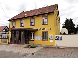 The town hall in Wittersheim | |
 Coat of arms | |
show Location of Wittersheim | |
 Wittersheim | |
| Coordinates: 48°46′54″N 7°39′33″E / 48.7817°N 7.6592°ECoordinates: 48°46′54″N 7°39′33″E / 48.7817°N 7.6592°E | |
| Country | France |
| Region | Grand Est |
| Department | Bas-Rhin |
| Arrondissement | Haguenau-Wissembourg |
| Canton | Haguenau |
| Intercommunality | CA Haguenau |
| Government | |
| • Mayor (2020–2026) | Jean-Marc Steinmetz[1] |
| Area 1 | 7.05 km2 (2.72 sq mi) |
| Population (Jan. 2018)[2] | 666 |
| • Density | 94/km2 (240/sq mi) |
| Time zone | UTC+01:00 (CET) |
| • Summer (DST) | UTC+02:00 (CEST) |
| INSEE/Postal code | 67546 /67670 |
| Elevation | 158–230 m (518–755 ft) (avg. 195 m or 640 ft) |
| 1 French Land Register data, which excludes lakes, ponds, glaciers > 1 km2 (0.386 sq mi or 247 acres) and river estuaries. | |


Wittersheim is a commune in the Bas-Rhin department in Grand Est in north-eastern France. It has a population of 603 (2008) and an area of 7,05 km².
Population[]
| Year | Pop. | ±% |
|---|---|---|
| 2006 | 572 | — |
| 2007 | 582 | +1.7% |
| 2008 | 603 | +3.6% |
| 2009 | 614 | +1.8% |
| 2010 | 608 | −1.0% |
| 2011 | 603 | −0.8% |
| 2012 | 597 | −1.0% |
| 2013 | 599 | +0.3% |
| 2014 | 611 | +2.0% |
| 2015 | 627 | +2.6% |
| 2016 | 644 | +2.7% |
See also[]
References[]
- ^ "Répertoire national des élus: les maires". data.gouv.fr, Plateforme ouverte des données publiques françaises (in French). 2 December 2020.
- ^ "Populations légales 2018". INSEE. 28 December 2020.
| Wikimedia Commons has media related to Wittersheim. |
| show Authority control |
|---|
This Bas-Rhin geographical article is a stub. You can help Wikipedia by . |
Categories:
- Communes of Bas-Rhin
- Bas-Rhin geography stubs