Woodville, New South Wales
| Woodville New South Wales | |||||||||||||||
|---|---|---|---|---|---|---|---|---|---|---|---|---|---|---|---|
 The historic timber general store at Woodville. | |||||||||||||||
 Woodville | |||||||||||||||
| Coordinates | 32°40′33″S 151°36′34.7″E / 32.67583°S 151.609639°ECoordinates: 32°40′33″S 151°36′34.7″E / 32.67583°S 151.609639°E | ||||||||||||||
| Population | 604 (2011 census)[2][Note 1] | ||||||||||||||
| • Density | 25.6/km2 (66/sq mi) 18 | ||||||||||||||
| Postcode(s) | 2321 | ||||||||||||||
| Elevation | 6 m (20 ft)[Note 2] | ||||||||||||||
| Area | 21.5 km2 (8.3 sq mi)[Note 3] | ||||||||||||||
| Time zone | AEST (UTC+10) | ||||||||||||||
| • Summer (DST) | AEDT (UTC+11) | ||||||||||||||
| Location |
| ||||||||||||||
| LGA(s) |
| ||||||||||||||
| Region | Hunter[1] | ||||||||||||||
| County | Durham[4] | ||||||||||||||
| Parish | Butterwick[4] | ||||||||||||||
| State electorate(s) | Port Stephens[5] | ||||||||||||||
| Federal division(s) | Paterson[6] | ||||||||||||||
| |||||||||||||||
| |||||||||||||||

Woodville is a rural suburb in the Hunter Region of New South Wales, Australia that is shared between the Port Stephens and Maitland local government areas (LGA).[1][3] Most of the suburb lies to the east of the Paterson River in the Port Stephens LGA while a small area of approximately 1.3 square kilometres (0.5 sq mi), to the west of the Paterson, is within the boundaries of the Maitland LGA.[8]
Land use[]
Woodville's primary land use is agricultural, although housing and small-acre rural residential lots are increasingly significant. Its agriculture consists mainly of broad-acre hay production, along with beef cattle grazing, turf-farming, poultry and olive production. It sits on the floodplains of the lower Hunter River and is subject to periodic flooding.
Township[]
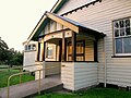
The suburb's centre consists of only a few buildings: an old timber shop, a few houses of mixed age and design and the All Saints sandstone gothic style church. The church is now privately owned and although no longer used for religious services, the heritage listed chapel is non-denominational and available for weddings both civil and religious while the timber hall associated with the church is now a function centre.
History[]
The Woodville region was occupied originally by Aboriginals, most likely the Worimi people. It offered abundant natural resources, with rivers, extensive wetlands, lakes, open woodland and rainforest. In the early 19th century, the first Europeans known to enter the region were timber-getters seeking to exploit the extensive red cedar trees that grew on and near the banks of the Paterson and Hunter rivers. Felled trees were floated down-river to timber mills in Newcastle.
Woodville has some significant historical buildings, such as Dunmore House, the Woodville shop/general store is Australia's oldest continually running business still carrying on the same services it was licensed for in 1844. The homestead of the historical property Stradbroke, which is listed in the Australian Heritage Database.[9] Increasingly, traditional farms are being subdivided for semi-rural small holdings.
The Woodville School of Arts dates to 1877. The Gothic Revival All Saints Church is heritage listed and was officially opened in 1864, it features impressive arched and leadlight windows following its restoration work in 1922, the Hall associated with the church was constructed in the 1890s and is of architectural interest. Iona School dates to 1918. Weddings and receptions are regularly held on the site which is unique in the region.
Woodville was also the name of a suburb in Sydney, causing confusion until the name of Woodville in Sydney was transposed to the new name of Villawood.
Dunmore Bridge[]
The heritage-listed Dunmore Bridge over the Paterson River is a wooden Allan truss lift-span bridge that was built in 1899.[10] The lift-span is intact although now inoperative. The bridge is located on Clarence Town Road, the main road between Maitland and Paterson, Seaham, Clarence Town and Dungog.
Image gallery[]
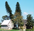
All Saints Church and hall
Iona School of Arts, a community hall
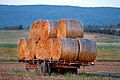
Hay wagon at Woodville

An old abandoned timber and brick house at Iona, Woodville


Notes[]
References[]
- ^ a b c "Suburb Search – Local Council Boundaries – Hunter (HT) – Port Stephens". New South Wales Division of Local Government. Retrieved 17 June 2008.
- ^ Australian Bureau of Statistics (31 October 2012). "Woodville (State Suburb)". 2011 Census QuickStats. Retrieved 24 October 2012.

- ^ a b "Suburb Search – Local Council Boundaries – Hunter (HT) – Maitland City Council". New South Wales Division of Local Government. Retrieved 17 June 2008.
- ^ a b "Woodville". Geographical Names Register (GNR) of NSW. Geographical Names Board of New South Wales. Retrieved 17 June 2008.
- ^ "Port Stephens". New South Wales Electoral Commission. Retrieved 23 November 2019.
- ^ "Paterson". Australian Electoral Commission. 19 October 2007. Retrieved 17 June 2008.
- ^ a b c "Paterson (Tocal AWS)". Climate statistics for Australian locations. Bureau of Meteorology. Retrieved 17 June 2008.
- ^ "Woodville". Land and Property Management Authority - Spatial Information eXchange. New South Wales Land and Property Information. Retrieved 17 June 2008.
- ^ "Stradbroke House and Outbuildings, Paterson Rd, Woodville, NSW, Australia (Place ID 1326)". Australian Heritage Database. Australian Government. 21 March 1978. Retrieved 17 June 2008.
- ^ "Dunmore Bridge over the Paterson River". New South Wales State Heritage Register. Office of Environment and Heritage. H01467. Retrieved 18 May 2018.
External links[]
| Wikimedia Commons has media related to Woodville, New South Wales. |
- "Woodville School of Arts website". Retrieved 24 April 2012.
- Suburbs of Maitland, New South Wales
- Suburbs of Port Stephens Council