Zagyvaszántó
This article relies too much on references to primary sources. (May 2019) |
Zagyvaszántó | |
|---|---|
Village | |
| Zagyvaszántó | |
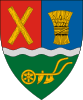 Coat of arms | |
 Zagyvaszántó | |
| Coordinates: 47°46′22.8″N 19°40′4.8″E / 47.773000°N 19.668000°ECoordinates: 47°46′22.8″N 19°40′4.8″E / 47.773000°N 19.668000°E | |
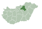
| Country | |
| County | Heves |
| Area | |
| • Total | 9.52 km2 (3.68 sq mi) |
| Population (2015) | |
| • Total | 1,985[1] |
| Time zone | UTC+1 (CET) |
| • Summer (DST) | UTC+2 (CEST) |
| Postal code | 3031 |
| Area code | (+36) 37 |
| Website | www |

Zagyvaszántó is a village located in Heves, Hungary, among the foothills of the Mátra mountain range. The closest significant town is Hatvan.
Etymology[]
Its name consists of two Hungarian words: 'Zagyva' and 'szántó'. Zagyva is the river which runs next to the village, while 'szántó' means 'field'.
History[]
The settlement's name is first mentioned in 1290 in a diploma, in which it is called 'Zántho' (which is the equivalent of 'szántó'). During the Ottoman-Hungarian wars the region was depopulated. In the middle of the 1900s the population started to rise rapidly. Since the start of the millennium the population is slowly decreasing.[2]
The 700th anniversary was celebrated in 1999.
International relations[]
Zagyvaszántó is the sister city of Csomakoros, Romania.[2]
References[]
| Wikimedia Commons has media related to Zagyvaszántó. |
- ^ Zagyvaszántó, census of 2015, KSH
- ^ a b "A falu története - Zagyvaszántó". www.zagyvaszanto.hu. Retrieved 2019-05-10.
| Towns (2) | ||
|---|---|---|
| Villages (11) | ||
Categories:
- Populated places in Heves County