Đắk Nông Province
Đắk Nông Province
Tỉnh Đắk Nông | |
|---|---|
          Dray Sap Falls • Mơ Nông Plateau • Dak R'Tih River • Đạo Nguyên Pagoda • Nam Đông Mountain | |
 Seal | |
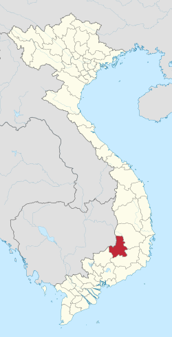 Location of Đắk/Ðắc Nông within Vietnam | |
 | |
| Coordinates: 11°59′N 107°42′E / 11.983°N 107.700°ECoordinates: 11°59′N 107°42′E / 11.983°N 107.700°E | |
| Country | |
| Region | Central Highlands |
| Capital | Gia Nghĩa |
| Area | |
| • Total | 6,515.6 km2 (2,515.7 sq mi) |
| Population (2018)[1] | |
| • Total | 574,673 |
| • Density | 88/km2 (230/sq mi) |
| Demographics | |
| • Ethnicities | Vietnamese, Ê Đê, Nùng, M'Nông, Tày |
| Time zone | UTC+7 (ICT) |
| Area codes | 261 (from 17 June 2017) 501 (until 16 July 2017) |
| ISO 3166 code | VN-72 |
| Website | www |

Đắk Nông (![]() listen), also Ðắc Nông, is a province of Vietnam. It is located in the country's Central Highlands. The provincial capital is Gia Nghĩa.
listen), also Ðắc Nông, is a province of Vietnam. It is located in the country's Central Highlands. The provincial capital is Gia Nghĩa.
Geography[]
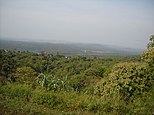
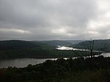
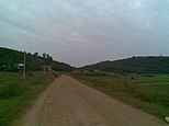
Đắk Nông borders Đắk Lắk Province in the north, Lâm Đồng Province in the south-east, and Bình Phước Province and Cambodia in the west. It is located in the southern part of the Central Highlands, about 500m above sea level. The terrain is lower in the west. Đắk Nông has large fields and lakes in the south. Đắk Nông has three main river systems: Ba River, Sêrêpôk River and other small rivers.
Climate[]
The average temperature is 24 degrees Celsius. The rainy season starts in May and ends in October. The dry season starts in November and ends in April the year after.
Economy[]
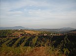
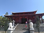
Like Đắk Lắk Province, coffee, pepper and rubber are the most important products of Đắk Nông. Đắk Nông is a potential province of tourism. There are many beautiful sites such as Ba Tang Waterfall, Diệu Thanh Waterfall, and Nâm Nung pine hill.
Administrative divisions[]
Đắk Nông is subdivided into eight district-level sub-divisions:
| Second Tier subdivisions |
Area (km²) |
Third Tier subdivisions | ||
|---|---|---|---|---|
| Ward | Township | Commune | ||
| Gia Nghĩa city | 286.64 | 5 | 3 | |
| 718.90 | 1 | 7 | ||
| Đăk Glong District | 7 | |||
| Đăk Mil District | 682.70 | 1 | 9 | |
| Đăk R'Lấp District | 63.42 | 1 | 10 | |
| Đăk Song District | 808.10 | 1 | 8 | |
| Krông Nô District | 816.80 | 1 | 11 | |
| Tuy Đức District | 1123.27 | 6 | ||
They are further subdivided into five commune-level towns (or townlets), 61 communes, and five wards.
History[]
Until recently, Đắk Nông was part of the larger Đắk Lắk Province, but is now fully independent. Before 1975, Đắk Nông was part of South Vietnam (Republic of Vietnam) and was formerly named Quảng Đức Province. However, after the 1975 Việt Cộng liberation and reunification of southern Vietnam in the Vietnam War, Quảng Đức was conjoined with Đắk Lắk Province. For Đắk Nông's history, please see Đắk Lắk Province.
References[]
- ^ Jump up to: a b Statistical Handbook of Vietnam 2014, General Statistics Office Of Vietnam
External links[]
| Wikimedia Commons has media related to Đắk Nông Province. |
| show Places adjacent to Đắk Nông Province |
|---|
| show Authority control |
|---|
- Đắk Nông Province
- Provinces of Vietnam