Cần Thơ
Cần Thơ
Thành phố Cần Thơ | |
|---|---|
| Cần Thơ City | |
    | |
| Nickname(s): "The capital of the West" (Tây Đô) | |
 | |
 | |
| Coordinates: 10°02′N 105°47′E / 10.033°N 105.783°E | |
| Country | |
| Region | Mekong Delta |
| Founded | 1789 |
| Capital | Ninh Kiều |
| Subdivision | 5 urban districts, 4 rural districts |
| Government | |
| • Type | Municipality (Class-1) |
| • Body | Cần Thơ People's Council |
| • Secretary of the Party | Lê Quang Mạnh |
| • Chairman of People's Council | Phạm Văn Hiểu |
| • Chairman of People's Committee | Trần Việt Trường |
| Area | |
| • Municipality | 1,438.96 km2 (555.59 sq mi) |
| Population (2019)[2] | |
| • Municipality | 1,235,171 |
| • Density | 860/km2 (2,200/sq mi) |
| • Urban | 860,557 |
| Ethnic groups | |
| • Vietnamese[3] | 97.47% |
| • Khmer | 1.59% |
| • Hoa | 0.88% |
| • Others | 0.06% |
| Time zone | UTC+07:00 (ICT) |
| Postal code | 90xxxx |
| Area codes | 292 |
| ISO 3166 code | VN-CT |
| License plate | 65 |
| GRP (Nominal) | 2020[4] |
| - Total | US$5.2 billion |
| - Per capita | US$4.200 |
| Climate | Aw |
| International airports | Can Tho International Airport |
| Website | cantho.gov.vn |

Cần Thơ (standard Vietnamese: [kə̂n tʰəː] (![]() listen), Southern: [kʌŋ˨˩ tʰəː]) is the fourth-largest city in Vietnam, and the largest city along the Mekong Delta region in Vietnam.[5][6]
listen), Southern: [kʌŋ˨˩ tʰəː]) is the fourth-largest city in Vietnam, and the largest city along the Mekong Delta region in Vietnam.[5][6]
It is noted for its floating markets, rice paper-making village, and picturesque rural canals.[6] It has a population of around 1,282,300 as of 2018,[7] and is located on the south bank of the Hậu River, a distributary of the Mekong River. In 2007, about 50 people died when the Cần Thơ Bridge collapsed, causing Vietnam's worst engineering disaster.[8] In 2011, Cần Thơ International Airport opened.[9]
The city is nicknamed the "western capital" (Vietnamese is Tây Đô), and is located 169 kilometres (105 miles) from Hồ Chí Minh City.
History: Vietnam War[]
During the Vietnam War, Cần Thơ was the home of the ARVN IV Corps capital. The ARVN 21st division was dedicated to protect the city of Cần Thơ, including the provinces of Chương Thiện (now in Hậu Giang), Bạc Liêu, An Xuyen (Cà Mau), Ba Xuyen (Soc Trang), and Kiên Giang. Before 1975, Cần Thơ was part of Phong Dinh province.and also On November 1, 1955, the third Light Division changed into the thirteenth Light Division, and the fifteenth, twelfth, and 106th regiments transformed into the 37th, 38th, and 39th regiments. The 37th and 38th Regiments consisted of battalions that originated in the present MR 3; The 39th regiment consisted of battalions from My Tho and Sa Dec in the Delta. The 39th Regiment participated in the successful campaigns against dissidents in Hua Hau in 1955-1956.
Administrative system[]
The city is an independent municipality at the same level as the other provinces of Vietnam. It was created in the beginning of 2004 by a split of the former Cần Thơ Province into two new administrative units: Cần Thơ City and Hậu Giang Province.
Cần Thơ is subdivided into nine district-level sub-divisions:
- 4 rural districts:
They are further subdivided into five commune-level towns (or townlets), 36 communes, and 44 wards.
Ninh Kiều, which has the well-known Ninh Kiều port, is the central district and also the most populated and wealthiest of these districts.[10]
The city borders the provinces of An Giang, Hậu Giang, Kiên Giang, Vĩnh Long and Đồng Tháp.
Transportation[]

Before 1975, National Highway 4 (now National Route 1A) bypassed the ferry from Binh Minh, VL to Cần Thơ where the ARVN 21st division patrolled heavily the ferry transportation to protect the civilians and ship merchants. South of the National Highway 4 from Cần Thơ to Ba Xuyen province (Soc Trang) were mainly heavily patrolled by ARVN soldiers to prevent route disruption.
Today, Cần Thơ is connected to the rest of the country by National Route 1A and Cần Thơ International Airport. The city's bridge, which is now completed, is the longest cable-stayed bridge in Southeast Asia. The six-lane Saigon–Cần Thơ Expressway is being built in parts[clarification needed] from Hồ Chí Minh City to Mỹ Tho. Hydrofoil express boats link this city with Hồ Chí Minh City.[citation needed] From Phú Quốc island, tourists can use the ferry, passenger bus or taxi to transfer to Cần Thơ.[11] There are many vehicles such as taxis, Grab motorbikes, buses, vans and coaches.
Tourism[]

The Mekong Delta is considered to be the "rice basket of Vietnam", contributing more than half of the nation's rice production. People say of Cần Thơ:
Cần Thơ gạo trắng nước trong, / Ai đi đến đó lòng không muốn về. ("Cần thơ's rice is white, its water clear. / Everyone who visit there, does not want to leave.")
Cần Thơ (shared with Hau Giang) is famous for its floating markets, especially Cai Rang Floating Market, where people sell and buy things on the river, as well as the bird gardens and the port of Ninh Kiều. The city offers a wide range of tropical fruits such as pomelo, longan, jackfruit, mango, guava, banana, rambutan, mangosteen, dragon fruit and durian. The Cần Thơ City Museum has exhibits on the city's history.[12]
Tourist attractions:
- Cần Thơ Bridge
- (Buddhist temple)
- The historic Bình Thủy house (nhà cổ Bình Thủy, 1870): a mix of French and Asian architecture
- Cái Răng Floating Market & Phong Điền Floating Market
- Bằng Lăng Stork Sanctuary (Thốt Nốt district)
- Canal tour
- Cần Thơ Cathedral
- Ông Chinese Pagoda
- Pitu Khôsa Răngsây Khmer Pagoda
- Quang Đức Pagoda
- [citation needed]
- Phật Học Pagoda[13]
- Mỹ Khánh tourist village
- Cần Thơ seminary

Education[]
Academic institutions in the city are Cần Thơ University, , Cần Thơ University of Medicine and Pharmacy, , , Cần Thơ College, College of Foreign Economic Relations – Cần Thơ Branch, Medical College, ,[14] [15] and Vocational College, with its well-known College of Agriculture and Mekong Delta Rice Research Institute, .[citation needed]
Climate[]
Under the Köppen climate classification, Cần Thơ has a tropical wet and dry climate. Cần Thơ's climate features two seasons: rainy (from May to November) and dry (from December to April). Average annual humidity is 83%, rainfall 1,635 mm (64 in) and temperature 27 °C (81 °F).
| hideClimate data for Cần Thơ | |||||||||||||
|---|---|---|---|---|---|---|---|---|---|---|---|---|---|
| Month | Jan | Feb | Mar | Apr | May | Jun | Jul | Aug | Sep | Oct | Nov | Dec | Year |
| Record high °C (°F) | 34.2 (93.6) |
35.2 (95.4) |
38.5 (101.3) |
40.0 (104.0) |
38.3 (100.9) |
37.3 (99.1) |
36.8 (98.2) |
35.5 (95.9) |
34.8 (94.6) |
35.8 (96.4) |
34.2 (93.6) |
34.0 (93.2) |
40.0 (104.0) |
| Average high °C (°F) | 30.0 (86.0) |
30.9 (87.6) |
32.5 (90.5) |
33.4 (92.1) |
32.9 (91.2) |
31.6 (88.9) |
31.1 (88.0) |
30.7 (87.3) |
30.7 (87.3) |
30.5 (86.9) |
30.2 (86.4) |
29.3 (84.7) |
31.1 (88.0) |
| Daily mean °C (°F) | 25.2 (77.4) |
25.9 (78.6) |
27.1 (80.8) |
28.3 (82.9) |
27.7 (81.9) |
27.0 (80.6) |
26.7 (80.1) |
26.6 (79.9) |
26.6 (79.9) |
26.7 (80.1) |
26.6 (79.9) |
25.4 (77.7) |
26.6 (79.9) |
| Average low °C (°F) | 22.1 (71.8) |
22.6 (72.7) |
23.7 (74.7) |
24.9 (76.8) |
25.0 (77.0) |
24.5 (76.1) |
24.3 (75.7) |
24.2 (75.6) |
24.3 (75.7) |
24.3 (75.7) |
24.1 (75.4) |
22.6 (72.7) |
23.9 (75.0) |
| Record low °C (°F) | 14.8 (58.6) |
17.3 (63.1) |
17.5 (63.5) |
19.2 (66.6) |
18.7 (65.7) |
19.0 (66.2) |
19.5 (67.1) |
19.7 (67.5) |
17.8 (64.0) |
18.7 (65.7) |
17.5 (63.5) |
16.5 (61.7) |
14.8 (58.6) |
| Average rainfall mm (inches) | 9 (0.4) |
2 (0.1) |
8 (0.3) |
40 (1.6) |
177 (7.0) |
218 (8.6) |
228 (9.0) |
240 (9.4) |
261 (10.3) |
321 (12.6) |
133 (5.2) |
38 (1.5) |
1,674 (65.9) |
| Average rainy days | 1.8 | 0.7 | 1.7 | 5.6 | 16.1 | 20.5 | 21.7 | 22.3 | 22.9 | 22.2 | 14.2 | 6.3 | 155.8 |
| Average relative humidity (%) | 81.6 | 80.1 | 78.3 | 79.3 | 84.3 | 87.0 | 86.7 | 87.5 | 87.9 | 87.1 | 84.9 | 82.8 | 84.0 |
| Mean monthly sunshine hours | 257 | 246 | 287 | 262 | 212 | 176 | 181 | 175 | 164 | 177 | 195 | 228 | 2,561 |
| Source: Vietnam Institute for Building Science and Technology[16] | |||||||||||||
Economy[]
After 120 years of development, the city now[when?] is the delta's most important center of economics, culture, science, and technology. It has a large freshwater port and two industrial parks.[citation needed]

Twin towns and sister cities[]

 Nice, France
 Shantou, China
 Phnom Penh, Cambodia
 Amol, Iran
 Riverside, California
 Jeollanamdo (South Jeolla), Korea
Notable people[]
- Lana Condor (born 1997), actress
Gallery[]


Cần Thơ market
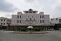
Museum of People's Armed Forces


References[]
- ^ "Phê duyệt và công bố kết quả thống kê diện tích đất đai của cả nước năm 2018" [Announcements of area statistics for the whole country in 2018]. Act No. 2908/QĐ-BTNMT of 13 November 2019 (in Vietnamese). Ministry of Natural Resources and Environment (Vietnam). – the data in the report are in ares, rounded to integers
- ^ Jump up to: a b General Statistics Office of Vietnam (2019). "Completed Results of the 2019 Viet Nam Population and Housing Census" (PDF). Statistical Publishing House (Vietnam). ISBN 978-604-75-1532-5.
- ^ Also called Kinh people
- ^ "Thành phố năng động bên dòng Hậu Giang" (in Vietnamese). Nhân Dân. 21 January 2020.
- ^ "Trang chu". Cổng Thông tin Điện tử thành phố Cần Thơ – CANTHO PORTAL (in Vietnamese and English). Ghi rõ nguồn "CanTho Portal" khi phát hành lại thông tin từ Portal này. 2012. Retrieved 15 October 2012.
- ^ Jump up to: a b Ron Emmons (7 February 2012). Frommer's Vietnam: with Angkor Wat. John Wiley & Sons. ISBN 978-1-118-11997-6. Retrieved 15 October 2012.
- ^ "Area, population and population density in 2018 by province". Statistical Yearbook of Vietnam 2018. Statistical Publishing House, General Statistic Office of Viet Nam. 2019. p. 90. ISBN 9786047511082. Retrieved 13 May 2020.
- ^ Jessica Rowson (3 October 2007). "50 deaths in Can Tho bridge collapse". New Civil Engineer. EMAP Ltd. Retrieved 15 October 2012.
- ^ Emmons, p. 342.
- ^ SGT (13 April 2012). "Ca Ba Old House is Can Tho classic". Vietnam.net Bridge. VIETNAMNET Bridge. Retrieved 15 October 2012.
- ^ "best way to transfer from Phu Quoc to Cam Tho". Retrieved 3 October 2019.
- ^ Emmons, p. 345.
- ^ https://www.citypassguide.com/en/travel/can-tho/attractions/pagodas/phat-hoc-pagoda
- ^ http://cantho.sis.edu.vn/
- ^ http://www.ctec.edu.vn/ctec2013/
- ^ "Vietnam Building Code Natural Physical & Climatic Data for Construction" (PDF) (in Vietnamese). Vietnam Institute for Building Science and Technology. Archived from the original (PDF) on 22 July 2018. Retrieved 23 July 2018.
External links[]
| show Places adjacent to Cần Thơ |
|---|


| show Authority control |
|---|
Coordinates: 10°02′N 105°47′E / 10.033°N 105.783°E
- ^ Jump up to: a b c d e f g h i j k l m n General Statistics Office of Vietnam (2019). "Completed Results of the 2019 Viet Nam Population and Housing Census" (PDF). Statistical Publishing House (Vietnam). ISBN 978-604-75-1532-5. Archived from the original on 10 January 2021. Retrieved 23 July 2021.
- ^ Jump up to: a b "Nghị quyết số 857/NQ-UBTVQH14 năm 2020 về việc thành lập thành phố Dĩ An, thành phố Thuận An và các phường thuộc thị xã Tân Uyên, tỉnh Bình Dương". 10 January 2020. Archived from the original on 22 April 2021. Retrieved 23 July 2021.
- ^ "Nghị quyết số 1111/NQ-UBTVQH14 năm 2020 về việc sắp xếp các đơn vị hành chính cấp huyện, cấp xã và thành lập thành phố Thủ Đức thuộc Thành phố Hồ Chí Minh". 9 December 2020. Archived from the original on 9 January 2021. Retrieved 23 July 2021.
- ^ "Nghị quyết số 1264/NQ-UBTVQH14 năm 2021 về việc điều chỉnh địa giới hành chính các đơn vị hành chính cấp huyện và sắp xếp, thành lập các phường thuộc thành phố Huế, tỉnh Thừa Thiên Huế". 27 April 2021. Archived from the original on 20 May 2021. Retrieved 23 July 2021.
- ^ "Nghị quyết số 837/NQ-UBTVQH14 năm 2019 về việc sắp xếp các đơn vị hành chính cấp huyện, cấp xã thuộc tỉnh Quảng Ninh". 17 December 2019. Archived from the original on 30 December 2019. Retrieved 23 July 2021.
- ^ "Nghị quyết số 788/NQ-UBTVQH14 năm 2019 về việc sắp xếp các đơn vị hành chính cấp huyện, cấp xã thuộc tỉnh Hải Dương". 16 October 2019. Archived from the original on 3 December 2019. Retrieved 23 July 2021.
- Cần Thơ
- Cities in Vietnam
- Mekong Delta
- Populated places in Cần Thơ
- Populated places on the Mekong River