Đông Hà
Đông Hà
Thành phố Đông Hà | |
|---|---|
| Đông Hà City | |
 | |
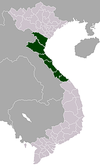
 Đông Hà Location of in Vietnam | |
| Coordinates: 16°49′49″N 107°5′50″E / 16.83028°N 107.09722°E | |
| Country | |
| Province | Quảng Trị |
| Area | |
| • Total | 72.96 km2 (28.17 sq mi) |
| Population (2009) | |
| • Total | 93,800 |
| Climate | Am |

Đông Hà (![]() listen) is the capital of Quảng Trị Province, Vietnam. Đông Hà is situated at the crossroads of National Highway 1A and Route 9, part of the East–West Economic Corridor (EWEC). It lies on the North–South Railway (Reunification Express) and is served by Đông Hà Railway Station. EWEC is an economic development program which includes northeast Thailand, Southern Laos, and central Vietnam.
listen) is the capital of Quảng Trị Province, Vietnam. Đông Hà is situated at the crossroads of National Highway 1A and Route 9, part of the East–West Economic Corridor (EWEC). It lies on the North–South Railway (Reunification Express) and is served by Đông Hà Railway Station. EWEC is an economic development program which includes northeast Thailand, Southern Laos, and central Vietnam.
History[]
The city was initially part of Champa, until it was conquered by the Qin Empire who were in control of most of Vietnam at the time.[1] In the 2nd century CE, the Cham people rebelled against Chinese rule. During the 14th and 15th century, ethnic Vietnamese gradually replaced the Cham inhabitants.
During the Vietnam War, Đông Hà was the northernmost town in South Vietnam and was the location of a strategically important United States Marine Corps Đông Hà Combat Base, to support Marine positions along the Vietnamese Demilitarized Zone (DMZ).[2] Tourists come to Đông Hà nowadays, especially ex-servicemen from the U.S. and Vietnam, who nearly always include a DMZ tour in their programs. The contemporary Vietnamese singer Như Quỳnh was born in Đông Hà in 1970.
Climate[]
| hideClimate data for Đông Hà | |||||||||||||
|---|---|---|---|---|---|---|---|---|---|---|---|---|---|
| Month | Jan | Feb | Mar | Apr | May | Jun | Jul | Aug | Sep | Oct | Nov | Dec | Year |
| Record high °C (°F) | 34.6 (94.3) |
37.9 (100.2) |
39.8 (103.6) |
42.1 (107.8) |
41.7 (107.1) |
41.4 (106.5) |
39.7 (103.5) |
39.4 (102.9) |
38.9 (102.0) |
34.7 (94.5) |
34.6 (94.3) |
33.0 (91.4) |
42.1 (107.8) |
| Average high °C (°F) | 23.5 (74.3) |
24.1 (75.4) |
27.4 (81.3) |
31.4 (88.5) |
33.9 (93.0) |
34.5 (94.1) |
34.7 (94.5) |
33.8 (92.8) |
31.5 (88.7) |
28.7 (83.7) |
25.8 (78.4) |
23.4 (74.1) |
29.4 (84.9) |
| Daily mean °C (°F) | 20.1 (68.2) |
20.5 (68.9) |
22.9 (73.2) |
25.9 (78.6) |
28.3 (82.9) |
29.6 (85.3) |
29.5 (85.1) |
28.8 (83.8) |
27.1 (80.8) |
25.2 (77.4) |
22.8 (73.0) |
20.4 (68.7) |
25.1 (77.2) |
| Average low °C (°F) | 17.7 (63.9) |
18.3 (64.9) |
20.2 (68.4) |
22.8 (73.0) |
24.9 (76.8) |
26.3 (79.3) |
26.2 (79.2) |
25.7 (78.3) |
24.3 (75.7) |
22.9 (73.2) |
20.6 (69.1) |
18.3 (64.9) |
22.4 (72.3) |
| Record low °C (°F) | 10.0 (50.0) |
11.2 (52.2) |
9.4 (48.9) |
15.8 (60.4) |
17.4 (63.3) |
21.5 (70.7) |
22.2 (72.0) |
22.7 (72.9) |
18.6 (65.5) |
16.9 (62.4) |
13.3 (55.9) |
9.8 (49.6) |
9.4 (48.9) |
| Average precipitation mm (inches) | 48 (1.9) |
33 (1.3) |
30 (1.2) |
60 (2.4) |
122 (4.8) |
92 (3.6) |
73 (2.9) |
174 (6.9) |
389 (15.3) |
661 (26.0) |
398 (15.7) |
171 (6.7) |
2,250 (88.6) |
| Average precipitation days | 12.2 | 11.5 | 9.9 | 9.8 | 10.3 | 8.9 | 7.2 | 10.7 | 16.5 | 20.5 | 20.3 | 16.9 | 154.7 |
| Average relative humidity (%) | 87.9 | 86.9 | 86.8 | 84.1 | 78.1 | 72.5 | 70.5 | 74.4 | 83.8 | 87.6 | 87.9 | 87.6 | 82.6 |
| Mean monthly sunshine hours | 118 | 96 | 140 | 175 | 232 | 222 | 238 | 206 | 167 | 136 | 95 | 87 | 1,910 |
| Source: Vietnam Institute for Building Science and Technology[3] | |||||||||||||
See also[]
 Dong Ha travel guide from Wikivoyage
References[]
- ^ "Quang Tri - Vietnam Tourism Information". www.vietnamtourism.org.vn. Retrieved 2021-02-10.
- ^ Keith W. Nolan The Story of an Armored Cavalry Squadron in Vietnam: 1-1 Cav, 1967-1968 ... Just north of Đông Hà on April 6 the correspondent, Brummett, and Nguyễn Ngọc Lương, the paper's interpreter, waited for a possible tank battle"
- ^ "Vietnam Building Code Natural Physical & Climatic Data for Construction" (PDF). Vietnam Institute for Building Science and Technology. Archived from the original (PDF) on 22 July 2018. Retrieved 31 July 2018.
| Wikimedia Commons has media related to Dong Ha. |
| show Districts of Vietnam North Central Coast |
|---|
| show Authority control |
|---|
This article about a location in Quảng Trị Province, Vietnam is a stub. You can help Wikipedia by . |
- Populated places in Quảng Trị Province
- Districts of Quảng Trị Province
- Dong Ha
- Cities in Vietnam
- Provincial capitals in Vietnam
- North Central Coast geography stubs