Hưng Yên
Hưng Yên
Thành phố Hưng Yên | |
|---|---|
| Hưng Yên City | |
 | |
| Nickname(s): Phố Hiến | |
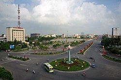
 Hưng Yên Location of in Vietnam | |
| Coordinates: 20°39′N 106°04′E / 20.650°N 106.067°E | |
| Country | |
| Province | Hưng Yên |
| Government | |
| • Chairman of People's Committee | Đỗ Xuân Tuyên |
| Area | |
| • Total | 73.4207 km2 (28.3479 sq mi) |
| Population (2013) | |
| • Total | 147,275 |
| • Density | 2,005.9/km2 (5,195/sq mi) |
| Time zone | UTC+7 (Indochina Time) |
| Climate | Cwa |

Hưng Yên (![]() listen) is a city in Vietnam. It is the provincial capital of Hưng Yên Province and is a third-graded city according to Vietnam's city classification table.
listen) is a city in Vietnam. It is the provincial capital of Hưng Yên Province and is a third-graded city according to Vietnam's city classification table.
Geography[]
- Hưng Yên is a delta city. It is located in the south of Hưng Yên Province, on the left bank (north bank) of the Red River in the northern part of Vietnam. Hưng Yên is about 60 km away from Hanoi.
- Hưng Yên borders Kim Động District to the north and Tiên Lữ District to the east. The Red River is the natural boundary between Hưng Yên and Hà Nam Province's Lý Nhân District and Duy Tiên District.
- Area: 46.80 km2 (4,685.51 ha)
Demography[]
- Population: 121,486 people (2008)
Administration[]
Hưng Yên administers 12 administrative divisions:
- 7 wards (phường): Lê Lợi, Quang Trung, Minh Khai, Hiến Nam, Lam Sơn, Hồng Châu and An Tảo.
- 5 communes (xã): Bảo Khê, Trung Nghĩa, Liên Phương, Hồng Nam and Quảng Châu.
Tourism[]
The city is well known in the world (especially with historians) with (an ancient port-city located in the area). There are still a lot of ancient Asian temples, pagodas and other religious buildings here.
Nhãn lồng (caged longan - a kind of fruit) is one of Hưng Yên's specialities.
Climate[]
| hideClimate data for Hưng Yên | |||||||||||||
|---|---|---|---|---|---|---|---|---|---|---|---|---|---|
| Month | Jan | Feb | Mar | Apr | May | Jun | Jul | Aug | Sep | Oct | Nov | Dec | Year |
| Record high °C (°F) | 32.0 (89.6) |
32.6 (90.7) |
37.0 (98.6) |
37.4 (99.3) |
38.5 (101.3) |
39.4 (102.9) |
38.4 (101.1) |
37.5 (99.5) |
35.2 (95.4) |
34.0 (93.2) |
34.5 (94.1) |
30.5 (86.9) |
39.4 (102.9) |
| Average high °C (°F) | 19.5 (67.1) |
19.7 (67.5) |
22.3 (72.1) |
26.7 (80.1) |
30.9 (87.6) |
32.4 (90.3) |
32.7 (90.9) |
31.7 (89.1) |
30.5 (86.9) |
28.3 (82.9) |
25.2 (77.4) |
21.7 (71.1) |
26.8 (80.2) |
| Daily mean °C (°F) | 16.2 (61.2) |
16.9 (62.4) |
19.6 (67.3) |
23.5 (74.3) |
27.0 (80.6) |
28.6 (83.5) |
29.0 (84.2) |
28.4 (83.1) |
27.1 (80.8) |
24.5 (76.1) |
21.1 (70.0) |
17.8 (64.0) |
23.3 (73.9) |
| Average low °C (°F) | 14.0 (57.2) |
15.0 (59.0) |
17.8 (64.0) |
21.4 (70.5) |
24.2 (75.6) |
25.8 (78.4) |
26.3 (79.3) |
25.8 (78.4) |
24.6 (76.3) |
21.8 (71.2) |
18.4 (65.1) |
15.1 (59.2) |
20.8 (69.4) |
| Record low °C (°F) | 4.9 (40.8) |
5.3 (41.5) |
6.6 (43.9) |
12.2 (54.0) |
16.5 (61.7) |
19.4 (66.9) |
20.6 (69.1) |
21.8 (71.2) |
16.5 (61.7) |
12.5 (54.5) |
8.4 (47.1) |
4.8 (40.6) |
4.8 (40.6) |
| Average precipitation mm (inches) | 26 (1.0) |
25 (1.0) |
48 (1.9) |
92 (3.6) |
172 (6.8) |
229 (9.0) |
219 (8.6) |
286 (11.3) |
261 (10.3) |
187 (7.4) |
75 (3.0) |
24 (0.9) |
1,644 (64.7) |
| Average precipitation days | 9.1 | 12.8 | 16.6 | 13.8 | 13.1 | 14.2 | 13.1 | 15.5 | 13.7 | 11.2 | 7.3 | 5.5 | 146.0 |
| Average relative humidity (%) | 85.2 | 87.6 | 90.1 | 89.8 | 86.2 | 84.4 | 84.0 | 87.1 | 86.9 | 84.8 | 82.6 | 82.4 | 85.9 |
| Mean monthly sunshine hours | 75 | 42 | 49 | 93 | 187 | 178 | 205 | 179 | 179 | 173 | 139 | 127 | 1,625 |
| Source: Vietnam Institute for Building Science and Technology[1] | |||||||||||||
See also[]
References[]
- ^ "Vietnam Building Code Natural Physical & Climatic Data for Construction" (PDF). Vietnam Institute for Building Science and Technology. Archived from the original (PDF) on 22 July 2018. Retrieved 6 August 2018.
Coordinates: 20°39′N 106°04′E / 20.650°N 106.067°E
| show Districts of the Red River Delta |
|---|

Categories:
- Populated places in Hưng Yên Province
- Provincial capitals in Vietnam
- Districts of Hưng Yên Province
- Cities in Vietnam