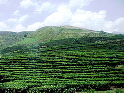
Phú Thọ
Phú Thọ
Thị xã Phú Thọ | |
|---|---|
| Phú Thọ Town | |
 | |
 Phú Thọ Location of Phú Thọ within Vietnam | |
| Coordinates: 21°24′1″N 105°13′21″E / 21.40028°N 105.22250°ECoordinates: 21°24′1″N 105°13′21″E / 21.40028°N 105.22250°E | |
| Country | |
| Province | Phú Thọ |
| Area | |
| • Total | 24.9 sq mi (64.6 km2) |
| Population (2013) | |
| • Total | 91,650 |
| Time zone | UTC+7 (Indochina Time) |
Phú Thọ (![]() listen) is a district-level town in Phú Thọ Province, Vietnam. As of 2003, the town had a population of 63,333.[1] The town covers an area of 64 km².[1]
listen) is a district-level town in Phú Thọ Province, Vietnam. As of 2003, the town had a population of 63,333.[1] The town covers an area of 64 km².[1]
Geography[]
Phú Thọ is bordered by Phù Ninh to the north, Thanh Ba to the southwest, Tam Nông to the south and Lâm Thao to the southeast.
References[]
- ^ Jump up to: a b "Districts of Vietnam". Statoids. Archived from the original on 2009-03-01. Retrieved March 23, 2009.
Categories:
- Districts of Phú Thọ Province
- Populated places in Phú Thọ Province
- County-level towns in Vietnam
- Northeast Vietnam geography stubs

