Bắc Giang
Bắc Giang
Thành phố Bắc Giang | |
|---|---|
| Bắc Giang City | |
 | |
 Seal | |
 Bắc Giang Location of in Vietnam | |
| Coordinates: 21°16′N 106°12′E / 21.267°N 106.200°E | |
| Country | |
| Province | Bắc Giang |
| Government | |
| • Party Secretary: | Nguyễn Sỹ Nhận[1] |
| • People's Council Chairman: | Mai Sơn |
| • People's Committee Chairman: | Lê Bá Chiến |
| Area | |
| • Total | 66.7736 km2 (25.7814 sq mi) |
| Population (2019) | |
| • Total | 201,595 |
| • Density | 2,974/km2 (7,700/sq mi) |
| Time zone | UTC+7 (Indochina Time) |
| Climate | Cwa |

Bắc Giang (![]() listen) is a city in Vietnam. It is the capital of Bắc Giang Province. Its name, deriving from that of the Province Sino-Vietnamese, means "north of the river." The location is very convenient for transportation: it is 50 km north of Hanoi, in the middle position on major transportation routes (roads, international railway) connecting Hanoi with the Lạng Sơn City and Đồng Đăng international border gate; Bắc Giang is located in an important transportation hub. The runs through the town's southern part heading for Haiphong.
listen) is a city in Vietnam. It is the capital of Bắc Giang Province. Its name, deriving from that of the Province Sino-Vietnamese, means "north of the river." The location is very convenient for transportation: it is 50 km north of Hanoi, in the middle position on major transportation routes (roads, international railway) connecting Hanoi with the Lạng Sơn City and Đồng Đăng international border gate; Bắc Giang is located in an important transportation hub. The runs through the town's southern part heading for Haiphong.
Although the name of Bắc Giang (北江 "North River") Province is very old, established in its first form in 1466, there was historically no town of that name. The town was created out the old Láng Thượng District after independence.[2] The Suối Mỡ thermal springs area is 37 km from the town centre.[3] Bắc Giang Peace Park was a sister city project with Madison, Wisconsin, United States.[4][5]
Economic situation[]
Bắc Giang City is a center of the nitrogen - chemical industry, textile industry, also the distribution center, transit of goods from China, as well as the place for local products being exported to China. The city has some small- and medium-sized industrial zones associated with large industrial zones such as Quang Châu, Đình Trám, Vân Trung and Song Khê - Nội Hoàng. The emblem of the BG industry is the Hà Bắc fertilizer factory, the first fertilizer plant in Vietnam.
In 2013, Bắc Giang City maintained high and stable economic growth reaching 17.3%, with the GDP per capita reaching $3000. The economic structure has shifted positively: trade and services 45.2%; industry, handicraft - construction 51.3%; agriculture - fishery 3.5%. The city has developed diverse industries such as agricultural and forestry processing, mechanical, chemical, textile, electronic and construction materials. Bắc Giang City is well known as one of the distribution centers for the transit of goods imported from China to Vietnam and vice versa. The service network has been developed strongly with large-scale supermarkets such as Big C Bắc Giang, Co.opmart supermarket, Bắc Giang Supermarket, Imexco Supermarket, Mediamart, Văn Chiến appliances and electrics store.
Administrative subdivisions[]
The city is subdivided to 16 commune-level subdivisions, including the wards of: Đa Mai, Dĩnh Kế, Hoàng Văn Thụ, Lê Lợi, Mỹ Độ, Ngô Quyền, Thọ Xương, Trần Nguyên Hãn, Trần Phú, Xương Giang and the rural communes of: Dĩnh Trì, Đồng Sơn, Song Khê, Song Mai, Tân Mỹ and Tân Tiến.
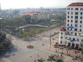
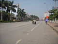
Gallery[]
Bắc Giang
Bắc Giang

Bắc Giang

Bắc Giang


Climate[]
| hideClimate data for Bắc Giang | |||||||||||||
|---|---|---|---|---|---|---|---|---|---|---|---|---|---|
| Month | Jan | Feb | Mar | Apr | May | Jun | Jul | Aug | Sep | Oct | Nov | Dec | Year |
| Record high °C (°F) | 30.8 (87.4) |
31.3 (88.3) |
33.6 (92.5) |
36.3 (97.3) |
38.7 (101.7) |
39.1 (102.4) |
37.6 (99.7) |
37.1 (98.8) |
37.0 (98.6) |
34.8 (94.6) |
33.5 (92.3) |
30.0 (86.0) |
39.1 (102.4) |
| Average high °C (°F) | 19.7 (67.5) |
20.0 (68.0) |
22.6 (72.7) |
26.8 (80.2) |
31.1 (88.0) |
32.5 (90.5) |
32.6 (90.7) |
32.0 (89.6) |
31.2 (88.2) |
28.9 (84.0) |
25.6 (78.1) |
22.1 (71.8) |
27.1 (80.8) |
| Daily mean °C (°F) | 16.2 (61.2) |
17.1 (62.8) |
19.9 (67.8) |
23.7 (74.7) |
27.1 (80.8) |
28.7 (83.7) |
29.0 (84.2) |
28.4 (83.1) |
27.4 (81.3) |
24.7 (76.5) |
21.1 (70.0) |
17.7 (63.9) |
23.4 (74.1) |
| Average low °C (°F) | 13.6 (56.5) |
15.0 (59.0) |
17.9 (64.2) |
21.5 (70.7) |
24.3 (75.7) |
25.8 (78.4) |
26.2 (79.2) |
25.8 (78.4) |
24.5 (76.1) |
21.5 (70.7) |
17.8 (64.0) |
14.5 (58.1) |
20.7 (69.3) |
| Record low °C (°F) | 3.4 (38.1) |
4.6 (40.3) |
5.9 (42.6) |
12.2 (54.0) |
16.1 (61.0) |
19.2 (66.6) |
21.8 (71.2) |
21.6 (70.9) |
17.2 (63.0) |
10.3 (50.5) |
6.7 (44.1) |
2.8 (37.0) |
2.8 (37.0) |
| Average precipitation mm (inches) | 24 (0.9) |
27 (1.1) |
49 (1.9) |
111 (4.4) |
193 (7.6) |
256 (10.1) |
253 (10.0) |
286 (11.3) |
176 (6.9) |
121 (4.8) |
38 (1.5) |
18 (0.7) |
1,552 (61.1) |
| Average precipitation days | 8.3 | 10.6 | 14.9 | 14.0 | 13.8 | 15.4 | 14.9 | 16.6 | 11.9 | 10.1 | 6.5 | 4.3 | 141.3 |
| Average relative humidity (%) | 78.3 | 81.6 | 85.3 | 86.1 | 83.1 | 82.3 | 82.4 | 84.5 | 82.3 | 80.2 | 77.4 | 76.5 | 81.7 |
| Mean monthly sunshine hours | 77 | 47 | 49 | 90 | 193 | 179 | 203 | 189 | 202 | 182 | 153 | 133 | 1,695 |
| Source: Vietnam Institute for Building Science and Technology[6] | |||||||||||||
References[]
- ^ http://www.bacgiang.gov.vn/email/c-194/timkiem.html&c=0
- ^ Bắc Giang thế và lực mới trong thế kỷ XXI published Công ty cổ phần thông tin kinh tế đối ngoại 2002 - Page 21 "Bắc Giang Town was formerly called Láng Thượng District. After the victory of the war of resistance against the French colonialists, Vietnamese authorities had decided to set up Bắc Giang Town.
- ^ Minh trị Lưu Historical remains & beautiful places of Hanoi and the surrounding area Page 268 2000 "Suối Mơ Relics is in Nghia Phương commune, Lục Ngạn district, 37 km from Bắc Giang town. It is dedicated to God of the soil, Lady Lord of Forestry princess Quế Mỵ Nương, daughter of the 16th Hùng King."
- ^ Cumulative list of organizations described in section 170 Volume 2 - Page 1907 United States. Internal Revenue Service - 2003 "Madison-Bac Giang Sister City Project Inc., Madison, Wi.
- ^ Friends journal - Volume 44 - Page 2 1998 "Following dedication of the peace park, the Madison-Bac Giang Vietnam Sister City Project evolved."
- ^ "Vietnam Building Code Natural Physical & Climatic Data for Construction" (PDF). Vietnam Institute for Building Science and Technology. Archived from the original (PDF) on 22 July 2018. Retrieved 4 August 2018.
Coordinates: 21°16′N 106°12′E / 21.267°N 106.200°E
| Wikimedia Commons has media related to Bac Giang City. |

| show Authority control |
|---|
- Bắc Giang
- Districts of Bắc Giang Province
- Populated places in Bắc Giang Province
- Provincial capitals in Vietnam
- Cities in Vietnam