Kon Tum Province
Kon Tum Province
Tỉnh Kon Tum | |
|---|---|
     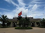         Cathedral Kon Tum • Dams Yaly • Stream Đắk Glei • Mountain Đắk Glei • The border mark of the tripoint between Vietnam - Laos - Cambodia • Bố Y Border Gate • Cathedral Tân Hương • Bishop of Kon Tum Building • Hotel Đồi Thông • Mountain Măng Đen • River Đắk Bla | |
 Seal | |
 Location of Kon Tum within Vietnam | |
 | |
| Coordinates: 14°45′N 107°55′E / 14.750°N 107.917°ECoordinates: 14°45′N 107°55′E / 14.750°N 107.917°E | |
| Country | |
| Region | Central Highlands |
| Capital | Kon Tum |
| Area | |
| • Total | 9,674.5 km2 (3,735.3 sq mi) |
| Population (2018) | |
| • Total | 528,043 |
| • Density | 55/km2 (140/sq mi) |
| Demographics | |
| • Ethnicities | Vietnamese, Xơ Đăng, Ba Na, Giẻ Triêng, Jarai |
| Time zone | UTC+7 (ICT) |
| Calling code | 60 |
| ISO 3166 code | VN-28 |
| Website | www |

Kon Tum Province lies in the Central Highlands region of Vietnam and shares borders with Laos and Cambodia. It has an area of 9,934 square km and a population of approximately 530,000. The economy is primarily agricultural.
Name[]
The name Kon Tum comes from the name of a village of the Bahnar ethnic group. In the Bahnar language, kon means "village" and tum means "pool". Prior to the adoption of the Vietnamese alphabet in the 1920s, the name was rendered as 崑嵩.
Administrative divisions[]
Kon Tum is subdivided into ten district-level sub-divisions:
| Second Tier subdivisions |
Area (km²) |
Third Tier subdivisions | ||
|---|---|---|---|---|
| Wards | Townships | Communes | ||
| Kon Tum city | 432.98 | 10 | 11 | |
| Đắk Glei District | 1495.26 | 1 | 11 | |
| Đắk Hà District | 844.47 | 1 | 10 | |
| Đắk Tô District | 509.24 | 1 | 8 | |
| Ia H'Drai District | 980.13 | 3 | ||
| Kon Plông District | 1381.20 | 9 | ||
| Kon Rẫy District | 886.60 | 1 | 6 | |
| Ngọc Hồi District | 824.00 | 1 | 7 | |
| Sa Thầy District | 1435.22 | 1 | 10 | |
| Tu Mơ Rông District | 857.18 | 11 | ||
They are further subdivided into six commune-level towns (or townlets), 83 communes, and 10 wards.
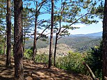
Geography[]
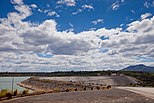
Neighboring provinces are Quảng Nam to the north, Quảng Ngãi to the east and Gia Lai to the south. The capital city is Kon Tum, located on the Đăk Bla river.
The southern border with Gia Lai follows the Sê San river up to Yali Falls Dam, as well as part of the Dak Bla, Dak Pokei and Dak Poe rivers.
The province is primarily located in the Sê San river basin, though parts are also in the headwaters of the , Trà Khúc and Sekong Rivers.
Demographics[]
Ethnic groups in Kon Tum Province include the Viet, Bahnar, Brau, Giẻ Triêng, Jarai, Rơ Măm, and Xo Dang.
Notable residents[]
- Siu Black, popular singer
See also[]
External links[]
| Wikimedia Commons has media related to Kon Tum. |
| show Places adjacent to Kon Tum Province |
|---|
| show Districts of Vietnam Central Highlands |
|---|

| show Authority control |
|---|
- Kon Tum Province
- Provinces of Vietnam