Aš
Aš | |
|---|---|
 Town centre | |
 Flag  Coat of arms | |
 Aš Location in the Czech Republic | |
| Coordinates: 50°13′26″N 12°11′42″E / 50.22389°N 12.19500°ECoordinates: 50°13′26″N 12°11′42″E / 50.22389°N 12.19500°E | |
| Country | |
| Region | Karlovy Vary |
| District | Cheb |
| First mentioned | 1270 |
| Government | |
| • Mayor | Dalibor Blažek |
| Area | |
| • Total | 55.86 km2 (21.57 sq mi) |
| Elevation | 666 m (2,185 ft) |
| Population (2021-01-01)[1] | |
| • Total | 13,105 |
| • Density | 230/km2 (610/sq mi) |
| Time zone | UTC+1 (CET) |
| • Summer (DST) | UTC+2 (CEST) |
| Postal code | 352 01 |
| Website | www |

Aš (Czech pronunciation: [aʃ]; German: Asch) is a town in Cheb District in the Karlovy Vary Region of the Czech Republic. It has about 13,000 inhabitants.
Administrative parts[]

Villages of Dolní Paseky, Doubrava, Horní Paseky, Kopaniny, Mokřiny, Nebesa, Nový Žďár and Vernéřov are administrative parts of Aš.
Geography[]
The town is situated in the Elster Mountains, in the northwesternmost area of the historic Bohemia region close to the border with Germany. With the neighbouring municipalities Hranice, Krásná, Podhradí and Hazlov in the south it forms Aš Land (Czech: Ašský výběžek or Ašsko), a panhandle area surrounded by German territory in the east, north and west. This area, located north of the historic Egerland, is also referred to as Bohemian Vogtland.
Road border crossings lead to Bad Elster and Eichigt in Saxony in the east, as well as to Selb in Bavaria in the west. Pedestrians and bicyclists can directly reach Bad Brambach in the east and Rehau in the west. Border controls have been abolished since the Czech Republic implemented the Schengen Agreement in 2007.
History[]
Previously uninhabited hills and swamps, the town of Asch was founded in the early 11th century by German colonists[2] descending from the Bavarian march of the Nordgau in the course of the Ostsiedlung. So far, previous Slavic settlements in the area are not known.[3] Similar to the Egerland region, the dialect spoken in the town was that of the Upper Palatinate region in the south, also known as Northern Bavarian. In the adjacent Saxon Vogtlandkreis to the east, this dialect is only found in localities close to the Czech border, such as Adorf and Markneukirchen. The Upper Palatinate dialect has a stronger presence in the Bad Brambach area, where it is known as Southern Vogtlandic (Südvogtländisch).
The first recorded rulers were the Vogt ministeriales from Weida, Thuringia, who gave the entire Vogtland region its name. In 1281, they officially received the estates as an immediate fief at the hands of King Rudolph I of Germany. Emperor Louis the Bavarian elevated them to Princes of the Holy Roman Empire in 1329. Nevertheless, two years later, they sold Aš Land to the Luxembourg king John of Bohemia, who since 1322 also held the adjacent Egerland in the south. Together with neighbouring Selb and Elster, Aš was enfeoffed to the Freiherren of Neuberg (Podhradí).[4] When in 1394 Konrad von Neuburg died without a male heir, by virtue of Hedwig von Neuburg's marriage to Konrad von Zedtwitz, Asch passed into the control of the noble House of Zedtwitz.

In 1557, the Aš region was finally incorporated into the Lands of the Bohemian Crown by the Habsburg king Ferdinand I. Like the neighbouring Egerland, it remained Protestant until the Thirty Years' War, as the Counter Reformation did not stretch to the West Bohemian borderlands. In the 1648 Peace of Westphalia, the Protestant confession of the citizens was confirmed. In 1774, Empress Maria Theresa officially mediatised Aš as part of the Bohemian crown land within the Habsburg Monarchy, against the delaying resistance by the Zedtwitz noble family. Nevertheless, she granted its Protestant citizens freedom of religion, confirmed in the 1781 Patent of Toleration, issued by her son Emperor Joseph II.
From 1806, Asch with Bohemia belonged to the Austrian Empire and Cisleithanian Austria after the Compromise of 1867. Until 1918, the town remained part of Austria-Hungary, head of the Asch district, one of the 94 Bezirkshauptmannschaften in Bohemia.[5] In 1854 a county legal code was granted to the region, ending five centuries of legal control by the Zedtwitz family. Asch was linked to the Eger (Cheb)–Hof railway line in 1864, with a branch-off to Saxon Adorf opened in 1885. It obtained the status of a town in 1872, as the population grew due to a flourishing textile industry. By 1910 the population had risen to 21,880, from 9,405 in 1869.[2]
Upon the dissolution of the Austro-Hungarian monarchy at the end of the World War I, a soldiers' council seized power and rejected the demands of separatists from Eger for annexation to the Bavarian lands of the German Weimar Republic, preferring to remain with the Republic of German-Austria, which was however soon denied by the 1919 Paris Peace Conference. During the negotiations of the Treaty of Saint-Germain-en-Laye the Americans, like Allen Welsh Dulles, had failed to persuade other powers to make at least the Bohemian peninsulas within Germany, like Aš Land or Rumburk in the Šluknov Hook, legal parts of Weimar Germany. Thus the area became part of newly established state of Czechoslovakia, and received its current Czech name[6] On 18 November 1920, Czech militia toppled the monument of Emperor Joseph II against local protest, whereby three citizens were shot: 27yo Ferdinand Künzel, 45yo baker Eduard Schindler, 22yo Robert Käßmann[7] A 1921 Czechoslovak census counted 183 ethnic Czechs, in a population of 40,000 in the district,[6] a 1930 census 520 Czechs, in a population of 45,000 in the district.[6]
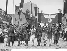
In 1937, the Sudeten German Party took over in Aš, led by Konrad Henlein, who for several years had worked in the town as a gym teacher. Henlein openly advocated the annexation of the Sudetenland territories to Nazi Germany, while Czech residents, mainly officials, were forced to leave the town. On 22 September 1938, a few days before the Munich Agreement, a Sudeten German Freikorps proclaimed a "Free State of Asch". Upon the German occupation of Czechoslovakia in October, according to the Agreement, Wehrmacht troops officially arrived, unopposed. By 1939 a German census counted a population of 23,130 in the town, almost 100% German Lutherans. From 1938 to 1945, Asch was one of the Municipalities in Sudetenland.
At the end of World War II, the town was occupied by U.S. Army forces on 20 April 1945. Czech officials arrested 64 men on 7 June and took them to Bory Prison in Plzeň, where half of them perished[8] Due to the Expulsion of Germans from Czechoslovakia in 1946 by the Beneš decrees, the city's population was reduced, according to the official website, to "half of the pre-war number of inhabitants".[9] A German expellee website states that 30,327 Germans have been expelled from March to November in 27 trains.[10] In 1949, 3,000 expellees met in far away Rüdesheim am Rhein, to protest, stating that their area never was inhabited by Slavs other than as a tiny minority.[4]
The population shrank further in 1950 due to the establishment of the Iron Curtain and the Czechoslovak border fortifications during the Cold War by the ruling Communists, as the whole Aš district was included into the border zone which made many people move out.[2] Because of the lowering number of inhabitants some houses remained uninhabited. There was lack of money for their renovation and it was necessary to demolish them.[2] The present-day population in the town is roughly half of the pre-war population.
Demography[]
|
|
| ||||||||||||||||||||||||||||||||||||||||||||||||||||||
| Source: Historical lexicon of municipalities of the Czech Republic[11] | ||||||||||||||||||||||||||||||||||||||||||||||||||||||||
Sights[]


Buildings[]
- Town Hall was built in 1733 in the baroque style, but in 1814 was burned out. In 1816 it was built again, according to the original plans.
- Town museum was built in 1892, and was completely reconstructed from 2009 to 2010. A central evidence of stone crosses of Czech Republic is located in this building. Also a collection of 25 000 pairs of gloves is located here.
- Catholic church of St. Nicholas from 1871.
- Salva Guardia Reichspost stone relief with imperial symbols. In these days it was part of the town museum's gardens.
- Watchtower Háj from 1902 to 1903 was designed by W. Kreis. The tower is 36 metres high.
- Town firehouse from 1930 designed by Emil Rösler.
Memorials and statues[]
- Memorial of J. W. Goethe from 1932, designed by Johannes Watzal is located on the Goethovo Square.
- Memorial with statue of Martin Luther from 1883, designed by J. Rössner is located on the Husovo Square. Re-erected in 2008, it is currently the only Luther Monument in the Czech Republic.
- Edvard Beneš Memorial from 1947 is located in Okružní street.
- Gustav Geipel Memorial from 1924, designed by Johannes Watzal is located in Okružní street. Gustav Geipel was citizen of Aš (?–1914), who sponsored poor weavers, children and old people.
- Theodor Körner Memorial from 1903 is located close to watchtower.
- Friedrich Ludwig Jahn Memorial from 1909 is also located close to watchtower.
- Robert Schumann Memorial desk from 1901 is located at the school of art.
- War Memorial (1848–1869), World War II Memorial and USSR Memorial are located at the central cemetery.
- US Army Liberation Memorial is located on the Masarykovo Square.
Education[]
There are five kindergartens, four elementary schools, a gymnasium, a special school and a school of art located in Aš. A high school of textile also existed here.
Transport[]

Railway 148 (Cheb-Hranice v Čechách) goes through the town. There are three train stations located here: Aš (the main train station), Aš-město and Aš-předměstí (currently just a shelter).
This railway and the first station were built in 1865. In 1968, the old Royal Bavarian State Railways station building was demolished, and the current one was built in 1969. The railway also continues to Hranice, but there is only one service per day.
Aš station also lies on the Cheb–Oberkotzau railway. This railway was closed during the Cold War, but reopened in 2015.
Trivia[]
Alongside with the municipality of Eš, Aš has the shortest place name in the Czech Republic with only two letters.[12]
Notable people[]
- Sebastian Knüpfer (1633–1676), composer
- Friedrich Wettengel (1750–1824), Lutheran theologian
- Andreas Leonhardt (1800–1866), composer
- Ernst Bareuther (1838–1905), German politician
- Karl Alberti (1856–1953), historian
- Emil Baumgärtel (1885–1939), Austrian politician (SPÖ)
- Wilhelm Ludwig (1901–1959), German geneticist
- Karl Fritzsch (1903–1945), KZ-commander
- Hermann Fischer (1912–1984), athlete and Communist resistance fighter against Nazism
- Karl Komma (1913–2012), composer
- Rudolf Hilf (1923–2011), political scientist and displaced politician
- Ernst Wilfer (1923–2014), German engineer
- Oskar Fischer (1923–2020), German politician
- Anton Bodem (1925–2007), theologian
- Gerhard Hahn (born 1933), professor of medieval studies
- Horst Tomayer (1938–2013), writer and actor
- Markéta Zinnerová (born 1942), children's book writer
- Charly Höllering (1944–2009), jazz musician and graphic artist
- Wolf Stegemann (born 1944), German journalist, author and poet
- Rüdiger Bartelmus (born 1944), theologian and professor
- Milan Bokša (born 1951), football manager
- Petr Sepéši (1960–1985), singer
- Jiří Plíšek (born 1972), football player and manager
- Lukáš Rešetár (born 1984), futsal player
- Lenka Marušková (born 1985), athlete
- Jiří Sekáč (born 1992), ice hockey player
Twin towns – sister cities[]
 Fiumefreddo di Sicilia, Italy
 Marktbreit, Germany
- Oelsnitz, Germany
- Plauen, Germany
- Rehau, Germany
See also[]
References[]
- ^ "Population of Municipalities – 1 January 2021". Czech Statistical Office. 2021-04-30.
- ^ Jump up to: a b c d "Historie města" (in Czech). Město Aš. Retrieved 2021-06-06.
- ^ Frühgschichte Archived November 6, 2007, at the Wayback Machine
- ^ Jump up to: a b Rüdesheimer Erklärung Archived November 9, 2007, at the Wayback Machine
- ^ Die postalischen Abstempelungen auf den österreichischen Postwertzeichen-Ausgaben 1867, 1883 und 1890, Wilhelm KLEIN, 1967
- ^ Jump up to: a b c Cz. Republik Archived November 6, 2007, at the Wayback Machine
- ^ Chronik Archived September 29, 2007, at the Wayback Machine
- ^ Die Verfolgung Archived November 9, 2007, at the Wayback Machine
- ^ "Because of the removal of German inhabitants in 1946 As had only a half of the pre-war number of inhabitants" https://web.archive.org/web/20060715090423/http://www.muas.cz/html/e_historie.htm
- ^ Die Vertreibung Archived November 6, 2007, at the Wayback Machine
- ^ "Historický lexikon obcí České republiky 1869–2011 – Okres Cheb" (in Czech). Czech Statistical Office. 2015-12-21. pp. 1–2.
- ^ "Zajímavosti názvů obcí v České republice" (in Czech). Czech Statistical Office. Retrieved 2020-07-22.
- ^ "Partnerská města" (in Czech). Město Aš. Retrieved 2020-07-23.
External links[]
| Wikimedia Commons has media related to Aš. |
- Official website
- (in Czech and German) Website of expelled Germans (from Germans point of view)
| show Authority control |
|---|
- Populated places in Cheb District
- Aš
- Cities and towns in the Czech Republic