Alegria, Rio Grande do Sul
Alegria | |
|---|---|
Municipality | |
 Flag  Seal | |
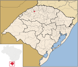 | |
 Alegria Location in Brazil | |
| Coordinates: 27°49′S 54°03′W / 27.817°S 54.050°WCoordinates: 27°49′S 54°03′W / 27.817°S 54.050°W | |
| Country | |
| Region | South |
| State | |
| Founded | 1987 |
| Area | |
| • Total | 175.28 km2 (67.68 sq mi) |
| Elevation | 383 m (1,257 ft) |
| Population (2020 [1]) | |
| • Total | 3,374 |
| • Density | 24.91/km2 (64.5/sq mi) |
| Time zone | UTC-3 (UTC-3) |
| • Summer (DST) | UTC-2 (UTC-2) |
| Website | http://www.pmalegria.com.br/ |

Alegria, Rio Grande do Sul is a municipality in the state of Rio Grande do Sul, Brazil.
See also[]
- List of municipalities in Rio Grande do Sul
References[]

 | This geographical article relating to Rio Grande do Sul is a stub. You can help Wikipedia by . |
Categories:
- Municipalities in Rio Grande do Sul
- Rio Grande do Sul geography stubs