São José do Inhacorá
São José do Inhacorá | |
|---|---|
| Municipality of São José do Inhacorá | |
 Coat of arms | |
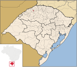 Location in Rio Grande do Sul | |
 São José do Inhacorá Location in Brazil | |
| Coordinates: 27°43′30″S 54°07′44″W / 27.72500°S 54.12889°WCoordinates: 27°43′30″S 54°07′44″W / 27.72500°S 54.12889°W | |
| Country | |
| Region | South |
| State | |
| Emancipated | 20 March 1992 |
| Government | |
| • Mayor | Gilberto Pedro Hammes |
| Area | |
| • Total | 77.806 km2 (30.041 sq mi) |
| Elevation | 220 m (720 ft) |
| Population (2020 [1]) | |
| • Total | 2,056 |
| Time zone | UTC-3 (BRT) |
| • Summer (DST) | UTC-2 (BRST) |
| Postal Code | 98958-000 |
| Area code(s) | +55 55 |
| Website | saojosedoinhacora.rs.gov.br |

São José do Inhacorá is a municipality in the state of Rio Grande do Sul, Brazil. Originally, this little city was a district of Três de Maio and obtained its emancipation in 1992.[citation needed]
The city is considered the less dangerous in Brazil to live, and it shares this status with Borá. Violence is virtually eradicated (0 deaths per 100 thousand inhabitants).[citation needed]
See also[]
- List of municipalities in Rio Grande do Sul
References[]
| show |
|---|

 | This geographical article relating to Rio Grande do Sul is a stub. You can help Wikipedia by . |
Categories:
- Municipalities in Rio Grande do Sul
- Rio Grande do Sul geography stubs