Camaquã
Camaquã | |
|---|---|
 Flag  Seal | |
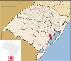 Location within Rio Grande do Sul | |
 Camaquã Location in Brazil | |
| Coordinates: 30°51′S 51°49′W / 30.850°S 51.817°WCoordinates: 30°51′S 51°49′W / 30.850°S 51.817°W | |
| Country | |
| State | Rio Grande do Sul |
| Government | |
| • Mayor | Ivo de Lima Ferreira |
| Area | |
| • Total | 1,679.556 km2 (648.480 sq mi) |
| Population (2020 [1]) | |
| • Total | 66,478 |
| • Density | 40/km2 (100/sq mi) |
| Time zone | UTC-3 (BRT) |
| • Summer (DST) | UTC-2 (BRST) |
Camaquã is a municipality in the state of Rio Grande do Sul, Brazil.
The municipality contains part of the 7,993 hectares (19,750 acres) Camaquã State Park, created in 1975.[2]
See also[]
| Wikimedia Commons has media related to Camaquã. |
- List of municipalities in Rio Grande do Sul
References[]
- ^ IBGE 2020
- ^ Parque Estadual do Camaquã (in Portuguese), SEMA: Secretaria do Ambiente e Desenvolvimento Sustentável (RS), retrieved 2017-01-22

 | This geographical article relating to Rio Grande do Sul is a stub. You can help Wikipedia by . |
Categories:
- Municipalities in Rio Grande do Sul
- Rio Grande do Sul geography stubs