Appoigny
Appoigny | |
|---|---|
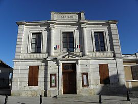 The town hall in Appoigny | |
 Coat of arms | |
show Location of Appoigny | |
 Appoigny | |
| Coordinates: 47°52′41″N 3°31′44″E / 47.8781°N 3.5289°ECoordinates: 47°52′41″N 3°31′44″E / 47.8781°N 3.5289°E | |
| Country | France |
| Region | Bourgogne-Franche-Comté |
| Department | Yonne |
| Arrondissement | Auxerre |
| Canton | Auxerre-2 |
| Area 1 | 22.09 km2 (8.53 sq mi) |
| Population (Jan. 2018)[1] | 3,248 |
| • Density | 150/km2 (380/sq mi) |
| Time zone | UTC+01:00 (CET) |
| • Summer (DST) | UTC+02:00 (CEST) |
| INSEE/Postal code | 89013 /89380 |
| Elevation | 82–201 m (269–659 ft) |
| 1 French Land Register data, which excludes lakes, ponds, glaciers > 1 km2 (0.386 sq mi or 247 acres) and river estuaries. | |


Appoigny is a commune in the Yonne department in Bourgogne-Franche-Comté in north-central France.
This village with all its flowers is well known for its architectural heritage but also for its hotels and restaurants. The Saint Pierre Collegial - a classified Historic Building - dates back to the 13th century. It has a tower of the 16th century and a magnificent Jube dating from 1606.
See also[]
References[]
- ^ "Populations légales 2018". INSEE. 28 December 2020.
| Wikimedia Commons has media related to Appoigny. |
| show Authority control |
|---|
This Yonne geographical article is a stub. You can help Wikipedia by . |
Categories:
- Communes of Yonne
- Yonne geography stubs