Avondale, Pennsylvania
Avondale, Pennsylvania | |
|---|---|
Borough | |
 | |
 Location in Chester County and the U.S. state of Pennsylvania | |
 Avondale Location in Pennsylvania | |
| Coordinates: 39°49′24″N 75°47′00″W / 39.82333°N 75.78333°WCoordinates: 39°49′24″N 75°47′00″W / 39.82333°N 75.78333°W[1] | |
| Country | United States |
| State | Pennsylvania |
| County | Chester |
| Area | |
| • Total | 0.50 sq mi (1.28 km2) |
| • Land | 0.48 sq mi (1.25 km2) |
| • Water | 0.01 sq mi (0.03 km2) |
| Elevation | 266 ft (81 m) |
| Population (2010) | |
| • Total | 1,265 |
| • Estimate (2019)[3] | 1,400 |
| • Density | 2,892.56/sq mi (1,117.94/km2) |
| Time zone | UTC-5 (EST) |
| • Summer (DST) | UTC-4 (EDT) |
| ZIP Code | 19311 |
| Area codes | 610 and 484 |
| FIPS code | 42-03656 |
| Website | avondaleboro |


Avondale is a borough in Chester County, in southeastern Pennsylvania, United States. The population was 1,265 at the 2010 census.
Geography[]
Avondale is located on Pennsylvania Route 41 just south of U.S. Route 1. The community is on the East Branch White Clay Creek.[4]
The borough has a total area of 0.5 square miles (1.3 km2), all land.[5]
Demographics[]
| Historical population | |||
|---|---|---|---|
| Census | Pop. | %± | |
| 1880 | 329 | — | |
| 1900 | 640 | — | |
| 1910 | 668 | 4.4% | |
| 1920 | 627 | −6.1% | |
| 1930 | 763 | 21.7% | |
| 1940 | 754 | −1.2% | |
| 1950 | 941 | 24.8% | |
| 1960 | 1,016 | 8.0% | |
| 1970 | 1,025 | 0.9% | |
| 1980 | 891 | −13.1% | |
| 1990 | 954 | 7.1% | |
| 2000 | 1,108 | 16.1% | |
| 2010 | 1,265 | 14.2% | |
| 2020 | 1,274 | 0.7% | |
| [6] | |||
As of the 2010 census, the borough was 30.7% non-Hispanic White, 8.9% Black or African American, 1.4% Native American, 0.8% Asian, and 2.8% were two or more races. 59.0% of the population were of Hispanic or Latino ancestry.[7]
At the time of the 2000 census,[8] there were 1,108 people, 345 households, and 247 families residing in Avondale. The population density was 2,248.7 per square mile (873.1/km2). There were 361 housing units at an average density of 732.7 per square mile (284.5/km2). The racial makeup of Avondale was 69.77% White, 16.61% African American, 0.90% Native American, 0.27% Asian, 10.38% from other races, and 2.08% from two or more races. Hispanic or Latino of any race accounted for 38.09% of the population.
Out of the 345 households, 36.5% had children under the age of 18 living with them, 49.6% were married couples living together, 12.8% had a female householder with no husband present, and 28.4% were non-families. 21.4% of all households were made up of individuals, and 6.7% had someone living alone who was 65 years of age or older. The average household size was 3.08 and the average family size was 3.52.
The population of Avondale was spread out, with 26.2% under the age of 18, 11.9% from 18 to 24, 32.7% from 25 to 44, 19.3% from 45 to 64, and 9.9% who were 65 years of age or older. The median age was 32 years. For every 100 females there were 113.1 males. For every 100 females age 18 and over, there were 122.3 males.
The median income for a household in Avondale was $46,875, and the median income for a family was $48,833. Males had a median income of $33,750 versus $25,536 for females. The per capita income was $16,794. About 9.7% of families and 14.9% of the population were below the poverty line, including 12.1% of those under age 18 and 15.3% of those age 65 or over.
Culture[]
Avondale is the location of St. Rocco Church, the first National Hispanic Parish established by the Roman Catholic Archdiocese of Philadelphia. The church was established in 2011 to serve the needs of the large Spanish-speaking Catholic Latino community in the area, which is mostly composed of Mexican immigrants, but also includes people from Puerto Rico, Colombia, Argentina, Guatemala, and other Latin American countries. Many parishioners work in the local mushroom farming industry.[9][10]
Notable people[]
Famed journalist Mark Sullivan (1874–1952) was born on a farm just outside Avondale and returned to live on that same farm in his later years.[11]
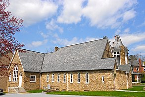
United Methodist church
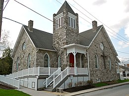
Presbyterian church


References[]
| Wikimedia Commons has media related to Avondale, Pennsylvania. |
- ^ a b U.S. Geological Survey Geographic Names Information System: Avondale, Pennsylvania
- ^ "2019 U.S. Gazetteer Files". United States Census Bureau. Retrieved July 28, 2020.
- ^ "Population and Housing Unit Estimates". United States Census Bureau. May 24, 2020. Retrieved May 27, 2020.
- ^ West Grove, PA, 7.5 Minute Topographic Quadrangle, USGS, 1954 (1987 rev.)
- ^ "US Gazetteer files: 2010, 2000, and 1990". United States Census Bureau. 2011-02-12. Retrieved 2011-04-23.
- ^ "Census 2020".
- ^ [1]
- ^ "U.S. Census website". United States Census Bureau. Retrieved 2016-12-13.
- ^ Gregory, George (11 November 2010). "Philadelphia Archdiocese Establishes National Parish for Hispanics". AmericanCatholic.org. Cincinnati, Ohio: Franciscan Media. Catholic News Service. Archived from the original on 2010-11-15. Retrieved 13 December 2016.
- ^ Pirro, J.F. (January 2012). "St. Rocco Church Welcomes Mexican Immigrants in Avondale". Main Line Today. Newtown Square, Pennsylvania: Today Media. Archived from the original on 2016-12-13. Retrieved 13 December 2016.
- ^ Rowe, Dolores I (2006). Around Avondale and West Grove. p. 8. ISBN 9780738545660. Retrieved 2014-11-24.
External links[]

- Populated places established in 1894
- Boroughs in Chester County, Pennsylvania
- 1894 establishments in Pennsylvania