West Pikeland Township, Chester County, Pennsylvania
West Pikeland Township | |
|---|---|
 Lightfoot Mill, National Historic Landmark | |
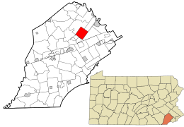 Location in Chester County and the state of Pennsylvania. | |
 Location of Pennsylvania in the United States | |
| Coordinates: 40°05′25″N 75°37′20″W / 40.09028°N 75.62222°WCoordinates: 40°05′25″N 75°37′20″W / 40.09028°N 75.62222°W | |
| Country | United States |
| State | Pennsylvania |
| County | Chester |
| Area | |
| • Total | 9.96 sq mi (25.79 km2) |
| • Land | 9.87 sq mi (25.55 km2) |
| • Water | 0.09 sq mi (0.24 km2) |
| Elevation | 374 ft (114 m) |
| Population (2010) | |
| • Total | 4,024 |
| • Estimate (2016)[2] | 4,083 |
| • Density | 413.80/sq mi (159.77/km2) |
| Time zone | UTC-5 (EST) |
| • Summer (DST) | UTC-4 (EDT) |
| Area code(s) | 610 |
| FIPS code | 42-029-83832 |

West Pikeland Township is a township in Chester County, Pennsylvania, United States. The population was 4,024 at the 2010 census.
History[]
The Chester Springs Historic District, Clinger-Moses Mill Complex, Fagley House, Ker-Feal, Lightfoot Mill, and Rice-Pennebecker Farm are listed on the National Register of Historic Places.[3]
Geography[]
According to the United States Census Bureau, the township has a total area of 10.0 square miles (26 km2), of which 0.04 square miles (0.10 km2), or 0.20%, is water.
Demographics[]
| Historical population | |||
|---|---|---|---|
| Census | Pop. | %± | |
| 1930 | 592 | — | |
| 1940 | 623 | 5.2% | |
| 1950 | 683 | 9.6% | |
| 1960 | 782 | 14.5% | |
| 1970 | 1,420 | 81.6% | |
| 1980 | 1,536 | 8.2% | |
| 1990 | 2,323 | 51.2% | |
| 2000 | 3,551 | 52.9% | |
| 2010 | 4,024 | 13.3% | |
| 2016 (est.) | 4,083 | [2] | 1.5% |
| [4] | |||
At the 2010 census, the township was 93.2% non-Hispanic White, 0.8% Black or African American, 0.1% Native American, 2.7% Asian, and 0.7% were two or more races. 2.3% of the population were of Hispanic or Latino ancestry.[5]
As of the census[6] of 2000, there were 3,551 people, 1,214 households, and 1,012 families living in the township. The population density was 356.3 people per square mile (137.5/km2). There were 1,240 housing units at an average density of 124.4/sq mi (48.0/km2). The racial makeup of the township was 96.11% White, 1.24% African American, 0.03% Native American, 1.89% Asian, 0.37% from other races, and 0.37% from two or more races. Hispanic or Latino of any race were 1.01% of the population.
There were 1,214 households, out of which 45.1% had children under the age of 18 living with them, 77.8% were married couples living together, 3.9% had a female householder with no husband present, and 16.6% were non-families. 12.7% of all households were made up of individuals, and 2.9% had someone living alone who was 65 years of age or older. The average household size was 2.93 and the average family size was 3.22.
In the township the population was spread out, with 30.7% under the age of 18, 3.2% from 18 to 24, 29.5% from 25 to 44, 29.0% from 45 to 64, and 7.5% who were 65 years of age or older. The median age was 39 years. For every 100 females there were 97.9 males. For every 100 females age 18 and over, there were 95.7 males.
The median income for a household in the township was $105,322, and the median income for a family was $111,760. Males had a median income of $80,611 versus $41,765 for females. The per capita income for the township was $48,616. About 0.5% of families and 0.5% of the population were below the poverty line, including none of those under age 18 and 2.3% of those age 65 or over.
Politics[]
While Chester County is becoming more liberal and Democratic as a whole, West Pikeland remains Republican. Even though Barack Obama was the first Democrat in 44 years to carry Chester County in a presidential election, West Pikeland remained Republican, with John McCain winning the township by about 54%-45%. This was significantly better than the 37% showing of John Kerry in 2004.The township government is governed by a Republican board.[7] In 2012, Mitt Romney carried Chester County by a 0.2% margin over President Obama, and West Pikeland supported Romney by 60%-38% margin.[8]
Education[]
It is in the Downingtown Area School District.
The township is divided between the boundaries of Lionville Elementary School and Pickering Valley Elementary School.[9] All of the township is zoned to Lionville Middle School and Downingtown East High School.[10]
See also[]
References[]
- ^ "2016 U.S. Gazetteer Files". United States Census Bureau. Retrieved Aug 13, 2017.
- ^ Jump up to: a b "Population and Housing Unit Estimates". Retrieved June 9, 2017.
- ^ "National Register Information System". National Register of Historic Places. National Park Service. July 9, 2010.
- ^ http://www.dvrpc.org/data/databull/rdb/db82/appedixa.xls
- ^ https://www.usatoday.com/news/nation/census/profile/PA
- ^ "U.S. Census website". United States Census Bureau. Retrieved 2008-01-31.
- ^ http://dsf.chesco.org/election/lib/election/results/525f.htm
- ^ http://www.chesco.org/DocumentCenter/View/11945
- ^ "Elementary Attendance Boundaries" (PDF). Downingtown Area School District. Retrieved 2021-06-18. - This map indicates the township limits.
- ^ "Secondary Attendance Boundaries" (PDF). Downingtown Area School District. Retrieved 2021-06-18. - This map indicates the borough limits.
External links[]
| Wikimedia Commons has media related to West Pikeland Township, Chester County, Pennsylvania. |
| show Municipalities and communities of Chester County, Pennsylvania, United States |
|---|

| show Authority control |
|---|
- Townships in Chester County, Pennsylvania