Caln Township, Chester County, Pennsylvania
Caln Township, Pennsylvania | |
|---|---|
 | |
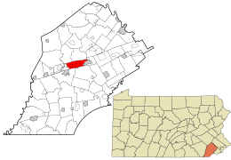 Location in Chester County and the state of Pennsylvania. | |
 Location of Pennsylvania in the United States | |
| Coordinates: 39°59′51″N 75°46′09″W / 39.99750°N 75.76917°WCoordinates: 39°59′51″N 75°46′09″W / 39.99750°N 75.76917°W | |
| Country | United States |
| State | Pennsylvania |
| County | Chester |
| Area | |
| • Total | 8.91 sq mi (23.09 km2) |
| • Land | 8.86 sq mi (22.94 km2) |
| • Water | 0.06 sq mi (0.15 km2) |
| Elevation | 351 ft (107 m) |
| Population (2010) | |
| • Total | 13,817 |
| • Estimate (2016)[2] | 14,097 |
| • Density | 1,591.80/sq mi (614.62/km2) |
| Time zone | UTC-5 (EST) |
| • Summer (DST) | UTC-4 (EDT) |
| Area code(s) | 610 |
| FIPS code | 42-029-10824 |
| Website | www |

Caln Township (/kæln/) is a township in Chester County, Pennsylvania, United States. The population was 13,817 at the 2010 census. The township was founded by settlers from Calne, Wiltshire in England in 1714. The relationship with Calne, Wiltshire, continues today as the two towns are sister cities. Caln is a Township of the First Class. The governing body is a Board of Commissioners. The Board President is President Paul Mullin, Vice President Jane Kennedy, Board Members Joshua Young, Lorraine Tindaro and Mark Evans. The Township Manager is Kristen Denne.
The township owns Ingleside Golf Club and over 200 acres (0.81 km2) of open space and parks. There are 53 employees including 20 police officers. Caln Township contains a commercial center called Thorndale. Within Thorndale there is a SEPTA train station which provides train service to Philadelphia. U.S. Route 30 is a major arterial roadway through Caln Township. There is a public hospital called the Brandywine Hospital and a major Veterans Administration hospital called the Coatesville VA Hospital. Caln Township is a part of the Coatesville School District. The western end of the township along US Business 30 is sometimes referred to as the village of Caln. Historically, there have also been places named Reeceville (northwestern corner), Ingleside (between Caln and Thorndale), Bondsville (north of Thorndale), and Galagherville (between Thorndale and Downingtown) although these names have fallen out of usage except for the roads named after them.
History[]
The Caln Meeting House was listed on the National Register of Historic Places in 1984.[3]
Geography[]
According to the United States Census Bureau, the township has a total area of 8.8 square miles (23 km2), of which 0.11% is water.
Adjacent townships
- Valley Township (northwest)
- West Brandywine Township (northwest)
- East Brandywine Township (north)
- East Caln Township (northeast)
- West Bradford Township (south)
- East Fallowfield Township (southwest)
The city of Coatesville is on the west side of the township. The borough of Downingtown is on the east side of the township; both are politically independent.
Demographics[]
| Historical population | |||
|---|---|---|---|
| Census | Pop. | %± | |
| 1930 | 1,676 | — | |
| 1940 | 3,661 | 118.4% | |
| 1950 | 5,779 | 57.9% | |
| 1960 | 6,685 | 15.7% | |
| 1970 | 6,689 | 0.1% | |
| 1980 | 9,639 | 44.1% | |
| 1990 | 11,997 | 24.5% | |
| 2000 | 11,916 | −0.7% | |
| 2010 | 13,817 | 16.0% | |
| 2020 | 14,432 | 4.5% | |
| [4][5] | |||
At the 2010 census, the township was 72.8% non-Hispanic White, 16.2% Black or African American, 0.1% Native American, 3.9% Asian, 0.1% Native Hawaiian or other Pacific Islander, and 2.2% were two or more races. 5.5% of the population were of Hispanic or Latino ancestry.[6]
At the 2000 census,[7] there were 11,916 people, 4,363 households and 3,067 families residing in the township. The population density was 1,360.6 per square mile (525.3/km2). There were 4,535 housing units at an average density of 517.8 per square mile (199.9/km2). The racial make-up was 78.78% White, 15.76% African American, 0.19% Native American, 2.44% Asian, 0.05% Pacific Islander, 1.19% from other races and 1.59% from two or more races. Hispanic or Latino of any race were 3.24% of the population.
There were 4,363 households, of which 35.7% had children under the age of 18 living with them, 54.4% were married couples living together, 11.4% had a female householder with no husband present, and 29.7% were non-families. 22.9% of all households were made up of individuals, and 6.4% had someone living alone who was 65 years of age or older. The average household size was 2.60 and the average family size was 3.10.
25.5% (of the population were under the age of 18, 6.5% from 18 to 24, 35.0% from 25 to 44, 21.9% from 45 to 64, and 11.0% were 65 years of age or older. The median age was 36 years. For every 100 females there were 102.5 males. For every 100 females age 18 and over, there were 103.3 males.
The median household income was $60,198 and the median family income was $65,520. Males had a median income of $43,169 and females $33,193. The per capita income was $25,494. About 3.6% of families and 5.0% of the population were below the poverty line, including 6.6% of those under age 18 and 8.0% of those age 65 or over.
Education[]
Coatesville Area School District is the area school district. Caln Elementary School and Coatesville Area High School are in the township.[8]
Downingtown Middle School of the Downingtown Area School District (DASD) is physically in Caln Township,[9] as is a part of Downingtown High School West.[10][11][12] DASD does not serve Caln Township.
References[]
- ^ "2016 U.S. Gazetteer Files". United States Census Bureau. Retrieved Aug 13, 2017.
- ^ "Population and Housing Unit Estimates". Retrieved June 9, 2017.
- ^ "National Register Information System". National Register of Historic Places. National Park Service. July 9, 2010.
- ^ "Archived copy". Archived from the original on 2019-04-09. Retrieved 2014-03-21.
{{cite web}}: CS1 maint: archived copy as title (link) - ^ "Census 2020".
- ^ https://www.usatoday.com/news/nation/census/profile/PA
- ^ "U.S. Census website". United States Census Bureau. Retrieved 2008-01-31.
- ^ "CALN TOWNSHIPPRECINCTS & POLLING PLACES" (PDF). Caln Township. Retrieved 2021-06-18.
- ^ "Polling Place Update for November 6, 2018 Election". Caln Township. Retrieved 2021-06-18.
- ^ "Borough Map" (PDF). Downingtown Borough. Retrieved 2021-06-18. - Compare to the school maps.
- ^ "Municipal Zoning Map" (PDF). Caln Township. 2018-08-30. Retrieved 2021-06-18. - Compare with address for Downingtown High West.
- ^ "Home". Downingtown High School West. Retrieved 2021-06-18.
445 Manor Ave., Downingtown, PA 19335
External links[]
| Wikimedia Commons has media related to Caln Township, Chester County, Pennsylvania. |

- Townships in Chester County, Pennsylvania
- 1714 establishments in Pennsylvania