Bandra
Bandra
Vandre | |
|---|---|
Suburb | |
     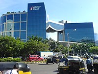 Bandra-Worli Sealink, IL&FS -Bandra Kurla Complex, PWC Office, Mumbai Bandstand Promenade, Jama Masjid Bandra and ICIC Bank | |
 Bandra Location of Bandra in Maharashtra, India | |
| Coordinates: 19°03′16″N 72°50′26″E / 19.054444°N 72.840556°ECoordinates: 19°03′16″N 72°50′26″E / 19.054444°N 72.840556°E | |
| Country | India |
| State | Maharashtra |
| District | Mumbai Suburban |
| City | Mumbai |
| Zone | 3 |
| Ward | H West |
| Government | |
| • Type | Municipal Corporation |
| • Body | Brihanmumbai Municipal Corporation (MCGM) |
| Population (2017) | |
| • Total | 337,391[1] |
| Demonyms | Mumbaikar |
| Languages | |
| • Official | Marathi |
| Time zone | UTC+5:30 (IST) |
| PIN | 400 050 400 051 |
| Vehicle registration | MH-02 |
| Lok Sabha constituency | Mumbai North Central |
| Vidhan Sabha constituency | Vandre West (covers Bandra West) Vandre East (covers Bandra East) |


Bandra (Pronunciation: [bæːɳɖɾa]) also known as Vandre (Pronunciation: [ʋaːn̪d̪ɾe]) is an upscale coastal suburb located in Mumbai, India. The suburb is located to the immediate north of the Mithi River, which separates Bandra from Mumbai City district.[2] It is the third-largest commercial hub in Maharashtra, after Mumbai & Pune, primarily aided by the Bandra Kurla Complex. Originally, Bandra was larger in size when present day Khar was also a part of it. Almost a century ago, it was considered too large a suburb to be served by one railway station. Therefore, the Khar Road railway station was established in 1924, to give the northern part of Bandra closer access to the Western Railway line. This eventually led to Khar being considered a separate suburb.[3] But to this day, the two adjoined suburbs make up one homogenous zone. Several prominent citizens of Mumbai, who are active in Bollywood, Media, Cricket and Politics reside in this area.
History[]
The name "Bandra" possibly originates from the Persian word for port, or "bandar."[4] It is described by Duncan Forbes's A Dictionary, Hindustani and English'(1848) as "a city; an emporium; a port, harbor; a trading town to which numbers of foreign merchants resort".[5] In Marathi, Bandra is known as Vandre, which also means 'port' and is possibly derived from the same Urdu/Persian word.
The area was under the rule of the Silhara dynasty in the 12th century. Bandra was a tiny fishing village inhabited by Kolis (fishermen) and farmers. It was part of Portuguese Bombay and Bassein before it was acquired by the British East India Company.
Portuguese Bandra[]
In 1534, Diego da Silveira, a pirate from the Mediterranean, entered Bandra's creek and burned the fishing town he found there.[citation needed] With that, Bandra came under the rule of the Portuguese crown.[6]
This turmoil was the start of a long period of Christianization of Bandra. Father Manuel Gomes, a Catholic priest, was instrumental in increasing the Church's prominence in Bandra. In 1580, he baptized 2,000 fishermen. By the time he died 11 years later, Father Gomes' "invincible strength of soul", as one historian describes it, had helped convert close to 6,000 people in the area. Father Gomes also established St. Andrew's Church.
Bandra became a Portuguese possession when the Sultanate of Cambay ceded the region in the Treaty of St. Matthew, which was signed aboard the Portuguese brig Sao Mateus in Baçaim harbor in 1534 and aided by Governor-General Nuno da Cunha and . The Portuguese enfeoffed (gave) Bandra, Kurla, Mazgaon and four other villages in 1548 to António Pessoa as a reward for his military services. This was confirmed by the Royal Chancellery on 2 February 1550.
As these villages were given for a period of 'two lives', they reverted to the Crown after the death of , Pessoa's widow. The Jesuits, who had applied for acquisition of these villages in anticipation of Isabel's death, obtained them from the viceroy in 1568 and received royal confirmation in 1570.[7]
In 1661, when King Charles married Catherine of Portugal, the island of Bombay was given to England as part of the dowry.[8] However, Salsette Island, on which Bandra lay, was not part of this treaty and remained with the Portuguese.[9]
The Portuguese built additional churches in Bandra, one of the earliest being St. Andrew's Church in 1575. Their Jesuit missionaries, who learned local languages and cultures, attracted many Indian converts to Catholicism among the villagers on the island. Their descendants continued to support the six Catholic parish churches—Mount Carmel, St. Peter's, St. Andrew's, St. Theresa's, St. Anne's and St. Francis d'Assisi—that lie within an area of four square kilometres.[10]
British Bandra[]
Bandra became part of English territory with the signing of the Treaty of Surat in 1775, but was retroceded to the Marathas in 1779 during the First Anglo-Maratha War. In 1802, Bajirao II signed the Treaty of Bassein with the English, surrendering sovereignty and again ceding Bandra, and it remained under British control until 14 August 1947.
Arrival of Railways and development: On 12 April 1867, the first railway service was inaugurated, with one train per day between Virar and Bombay, as part of the then private rail company, BB&CI which was the earlier form of Western Railway. A grand railway station building for Bandra was inaugurated in 1869. The innovative aspects used in the design of this structure are visible to this day. On closer scrutiny, it is evident how railway tracks bunched together make up each of the iron pillars, that hold up the roof over the platforms. In 1873, with growing demands, the frequency of trains available was increased to 24 each day. In the early 1900s, the affluent Pathare Prabhu community lived in South Mumbai, and used their quaint bungalows in the Khar part of Bandra as weekend dwellings. Khar Danda was one of the original villages of the erstwhile larger Bandra. Back then, the local Bandra railway station was felt considerably far to alight from trains and hire 'tangas' (horse carriages) to get to their bungalows by these Bandra residents. Keeping these factors and Bandra's growing population in mind, a new railway station named 'Khar Road' was introduced adjoining Bandra Railway station on 1 July 1924. This development is the primary reason that the Khar part of Bandra started being referred to as a suburb by itself.[11] As late as the 1930s, Bandra had only one bus service from Pali Naka, Hill Road to the Railway station. Other people just walked to the nearest railway station. After World War II, the building boom began with an aim to accommodate immigrants. As of 2018, 940 trains stop daily at Bandra railway station.
Bandra was raised to the status of a municipality in 1876 and was then expanded. In 1950, following independence, it was merged into the Bombay Municipal Corporation to form the . Bandra consisted of many villages, among them Sherly, Malla, Rajan, Kantwady, Waroda, Ranwar, Boran, Khar Danda, Pali, and Chuim. These have almost been lost to urban development of the island.
Mount Mary's Church[]

The Bandra Fair is held during the eight days of the Octave of the Nativity of Our Lady, beginning 8 September, when people throng the church.[12][13]
Educational institutions[]
The first school founded in Bandra after Bombay passed on to the English was St Andrew's Parish School, started by Fr. Francisco de Melo in 1780 to teach catechism to the children of the parish. This later became St. Andrew's High School.[14] The school is located in Bandra West.
St. Theresa's High School grew out of St. Andrew's Indian Christians' School, housed in a very dilapidated building situated in Old Khar. This school was founded in 1918. It was taken over by the Society of Divine Word (S.V.D). in 1952. It is counted among the best schools in Mumbai.[15]
St. Stanislaus High School was founded in 1863 by the Society of Jesus. It started as a Native Boy's orphanage. It became a high school in 1923 and was the first English medium school in the suburbs. Later, it grew to be a full-fledged educational institution for day-scholars as well as boarders. What started out as a school for 40 orphans has grown to support 2,300 students. St. Stanislaus High School is located on Hill Road, in Bandra West. Cardinal Gracias High School is a convent school located in Bandra East. St. Joseph's Convent High School for girls is run by the nuns of the congregation of the Daughters of the Cross in Bandra West. It was built in 1865 (Bandra was then known as Bandora)[16] and boasts a beautiful chapel. The school has produced illustrious alumni over the years.[17] R.D. National College was originally set up in 1922 in Hyderabad, Pakistan under the guidance of Annie Besant. In the run-up to the Partition of India, it was relocated to its present site in 1949 in Bandra. The Thadomal Shahani Engineering College was established in 1983 by the Hyderabad (Sind) National Collegiate Board. It was the first private engineering institute to be affiliated with the federal University of Mumbai to offer courses in Computer Engineering, Information Technology, Biomedical Engineering and Biotechnology.
The Rizvi Education Complex, located off Carter Road, comprises the Rizvi College of Arts, Science and Commerce (established in 1985); Rizvi High School (established in 1985); Rizvi College of Engineering (established in 1998); Rizvi College of Architecture; Rizvi College of Hotel Management & Catering Technology; ; Rizvi College of Education and the Rizvi College of Fashion Designing & Creative Arts[18] All are managed by the Rizvi Education Society, and may have the status of Muslim religious minority institution.
St. Andrew's College Of Arts, Science and Commerce is another famous college located in the heart of Bandra, just a few hundred metres away from St. Stanislaus High School. It offers various courses including Bachelor of Arts, Bachelor of Commerce and other certified courses related to retail and travel-tourism to name a few. St. Andrews boasts of one of the best auditoriums in the city.[19]
Bandra lake[]
Bandra Lake, also called Bandra Talao or Motha Reservoir was constructed by a rich Konkani Muslim of Navapada (also spelt Naupada or Naopara), an adjoining village.[20]
The lake was later acquired by the Municipal Corporation of Greater Mumbai. It was officially renamed Swami Vivekanand Sarovar. Paddle boating facilities and pisciculture (fish farming) activities were operational in this lake during the 1990s but have since stopped. This lake is now a heritage structure of "Heritage II" status.[20][21][22] The Portuguese also pronounced Bandra As Bandora.
Development of Bandra as a Commercial Hub[]
As traffic in the Mumbai Metropolitan Region worsened, especially in South Mumbai, there was increased demand to construct a business district outside of Mumbai, in the suburbs. In the mid-2000s, the city of Bandra started an audacious task to reclaim lands on the Mithi River in the eastern portion of the city, near the Kurla border. The newly formed Bandra-Kurla Complex (BKC) has attracted several equity and technology firms, such as Blackstone, Google, and Amazon, who chose Bandra instead of Mumbai City for its location, lower-cost of land, and new development.
As the last suburb before entering Mumbai City, Bandra has for a while been strained with traffic, particularly around the railway station and S.V. Road. The development of a business centre has only exacerbated the traffic problems, as unlike other commercial hubs, Bandra's BKC is located between Bandra and Kurla stations and requires approximately 10-15 minute vehicular commute from either of the stations. Nearly 300,000 office-goers alight daily at Bandra Railway Station and take a taxi or bus to BKC. This has made Bandra among the busiest stations in India, surpassing Andheri and Bombay Central, and the second-busiest station in Maharashtra's Western Railway after Churchgate railway station.
Urban art[]
Bandra has a large collection of street art or graffiti. The paintings on walls are principally located in the vicinity of Chapel Road and Veronica Street, but prominent works are also visible near Bandstand and Mount Mary Church.[23][24] They consist of various types of graffiti, including pieces, stencils, tags, etc. Globally renowned artists such as Gomez have created works on these walls. St+art Mumbai, Bollywood Art Project[25] and Dharavi Art Room are some of the organizations that conduct various programs to encourage the artists. The programs have support from the Brihanmumbai Municipal Corporation (BMC).[26] Bandra is also home to the 37X46 metre (120X150 foot) portrait of Dadasaheb Phalke on the MTNL building at Bandra Reclamation. It was created by Ranjit Dahiya (from the Bollywood Art Project) and other artists including Yantr, Munir Bukhari and Nilesh Kharade as part of the St+art Mumbai festival in 2014. The mural was unveiled officially by Amitabh Bachchan and Piyush Pandey.[27] It is reportedly Asia's largest mural.[28]

Geography[]

Bandra is split by the local railway-line into West Bandra (Postal Code 400050) and East Bandra (Postal Code 400051). The part of Bandra located on the western side of the railway line developed into a fashionable suburb by the middle of the 20th century. Film director Mehboob Khan established the Mehboob Studios here in 1954. Soon the area became a center for the Indian movie industry, Bollywood. A recording studio was set up in the 1970s.[29][30]
In the mid-to-late 1990s, the eastern part emerged as a commercial and administrative hub. It houses the Family Court, Bandra-Kurla Commercial Complex, the office of the state housing development authority (MHADA) and the office of the District Collector. The residential quarters of the employees of the Maharashtra State Government are also located here.
Most roads and places in Bandra were given English names during British rule. They have been renamed over time but many are still popularly known by their old names.
- Neighbouring suburbs: Dharavi, Khar, Kurla, Mahim, Santacruz
- Arterial Roads: Swami Vivekanand Road (S.V Road), Linking Road, Turner Road (Guru Nanak Marg), Hill Road (renamed Ramdas Nayak Marg), Carter Road (renamed Naushad Ali Marg), Navpada Road (Balsamant), Western Express Highway. The Bandra-Worli Sea Link connects the western part of Bandra to Worli by the sea route, thus diverting a lot of road traffic.


Transport[]

Bandra railway station is connected with the Western Railway and the Harbour Line, which is an offshoot of the suburban Central Railway. It also has a newly built terminus called Bandra Terminus in Bandra (E) from where trains bound for northern and western India are scheduled regularly. The important trains include the Bandra-New Delhi Rajdhani Express, Bandra-Indore Express, Bandra-Patna Express, Bandra-Jaipur Express, Bandra-Jodhpur Express and the Bandra-Amritsar Express
Public transport also includes BEST buses, auto rickshaws and taxis, which are abundant. Bandra is the last southern point from Mumbai where auto rickshaws ply. Beyond Bandra, entering Mahim, only taxis are allowed to ply.
The Bandra-Worli Sea Link bridge connects Bandra West with Worli, located in central Mumbai. Due to Bandra's central location, most parts of the city are easily accessible.
Places of interest[]


- Jogger's Park: Jogger's Park is a small seaside jogging track. The park, next to the Otter's Club, was where Mumbai's first laughing club was launched.
- Khar Danda : One of the oldest village in Bandra.
- Bandra Reclamation
- Mount Mary's Basilica
- Bandstand Promenade
- Hill Road: A popular street shopping area with various restaurants, branded retails
- Linking Road: A popular place for shopping
- Pali Hill: An affluent residential locality with several restaurants and eateries
- Bandra-Kurla complex
- Carter Road Promenade
- Bandra Fort: Also known as Castella de Aguada, which is Portuguese for Fort of the Waterpoint
- Colonial-era bungalows, Bandra's unique architectural heritage is being threatened by ongoing development.[31]
Notable residents[]
- Dilip Kumar
- Former Member of Parliament Priya Dutt
- Sunil Dutt
- Rahul Roy
- Shah Rukh Khan
- Katrina Kaif
- Salman Khan
- Salim Khan
- Sushant Singh Rajput
- Heart surgeon Sharad Panday
- BJP Mumbai President Ashish Shelar
- Sachin Tendulkar
- Aamir Khan
- Madhubala
- Ashutosh Gowariker
- Aditya Roy Kapur
- Sidharth Malhotra
- Tara Sutaria
- Shiv Sena chief Uddhav Thackeray
- Shiv Sena MLA late Bala Sawant
- Mohammed Rafi, Bollywood playback singer
- Farhan Akhtar
- Rekha
- Kangana Ranaut
- Baba Siddique INC Leader
- Saif Ali Khan
- Tiger Shroff
- Flt Lt Lawrence Frederic Pereira, VrC
- Lieutenant-General Francis Tiburtius Dias, PVSM, AVSM, VrC
- Varun Dhawan
- Jacqueline Fernandez
- Mithila Palkar
See also[]
References[]
| Wikimedia Commons has media related to Bandra. |
- ^ "Mumbai Wards & Districts: Population & Density by Sector 2001". www.demographia.com.
- ^ Bandra Is Changing But It Isn't Being Gentrified, 21 April 2014, archived from the original on 18 October 2014, retrieved 10 October 2015
- ^ "Mumbai's Khar Station Turns 90". ndtv.com. Retrieved 1 July 2014.
- ^ "A Tour Through Mumbai's Historical Neighbourhoods".
- ^ Duncan Forbes (1848). A Dictionary, Hindustani and English: To which is Added a Reversed Part, English and Hindustani. W.H. Allen. Retrieved 12 April 2012.
- ^ "The East Indians of Bandra". www.east-indians.net. Retrieved 10 March 2021.
- ^ Have Bandra's xenophobes forgotten their own history?, First Post, 9 March 2012
- ^ Catherine of Bragança (1638–1705), BBC
- ^ Greater Bombay District Gazetteer 1960, p. 174
- ^ Mumbai: Once a part of Bandra's Catholic heritage, a chapel at Pali Hill will soon be history, DNA India, 21 April 2013
- ^ "July 02, 2014". IndiaTV.
- ^ Mount Mary fair begins today[permanent dead link] Indian Express, 8 September 2007.
- ^ "Devotees throng to Bandra Fair on opening day as stall owners protest", DNA (newspaper), 13 September 2010.
- ^ "History". St Andrew High School, Bandra. Archived from the original on 31 March 2012. Retrieved 19 April 2012.
- ^ "Archived copy". Archived from the original on 12 April 2012. Retrieved 21 June 2012.CS1 maint: archived copy as title (link)
- ^ "Here's everything you need to know about the journey from Bandora to Bandra | Latest News & Updates at Daily News & Analysis". dna. 16 December 2015. Retrieved 26 May 2018.
- ^ "Illustrious Alumnae – St. Joseph's Convent School". sjcschoolbandra.org. Archived from the original on 25 January 2017. Retrieved 27 September 2016.
- ^ "Rizvi Education Society". www.rizvi.edu.in.
- ^ "St. Andrew's College".
- ^ Jump up to: a b "Gazetteer of Thane District – Places of Interest, 1882". Cite journal requires
|journal=(help) - ^ "BMC plans walkway around Bandra Talao". MiD DAY. 31 January 2011. Retrieved 10 January 2012.
- ^ "Makeover for Bandra Talao finally kicks off". Daily News and Analysis. 30 June 2010. Retrieved 10 January 2012.
- ^ "Ranwar Village". Minor Sights. Retrieved 22 March 2016.
- ^ "Bollywood Art Project". Minor Sights. Retrieved 22 March 2016.
- ^ "Bollywood Art Project – BAP". www.facebook.com.
- ^ "Mumbai Street Life – Graffiti @ Chapel Road Bandra". wordpress.com. 19 July 2015.
- ^ "Phalke Mural to be Unveiled Today". The Indian Express. Retrieved 26 May 2018.
- ^ "Larger than life". India Today. Retrieved 26 May 2018.
- ^ "Mehboob mere, Mehboob tere". Pune Mirror. 1 November 2008. Archived from the original on 18 July 2011. Retrieved 21 February 2011.
- ^ "Mumbai, meri mehboob?". DNA. 7 February 2011.
- ^ "India: Bungalows of Bandra – Bombay's Vanishing Heritage". www.minorsights.com.
- Bandra
- 1534 establishments in the Portuguese Empire
- Suburbs of Mumbai
- Neighbourhoods in Mumbai