Bannu District
This article possibly contains original research. (February 2017) |
District Bannu
ضلع بنوں | |
|---|---|
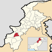 Bannu District's location in Khyber Pakhtunkhwa | |
| Country | |
| Province | |
| Headquarters | Bannu |
| Government | |
| • Deputy Commissioner | N/A |
| Area | |
| • District | 1,227 km2 (474 sq mi) |
| Population | |
| • District | 1,167,892 |
| • Density | 950/km2 (2,500/sq mi) |
| • Urban | 49,965 |
| • Rural | 1,117,927 |
| Time zone | UTC+5 (PST) |
| Number of tehsils | 4 |
Bannu District (Pashto: بنو ولسوالۍ, Urdu: ضِلع بنوں) is a district in Bannu Division of Khyber Pakhtunkhwa province in Pakistan. It was recorded as a district in 1861 during the British Raj.[2]:3 It is one of 26 districts that make up the Khyber Pakhtunkhwa province of Pakistan. It borders North Waziristan to the northwest, Karak to the northeast, Lakki Marwat to the southeast, and South Waziristan to the southwest. It is represented in the provincial assembly by four MPAs.[3]
.[2]:3–16
The major industries of Bannu are cloth weaving, sugar mills and the manufacturing of cotton fabrics, machinery and equipment. It is known for its weekly Jumma fair. The district forms a basin drained by the Kurram and Gambila (or Tochi) rivers, which originate in the hills of Waziristan. Although Bannu is surrounded by rugged and dry mountains, it is a fertile place, and early English visitors had been known to refer to it as a "paradise" – see the description by Edwardes quoted by Thornton.[2]:6–7
Physical features[]
The district forms a basin drained by the Kurram River and Gambila River (or Tochi river)[4]:392 which originate in the hills of Waziristan. The Bannu Valley proper stretches to the foot of the frontier hills, forming an irregular oval, measuring 60 miles (97 km) from north to south and 40 miles (64 km) from east to west.[5]
History[]
The history of Bannu goes back to prehistoric times, due to its strategic location. Sheri Khan Tarakai is an ancient settlement site located in the Bannu District with ruins of the oldest known village settlement in the Bannu region, which was occupied from the late fifth until the early third millennium BC.[6]
The sacred texts of Zend Avesta and Vendidad mentions Varəna, the Avestan predecessor of the name for Bannu, as one of the sixteen most beautiful and perfect lands created by Ahura Mazda.[7] Bannu is the homeland and birthplace of FerΘraētaona/Frēdōn/Afrīḏūn;[8]:47–50
British era (1861–1947)[]
After the British annexation of Punjab, then including parts of the North-West Frontier Province (NWFP), the valley was administered by Herbert Edwardes.[5] As a result of his administration, the region became a source of strong support[clarification needed], during the Indian Rebellion of 1857. Although the valley itself was peaceful, it was subject to incursions from the Waziri tribes of the Tochi Valley and the neighbouring hills. The primary export of the region was wheat, Salt and alum were also quarried at Kalabagh.[5]
As of 1911, the Indus had no bridges within the district, but was navigable for local boats throughout its course of 76 mi (122 km).[5]
Administrative subdivisions[]
Bannu District is divided into 5 tehsils and 49 union councils.[9][10]
Provincial and National Assembly Seats[]
The district has 4 Provincial Seats in the Khyber-Pakhtunkhwa Assembly[11] while it has 1 seat in National Assembly.[12]
National Assembly[]
- NA-35 (Bannu)
| Election | Member | Party | |
|---|---|---|---|
| 2002 | Maulana Syed Nasib Ali Shah | MMA | |
| 2008 | Maulana Fazal ur Rehman | MMA | |
| 2013 | Akram Khan Durrani | JUI (F) | |
| 2018 | Imran Ahmad Khan Niazi | PTI | |
| 2018 | Zahid Akram Durrani | JUI (F) | |
Provincial Assembly[]
| Member of Provincial Assembly | Party Affiliation | Constituency | Year |
|---|---|---|---|
| Sher Azam Khan | Pakistan Peoples Party Parliamentarians | PK-87 Bannu-I | 2018 |
| Pakhtoon Yar Khan | Pakistan Tehreek-e-Insaf | PK-88 Bannu-II | 2018 |
| Shah Muhammad Khan | Pakistan Tehreek-e-Insaf | PK-89 Bannu-III | 2018 |
| Akram Khan Durrani | Muttahida Majlis-e-Amal | PK-90 Bannu-IV | 2018 |
Demographics[]
The district has a population of 675,667, according to 1998 consensus, spread over an area of 1,227 square kilometres (474 sq mi). According to 2017 consensus, the population of Bannu district is 1,167,892.[9]
The major first language is Pashto (Banuchi Dialect), accounting for 99.3% of the population.[13]:23
The main tribes are the Bannuchi, Wazir, Yusufzai , Bettani, Mehsud, Dawar, Marwat, Khattak, Bangash, Arain and Sulaimankhel who speak the local Pashto dialects Bannuchi and Waziri.
See also[]
References[]
- ^ "DISTRICT WISE CENSUS RESULTS CENSUS 2017" (PDF). www.pbscensus.gov.pk. Archived from the original (PDF) on 2017-08-29. Retrieved 2017-09-01.
- ^ Jump up to: a b c S.S. Thorbourne (1883). Bannu; or our Afghan Frontier. London: Trűbner & Co. ISBN 1314135279.
- ^ Constituencies and MPAs – Website of the Provincial Assembly of the NWFP
- ^ "Imperial Bannu District". Gazetteer of India. 6. Clarendon Press. 1908.
- ^ Jump up to: a b c d One or more of the preceding sentences incorporates text from a publication now in the public domain: Chisholm, Hugh, ed. (1911). "Bannu". Encyclopædia Britannica. 3 (11th ed.). Cambridge University Press. p. 355.
- ^ Petrie, C.A., Thomas, K.D. & Morris, J.C. 2010. Chronology of Sheri Khan Tarakai, in Petrie, C.A. (ed.). Sheri Khan Tarakai and early village life in the borderlands of north-west Pakistan, Bannu Archaeological Project Monographs – Volume 1, Oxbow Books, Oxford: 343–352.
- ^ Michael Witzel, "The Home of the Aryans" people.fas.harvard.edu.
- ^ Gherardo Gnoli. Zoroaster’s Time and Homeland: a study on the origins of Mazdeism.Published by Istituto Universitario Orientale (1980), ASIN: B0018NEFO0.
- ^ Jump up to: a b "Pakistan Tehsil Wise Census 2017 [PDF] (official)" (PDF). www.pbscensus.gov.pk. Archived from the original (PDF) on 2017-11-07. Retrieved 2017-11-11.
- ^ Provincial Disaster Management Authority, Government of Khyber Pakhtunkhwa (1 July 2009). "Pakistan: North West Frontier Province District, Tehsil and Union Code Reference Map" (PDF). United Nations Pakistan unportal.un.org.pk. Archived from the original (PDF) on 10 August 2013.
- ^ "By Seat | KP Assembly". www.pakp.gov.pk. Retrieved 2017-11-13.
- ^ "The Election Commission :: Untitled Page". 2012-11-15. Archived from the original on 2012-11-15. Retrieved 2017-11-13.CS1 maint: bot: original URL status unknown (link)
- ^ 1998 District Census report of Bannu. Census publication. 35. Islamabad: Population Census Organization, Statistics Division, Government of Pakistan. 1999.
Coordinates: 33°03′38″N 70°33′08″E / 33.06048°N 70.552176°E
External links[]
- "History and Settlement of Bannu, Excerpts from Gazetteer of the Bannu District, 1887", Khyber.org
- Website about Bannu
| hide Districts of Khyber Pakhtunkhwa | ||
|---|---|---|
Provincial capital: Peshawar | ||
| Bannu |  | |
| Dera Ismail Khan | ||
| Hazara | ||
| Kohat | ||
| Malakand | ||
| Mardan | ||
| Peshawar | ||
| show Administrative divisions of Bannu District |
|---|
| show Authority control |
|---|
- Bannu District
- Districts of Khyber Pakhtunkhwa
- 1861 establishments in British India