Barenton-sur-Serre
Barenton-sur-Serre | |
|---|---|
Commune | |
 The Town Hall | |
show Location of Barenton-sur-Serre | |
 Barenton-sur-Serre | |
| Coordinates: 49°40′20″N 3°40′52″E / 49.6722°N 3.6811°ECoordinates: 49°40′20″N 3°40′52″E / 49.6722°N 3.6811°E | |
| Country | France |
| Region | Hauts-de-France |
| Department | Aisne |
| Arrondissement | Laon |
| Canton | Marle |
| Intercommunality | |
| Government | |
| • Mayor (2020–2026) | Christian Lecuyer[1] |
| Area 1 | 8.05 km2 (3.11 sq mi) |
| Population (Jan. 2018)[2] | 133 |
| • Density | 17/km2 (43/sq mi) |
| Time zone | UTC+01:00 (CET) |
| • Summer (DST) | UTC+02:00 (CEST) |
| INSEE/Postal code | 02048 /02270 |
| Elevation | 61–122 m (200–400 ft) |
| 1 French Land Register data, which excludes lakes, ponds, glaciers > 1 km2 (0.386 sq mi or 247 acres) and river estuaries. | |


Barenton-sur-Serre (French pronunciation: [baʁɑ̃tɔ̃ syʁ sɛʁ], literally Barenton on Serre) is a commune in the department of Aisne in the Hauts-de-France region of northern France.
Geography[]
Barenton-sur-Serre is located some 35 km south-east of Saint-Quentin and 15 km north-east of Laon. National Route N2 passes through the commune from Froidmont-Cohartille in the north-east running south-west through the commune. Access to the village is by road D3060 running west from the N2 to the village then continuing north-west to road D12. There is also access to the village on a country road from Froidmont-Cohartille. There is quite a large area of forest north of the village and in a belt extending south-east of the village. The rest of the commune is all farmland.[3]
The Ru de Barentons flows from the south of the commune into the Souche river which flows from east to west through the commune then continues north-west to join the Serre river.[3]
Neighbouring communes and villages[]
| show Places adjacent to Barenton-sur-Serre |
|---|
Administration[]
This list is incomplete; you can help by . (April 2021) |
List of Successive Mayors of Barenton-sur-Serre[4]
| From | To | Name | Party |
|---|---|---|---|
| 1995 | 2008 | Gérard Cuvillier | DVD |
| 2008 | 2014 | Sébastien Lhermine | |
| 2014 | 2020 | Bruno Séverin | |
| 2020 | Present | Christian Lecuyer |
Population[]
| Year | Pop. | ±% |
|---|---|---|
| 2006 | 111 | — |
| 2007 | 111 | +0.0% |
| 2008 | 110 | −0.9% |
| 2009 | 113 | +2.7% |
| 2010 | 115 | +1.8% |
| 2011 | 118 | +2.6% |
| 2012 | 118 | +0.0% |
| 2013 | 117 | −0.8% |
| 2014 | 121 | +3.4% |
| 2015 | 126 | +4.1% |
| 2016 | 130 | +3.2% |
Gallery[]

The Church
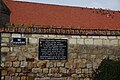
Jedburgh Augustus Memorial

The Souche river from the bridge

The War Memorial


See also[]
References[]
- ^ "Répertoire national des élus: les maires". data.gouv.fr, Plateforme ouverte des données publiques françaises (in French). 2 December 2020.
- ^ "Populations légales 2018". INSEE. 28 December 2020.
- ^ Jump up to: a b c Google Maps
- ^ List of Mayors of France (in French)
External links[]
- Barenton-sur-Serre on the old National Geographic Institute website (in French)
- 40000 Bell Towers website (in French)
- Barenton-sur-Serre on Lion1906
- Barenton-sur-Serre on Géoportail, National Geographic Institute (IGN) website (in French)
- Baranton sur Serre on the 1750 Cassini Map
| Wikimedia Commons has media related to Barenton-sur-Serre. |
| Authority control |
|
|---|
- Communes of Aisne