Bauan
Bauan | |
|---|---|
| Municipality of Bauan | |
 | |
 Seal | |
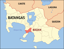 Map of Batangas with Bauan highlighted | |
show OpenStreetMap | |
 Bauan Location within the Philippines | |
| Coordinates: 13°47′30″N 121°00′31″E / 13.7917°N 121.0085°ECoordinates: 13°47′30″N 121°00′31″E / 13.7917°N 121.0085°E | |
| Country | Philippines |
| Region | Calabarzon |
| Province | Batangas |
| District | 2nd district |
| Founded | May 3, 1596 [1] |
| Barangays | 40 (see Barangays) |
| Government | |
| • Type | Sangguniang Bayan |
| • Mayor | Ryanh M. Dolor |
| • Vice Mayor | Julian C. Casapao |
| • Representative | Raneo E. Abu |
| • Municipal Council | show
Members |
| • Electorate | 56,158 voters (2019) |
| Area | |
| • Total | 53.31 km2 (20.58 sq mi) |
| Elevation | 58 m (190 ft) |
| Highest elevation | 274 m (899 ft) |
| Lowest elevation | 0 m (0 ft) |
| Population (2020 census) [4] | |
| • Total | 90,819 |
| • Density | 1,700/km2 (4,400/sq mi) |
| • Households | 20,241 |
| Economy | |
| • Income class | 1st municipal income class |
| • Poverty incidence | 3.26% (2015)[5] |
| • Revenue | ₱293,474,012.98 (2016) |
| Service provider | |
| • Electricity | First Bay Power Corporation (FBP) |
| Time zone | UTC+8 (PST) |
| ZIP code | 4201 |
| PSGC | |
| IDD : area code | +63 (0)43 |
| Climate type | tropical monsoon climate |
| Native languages | Tagalog |
| Website | www |


Bauan, officially the Municipality of Bauan (Tagalog: Bayan ng Bauan), is a 1st class municipality in the province of Batangas, Philippines. According to the 2020 census, it has a population of 90,819 people. [4]
History[]
Religious attribution and miracles[]

The Augustinian church of Bauan was founded as a visita (small chapel without a resident priest) in 1590 on the slopes of Mount Macolod, along Taal Lake's southern shore. The resident priest of Taal, Father Diego de Avila would visit periodically and attend to the spiritual needs of the settlement.[6]
six years after the establishment of the ecclesiastical mission of Bauan, a giant cross made of anubing was found in a Diñgin (a place of worship) near the town of Alitagtag. In 1790, Castro y Amoedo found a Tagalog document in the Bauan Cathedral Archives, signed by 25 Indio elders, stating the cross was made around 1595, as protection from ghosts surrounding the Tolo fountain. Subsequent miracles were associated with this cross. On 3 May, the 2.5 m tall cross was brought to the Chapel of Alitagtag. A golden sun, with a human face, and radiating rays was added, while the devout would cut away pieces of the cross to make talisman replicas. The elders also thought the cross protected the town from pestilence, locusts, drought, volcanic eruptions, and Moro pirates.[6]
Today, the traditional folk dance of Bauan, subli, is a religious homage to the Cross of Alitagtag. The dance is performed at a sambahan (place of worship), two of which are natural grottos along the shore of Taal Lake, and one of which is called Diñgin.[6]
Bauan became an independent parish on 12 May 1596, but was re-annexed to Taal, its matriz (mother town), because of too few tributos (taxpayers). Due to Taal Volcano eruptions, the town moved to Durungao (lookout point), led by Father Jose Rodriguez, in 1662. The town moved again in 1671 to Loual, along Taal's Seno de Bauan. An earthquake struck the town in 1677. In 1689, Father Nicolas de Rivera helped the town build its third church. In 1690, Father Rivera, with the help of the Taal parish priest Father Simon Martinez, moved the town to the seaside, its present location. However, a typhoon destroyed the church in 1692.[6]
A fourth stone church was built from 1695 to 1710. The current church was built in 1762 by Father Jose Victoria and Don Juan Bandino. A fort was built in 1775 to protect the town from Moro raids.[6]
Fr. Jose Vitoria introduced the cultivation of indigo in Bauan while building the present church. This was continued until 1856 during the administrations of Fr. Jose Trevino and Fr. Hipolito Huerta. It was completed under the supervision of Fr. Felipe Bravo in 1881. From there until 1894, final decorations were supervised by Fr. Moises Santos and Fr. Felipe Garcia. The church is said to be the most artistically built in the province of Batangas during that time. Father Bravo was also an imminent botanist who put up a museum of natural history and collected rare books that were lost when the church was razed by fire during the Philippine revolution against Spain in 1898. The church was probably rebuilt and again destroyed by fire in 1938. It has been restored since then.
In March 2019, the Black Nazarene visited the church to help funds for rebuilding after the church was damaged in the 2017 Batangas earthquakes.
The town of Bauan used to encompass a much more extensive area. However, throughout history, chunks of Bauan have been converted into municipalities; San Jose in 1765, San Luis in 1861, Alitagtag in 1901, Mabini in 1918, and San Pascual in 1969.
Geography[]
Bauan is one of the lowland towns of central Batangas that hosts some mountains and hills, with the tallest; Mount Durungao. It also has beach resorts with Sampaguita Beach in barangay Sampaguita in the western part of the town considered one of the more notable ones.[7][better source needed][8][better source needed]
The town is bounded by the municipality of San Luis to the north, the municipality of San Pascual to the east, and the municipality of Mabini to the south/southwest. It is also bordered by Balayan Bay to the west and Batangas Bay to the southeast. Vehicles can access the municipality coming from those towns by way of large thoroughfares such as the Palico-Balayan-Batangas Road, the Bauan-Mabini Road and Makalintal Avenue.
According to the Philippine Statistics Authority, the municipality has a land area of 53.31 square kilometres (20.58 sq mi) [9] constituting 1.71% of the 3,119.75-square-kilometre- (1,204.54 sq mi) total area of Batangas.
Barangays[]
Bauan is politically subdivided into 40 barangays.[10]
Barangay San Teodoro was created in 1953 from the sitio of Pook ng Buhangin from Barrio Ilat and the sitio of Cupang from Barrio Gelerang Kawayan.[11] In 1954, the sitio of Jipit in the barrio of San Antonio was converted into the barrio of Santo Niño,[12] while the sitio of Pook ni Banal in the Barrio of Malaking Pook was converted into the barrio of Pook ni Banal.[13] The next year, sitio Pinagcurusan in barrio Maricaban and sitio Pinagcurusan in barrio Tingloy were constituted into barrio San Jose,[14] while sitio Pirasan in barrio Payapa was constituted into the barrio of San Juan.[15] In 1956 portions of San Andres and Bolo were separated to form the barrio of San Miguel.[16] The next year, sitio Puting Buhangin of barrio Magalanggalang was converted into barrio Orense.[17]
| PSGC | Barangay | Population | ±% p.a. | |||
|---|---|---|---|---|---|---|
| 2020 [4] | 2010 [18] | |||||
| 041006001 | Alagao | 2.7% | 2,496 | 1,836 | 3.01% | |
| 041006002 | Aplaya | 8.9% | 8,038 | 7,604 | 0.54% | |
| 041006003 | As‑Is | 2.6% | 2,344 | 2,239 | 0.44% | |
| 041006004 | Bagong Silang | 0.5% | 457 | 410 | 1.05% | |
| 041006005 | Baguilawa | 1.7% | 1,535 | 1,412 | 0.81% | |
| 041006006 | Balayong | 3.0% | 2,746 | 2,496 | 0.93% | |
| 041006007 | Barangay I (Poblacion) | 1.8% | 1,619 | 1,492 | 0.79% | |
| 041006008 | Barangay II (Poblacion) | 3.5% | 3,148 | 3,062 | 0.27% | |
| 041006009 | Barangay III (Poblacion) | 0.6% | 583 | 556 | 0.46% | |
| 041006010 | Barangay IV (Poblacion) | 3.3% | 2,977 | 2,432 | 1.97% | |
| 041006011 | Bolo | 5.8% | 5,311 | 4,212 | 2.26% | |
| 041006012 | Colvo | 0.6% | 545 | 495 | 0.93% | |
| 041006013 | Cupang | 2.1% | 1,897 | 1,808 | 0.46% | |
| 041006014 | Durungao | 2.0% | 1,776 | 1,487 | 1.73% | |
| 041006015 | Gulibay | 1.5% | 1,352 | 1,419 | −0.47% | |
| 041006016 | Inicbulan | 4.0% | 3,674 | 3,007 | 1.95% | |
| 041006018 | Locloc | 1.7% | 1,517 | 1,605 | −0.54% | |
| 041006019 | Magalang‑Galang | 0.4% | 340 | 345 | −0.14% | |
| 041006020 | Malindig | 0.4% | 358 | 391 | −0.85% | |
| 041006021 | Manalupang | 1.5% | 1,352 | 1,065 | 2.33% | |
| 041006022 | Manghinao Proper | 11.9% | 10,789 | 7,974 | 2.96% | |
| 041006023 | Manghinao Uno | 2.8% | 2,556 | 2,378 | 0.70% | |
| 041006024 | New Danglayan | 2.1% | 1,878 | 1,757 | 0.64% | |
| 041006025 | Orense | 0.8% | 742 | 712 | 0.40% | |
| 041006026 | Pitugo | 0.9% | 801 | 643 | 2.14% | |
| 041006028 | Rizal | 0.8% | 745 | 699 | 0.62% | |
| 041006029 | Sampaguita | 0.6% | 522 | 536 | −0.26% | |
| 041006030 | San Agustin | 1.2% | 1,046 | 931 | 1.13% | |
| 041006031 | San Andres Proper | 2.9% | 2,674 | 2,623 | 0.19% | |
| 041006032 | San Andres Uno | 0.7% | 654 | 584 | 1.10% | |
| 041006033 | San Diego | 0.6% | 521 | 518 | 0.06% | |
| 041006034 | San Miguel | 2.0% | 1,818 | 1,829 | −0.06% | |
| 041006035 | San Pablo | 0.9% | 838 | 814 | 0.28% | |
| 041006036 | San Pedro | 2.6% | 2,327 | 2,080 | 1.09% | |
| 041006037 | San Roque | 7.3% | 6,634 | 6,110 | 0.80% | |
| 041006038 | San Teodoro | 2.0% | 1,788 | 1,627 | 0.91% | |
| 041006039 | San Vicente | 0.9% | 778 | 613 | 2.33% | |
| 041006041 | Santa Maria | 5.6% | 5,129 | 4,763 | 0.72% | |
| 041006042 | Santo Domingo | 2.7% | 2,407 | 2,285 | 0.50% | |
| 041006044 | Sinala | 2.8% | 2,585 | 2,502 | 0.32% | |
| Total | 90,819 | 81,351 | 1.07% | |||
Climate[]
| hideClimate data for Bauan, Batangas | |||||||||||||
|---|---|---|---|---|---|---|---|---|---|---|---|---|---|
| Month | Jan | Feb | Mar | Apr | May | Jun | Jul | Aug | Sep | Oct | Nov | Dec | Year |
| Average high °C (°F) | 29 (84) |
30 (86) |
31 (88) |
33 (91) |
32 (90) |
30 (86) |
29 (84) |
29 (84) |
29 (84) |
29 (84) |
29 (84) |
29 (84) |
30 (86) |
| Average low °C (°F) | 20 (68) |
20 (68) |
21 (70) |
22 (72) |
24 (75) |
24 (75) |
24 (75) |
24 (75) |
24 (75) |
23 (73) |
22 (72) |
21 (70) |
22 (72) |
| Average precipitation mm (inches) | 11 (0.4) |
13 (0.5) |
14 (0.6) |
32 (1.3) |
101 (4.0) |
142 (5.6) |
208 (8.2) |
187 (7.4) |
175 (6.9) |
131 (5.2) |
68 (2.7) |
39 (1.5) |
1,121 (44.3) |
| Average rainy days | 5.2 | 5.0 | 7.4 | 11.5 | 19.8 | 23.5 | 27.0 | 25.9 | 25.2 | 23.2 | 15.5 | 8.3 | 197.5 |
| Source: Meteoblue [19] (Use with caution: this is modeled/calculated data, not measured locally.) | |||||||||||||
Demographics[]
| Year | Pop. | ±% p.a. |
|---|---|---|
| 1903 | 39,094 | — |
| 1918 | 27,729 | −2.26% |
| 1939 | 37,043 | +1.39% |
| 1948 | 40,168 | +0.90% |
| 1960 | 41,147 | +0.20% |
| 1970 | 36,862 | −1.09% |
| 1975 | 38,200 | +0.72% |
| 1980 | 43,560 | +2.66% |
| 1990 | 59,258 | +3.13% |
| 1995 | 64,190 | +1.51% |
| 2000 | 72,604 | +2.68% |
| 2007 | 79,831 | +1.32% |
| 2010 | 81,351 | +0.69% |
| 2015 | 91,297 | +2.22% |
| 2020 | 90,819 | −0.10% |
| Source: Philippine Statistics Authority [20] [18] [21][22] | ||
In the 2020 census, Bauan had a population of 90,819. [4] The population density was 1,700 inhabitants per square kilometre (4,400/sq mi).
Economy[]
| Poverty Incidence of Bauan | |
| Source: Philippine Statistics Authority[23][24][25][26][27][28] | |
Bauan is one of three political entities included in Metro Batangas, and as such has contributed to its continuous growth in businesses and population. It is also home to a handful of tourist destinations and points of interest.
Restaurants found in the national capital region Metro Manila have their branches in the town including Jollibee, McDonald's, Mang Inasal, and Greenwich. There are also some shopping centers and malls, including Citimart Bauan and Saveway. The town's market is also one of the biggest in Batangas.[citation needed] Fresh fruits, vegetables, meat, and fish are sold there. Household items such as brooms, appliances, sewing supplies can also be found in the town's market.
The town is home to the famous Londres, a soft bread coated in sugar, and Pianono, a rolled bread with cream inside. Across from the market is Rory's Refreshment & Eatery, where one of the best lomi in the country can be found.
While Bauan is known as "the Gateway to Mabini," an adjacent town known for its beaches, Bauan has Sampaguita beach. It is a long, white-sand beach that is relatively underdeveloped but fairly accessible. It is slowly becoming popular[citation needed] and is already being flocked by tourists. There is also a river in Bauan called the Abaksa River that can be found in between Inicbulan and Balayong. It is a fairly shallow river with cool waters and is also relatively underdeveloped.
Notable people[]
- Raneo Abu,[citation needed]
Batangas 2nd District Representative
- Jejomar Binay, 13th Vice President of the Philippines
- Dennis Datu, ABS-CBN field reporter
- Joshua Garcia, actor, endorser
- Hermilando Mandanas, Governor of Batangas
- Cecilia Muñoz-Palma, former associate justice
- Voltaire Y. Rosales, former executive judge
- Webster Gamier, a Freemason, and the first Metrology Engineer in the Philippines[citation needed]
- Rommel Sandoval
Gallery[]

J.P. Rizal St. looking towards north
Municipal Hall of Bauan

Immaculada Concepcion Parish Church

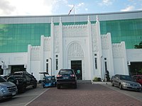
Bauan Plaza Hotel
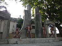
Plaza Orense Monument
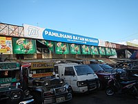
Bauan Market


References[]
- ^ "Patron Saints of Towns and Cities | Patron Saint of Different Municipalities in the Philippines". Flickr. 2007-08-25. Retrieved 2019-05-10.
- ^ Municipality of Bauan | (DILG)
- ^ "2015 Census of Population, Report No. 3 – Population, Land Area, and Population Density" (PDF). Philippine Statistics Authority. Quezon City, Philippines. August 2016. ISSN 0117-1453. Archived (PDF) from the original on May 25, 2021. Retrieved July 16, 2021.
- ^ Jump up to: a b c d Census of Population (2020). "Region IV-A (Calabarzon)". Total Population by Province, City, Municipality and Barangay. PSA. Retrieved 8 July 2021.
- ^ https://psa.gov.ph/sites/default/files/City%20and%20Municipal-level%20Small%20Area%20Poverty%20Estimates_%202009%2C%202012%20and%202015_0.xlsx; publication date: 10 July 2019; publisher: Philippine Statistics Authority.
- ^ Jump up to: a b c d e Hargrove, Thomas (1991). The Mysteries of Taal: A Philippine volcano and lake, her sea life and lost towns. Manila: Bookmark Publishing. pp. 75–101. ISBN 9715690467.
- ^ Beltran, Maria Rona. "SAMPAGUITA BEACH RESORT IN BAUAN, BATANGAS".
- ^ iviangita (27 April 2016). "Sampaguita Beach: A Hidden Gem in Batangas".
- ^ "Province: Batangas". PSGC Interactive. Quezon City, Philippines: Philippine Statistics Authority. Retrieved 12 November 2016.
- ^ "Municipal: Bauan". PSGC Interactive. Quezon City, Philippines: Philippine Statistics Authority. Retrieved 8 January 2016.
- ^ "An Act to Create the Barrio of San Teodoro in the Municipality of Bauan, Province of Batangas". LawPH.com. Retrieved 2011-04-09.
- ^ "An Act to Convert the Sitio of Jipit, in the Barrio of San Antonio, Municipality of Bauan, Province of Batangas, into a Barrio to Be Known As the Barrio of Santo Niño". LawPH.com. Retrieved 2011-04-11.
- ^ "An Act to Convert the Sitio of Pook Ni Banal in the Barrio of Malaking Pook, Municipality of Bauan, Province of Batangas, into a Barrio". LawPH.com. Retrieved 2011-04-11.
- ^ "An Act Creating the Barrio of San Jose, Maricaban Island, Municipality of Bauan, Province of Batangas". LawPH.com. Retrieved 2011-04-12.
- ^ "An Act Creating the Barrio of San Juan in Maricaban Island, Municipality of Bauan, Province of Batangas". LawPH.com. Retrieved 2011-04-12.
- ^ "An Act Creating the Barrio of San Miguel in the Municipality of Bauan, Province of Batangas". LawPH.com. Retrieved 2011-04-12.
- ^ "An Act Converting the Sitio of Puting Buhangin, Barrio Magalanggalang, Municipality of Bauan, Province of Batangas, into a Barrio of Said Municipality to Be Known As the Barrio of Orense". LawPH.com. Archived from the original on 2012-07-09. Retrieved 2011-04-12.
- ^ Jump up to: a b Census of Population and Housing (2010). "Region IV-A (Calabarzon)". Total Population by Province, City, Municipality and Barangay. NSO. Retrieved 29 June 2016.
- ^ "Bauan: Average Temperatures and Rainfall". Meteoblue. Retrieved 5 May 2020.
- ^ Census of Population (2015). "Region IV-A (Calabarzon)". Total Population by Province, City, Municipality and Barangay. PSA. Retrieved 20 June 2016.
- ^ Censuses of Population (1903–2007). "Region IV-A (Calabarzon)". Table 1. Population Enumerated in Various Censuses by Province/Highly Urbanized City: 1903 to 2007. NSO.
- ^ "Province of Batangas". Municipality Population Data. Local Water Utilities Administration Research Division. Retrieved 17 December 2016.
- ^ "Poverty incidence (PI):". Philippine Statistics Authority. Retrieved 28 December 2020.
- ^ https://psa.gov.ph/sites/default/files/NSCB_LocalPovertyPhilippines_0.pdf; publication date: 29 November 2005; publisher: Philippine Statistics Authority.
- ^ https://psa.gov.ph/sites/default/files/2003%20SAE%20of%20poverty%20%28Full%20Report%29_1.pdf; publication date: 23 March 2009; publisher: Philippine Statistics Authority.
- ^ https://psa.gov.ph/sites/default/files/2006%20and%202009%20City%20and%20Municipal%20Level%20Poverty%20Estimates_0_1.pdf; publication date: 3 August 2012; publisher: Philippine Statistics Authority.
- ^ https://psa.gov.ph/sites/default/files/2012%20Municipal%20and%20City%20Level%20Poverty%20Estima7tes%20Publication%20%281%29.pdf; publication date: 31 May 2016; publisher: Philippine Statistics Authority.
- ^ https://psa.gov.ph/sites/default/files/City%20and%20Municipal-level%20Small%20Area%20Poverty%20Estimates_%202009%2C%202012%20and%202015_0.xlsx; publication date: 10 July 2019; publisher: Philippine Statistics Authority.
Further reading[]
- Thomas R. Hargrove, The Mysteries of Taal: A Philippine Volcano and Lake, Her Sea Life and Lost Towns
External links[]
| Wikisource has the text of the 1911 Encyclopædia Britannica article Bauan. |
 Media related to Bauan at Wikimedia Commons
- Bauan Profile at PhilAtlas.com
- Philippine Standard Geographic Code
| show Places adjacent to Bauan |
|---|
| hide | |
|---|---|
Batangas City (capital) | |
| Municipalities | |
| Component cities | |
| show Authority control |
|---|
- Municipalities of Batangas
- 1590 establishments in the Spanish Empire
- Populated places established in 1590