Behadar
Behadar
Behadar Kala | |
|---|---|
Populated place | |
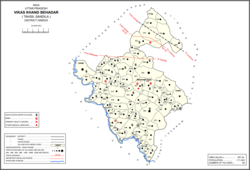 Map showing Behadar (#937) in Behadar CD block | |
 Behadar Location in Uttar Pradesh | |
| Coordinates: 27°01′26″N 80°24′43″E / 27.024°N 80.412°ECoordinates: 27°01′26″N 80°24′43″E / 27.024°N 80.412°E | |
| Country | |
| State | Uttar Pradesh |
| District | Hardoi |
| Area | |
| • Total | 5.996 km2 (2.315 sq mi) |
| Population (2011)[1] | |
| • Total | 4,458 |
| • Density | 740/km2 (1,900/sq mi) |
| Languages | |
| • Official | Hindi |
| Time zone | UTC+5:30 (IST) |

Behadar, also Behadar Kala, is a village and corresponding community development block in Hardoi district of Uttar Pradesh, India.[1] There is a market at Behadar Kalan Hashimpore on Wednesdays and Sundays, with no particular specialisation.[2] The village has 3 primary schools and 0 healthcare facilities.[1] As of 2011, the population of Behadar is 4,458, in 1,194 households.[1]
Villages[]
Behadar CD block has the following 90 villages:[1]
| Village name | Total land area (hectares) | Population (in 2011) |
|---|---|---|
| 848.2 | 5,244 | |
| 255.6 | 1,696 | |
| 312.8 | 2,620 | |
| 267.1 | 2,052 | |
| 89.7 | 924 | |
| 265.1 | 1,271 | |
| 290 | 1,150 | |
| 162.7 | 1,664 | |
| 148.7 | 1,945 | |
| 422.9 | 2,493 | |
| 112.4 | 973 | |
| 342.2 | 2,764 | |
| 119.7 | 1,110 | |
| 103.3 | 1,247 | |
| 517.4 | 4,245 | |
| 134 | 666 | |
| 382.2 | 3,608 | |
| 165.2 | 1,091 | |
| 478.2 | 3,813 | |
| 128.8 | 1,609 | |
| 109.3 | 946 | |
| 94.4 | 972 | |
| 95.6 | 504 | |
| 334.8 | 2,705 | |
| 552.1 | 2,197 | |
| 441.1 | 3,362 | |
| 1,047.8 | 4,332 | |
| 138.7 | 1,058 | |
| 534.2 | 3,846 | |
| 267.8 | 1,973 | |
| 447.1 | 3,887 | |
| 236 | 825 | |
| 254.3 | 1,107 | |
| 359.1 | 1,962 | |
| 606 | 4,174 | |
| 809.7 | 2,333 | |
| 280.3 | 2,305 | |
| 814.8 | 5,523 | |
| Behadar Kala (block headquarters) | 599.6 | 4,458 |
| 536.5 | 4,320 | |
| 363.5 | 1,838 | |
| 228.6 | 1,329 | |
| 259.8 | 1,916 | |
| 433 | 3,676 | |
| 170 | 1,361 | |
| 332.5 | 2,762 | |
| 139.4 | 1,120 | |
| 139.7 | 501 | |
| 220.4 | 1,135 | |
| 62.3 | 430 | |
| 190.1 | 1,130 | |
| 328.3 | 2,243 | |
| 90.9 | 1,061 | |
| 121 | 945 | |
| 159.7 | 1,123 | |
| 379.6 | 1,869 | |
| 144.2 | 452 | |
| 596.3 | 2,930 | |
| 80.1 | 649 | |
| 231.7 | 1,430 | |
| 72.2 | 589 | |
| 225.9 | 2,092 | |
| 95.4 | 172 | |
| 108.2 | 562 | |
| 79.4 | 776 | |
| 139.4 | 1,483 | |
| 146.6 | 954 | |
| 302.2 | 2,374 | |
| 220.8 | 1,747 | |
| 759.2 | 5,234 | |
| 284.4 | 1,445 | |
| 131.8 | 1,084 | |
| 76 | 514 | |
| 518 | 3,269 | |
| 189 | 1,248 | |
| 137.4 | 936 | |
| 153.6 | 1,322 | |
| 164.9 | 1,206 | |
| 351.3 | 3,385 | |
| 280.7 | 1,877 | |
| 431.2 | 2,705 | |
| 79.6 | 459 | |
| 255 | 1,761 | |
| 95.3 | 421 | |
| 131.6 | 761 | |
| 175.9 | 1,126 | |
| 454.5 | 1,728 | |
| 129.9 | 810 | |
| 626.9 | 3,424 |
References[]
- ^ a b c d e f "Census of India 2011: Uttar Pradesh District Census Handbook - Hardoi, Part A (Village and Town Directory)" (PDF). Census 2011 India. pp. 417–34. Retrieved 18 June 2021.
- ^ Census 1961: District Census Handbook, Uttar Pradesh (36 - Hardoi District) (PDF). Lucknow. 1965. pp. 167, cxlii-cxliii of section "Sandila Tahsil". Retrieved 18 June 2021.
Categories:
- Villages in Hardoi district