Bharawan
Bharawan | |
|---|---|
Populated place | |
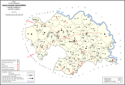 Map showing Bharawan (#131) in Bharawan CD block | |
 Bharawan Location in Uttar Pradesh, India | |
| Coordinates: 27°09′30″N 80°42′22″E / 27.158277°N 80.706018°ECoordinates: 27°09′30″N 80°42′22″E / 27.158277°N 80.706018°E[1] | |
| Country | |
| State | Uttar Pradesh |
| District | Hardoi |
| Area | |
| • Total | 10.451 km2 (4.035 sq mi) |
| Population (2011)[2] | |
| • Total | 10,443 |
| • Density | 1,000/km2 (2,600/sq mi) |
| Languages | |
| • Official | Hindi |
| Time zone | UTC+5:30 (IST) |


Bharawan is a village and corresponding community development block in Sandila tehsil of Hardoi district, Uttar Pradesh, India.[2] Located 23 km from Sandila, it hosts a market on Mondays and Thursdays[3] and has four primary schools and one healthcare facility.[2] The main staple foods are wheat and juwar.[3] As of 2011, the population of Bharawan is 10,443, in 1,649 households.[2]
Demographic history[]
The 1961 census recorded Bharawan as comprising 13 hamlets, with a total population of 4,314 (2,286 male and 2,028 female), in 838 households and 701 physical houses.[4] The area of the village was given as 2,657 acres.[4]
The 1981 census recorded Bharawan as having a population of 6,066, in 1,466 households, and covering an area of 1,074.88 hectares.[3]
Villages[]
Bharawan CD block has the following 97 villages:[2]
| Village name | Total land area (hectares) | Population (in 2011) |
|---|---|---|
| 717.2 | 4,016 | |
| 664.1 | 3,515 | |
| 1,458.7 | 8,770 | |
| 92.7 | 836 | |
| 54 | 597 | |
| 189.2 | 802 | |
| 176.5 | 2,901 | |
| 99.5 | 361 | |
| 844 | 6,428 | |
| 150.3 | 964 | |
| 139.8 | 694 | |
| 284.5 | 2,601 | |
| 423.6 | 2,899 | |
| 583.4 | 1,577 | |
| 206.5 | 1,197 | |
| 258.3 | 2,345 | |
| 50.6 | 252 | |
| 99.4 | 492 | |
| 226.1 | 1,025 | |
| 78.8 | 492 | |
| 79.5 | 451 | |
| 527.5 | 3,339 | |
| 68.9 | 264 | |
| 95.7 | 1,281 | |
| 192.5 | 1,018 | |
| 508.5 | 2,834 | |
| 105.5 | 1,031 | |
| 189.5 | 1,200 | |
| 411 | 1,924 | |
| 24 | 504 | |
| 400.9 | 1,819 | |
| 124.2 | 541 | |
| 77.2 | 684 | |
| 451.7 | 2,067 | |
| 1,086.4 | 4,285 | |
| 434.4 | 4,353 | |
| 836.7 | 3,586 | |
| 380.8 | 2,143 | |
| 798.5 | 4,440 | |
| 29.9 | 166 | |
| 120.9 | 1,016 | |
| 80.2 | 655 | |
| 1,223.7 | 8,116 | |
| 49.8 | 728 | |
| 101.6 | 911 | |
| 110.8 | 698 | |
| 507 | 4,622 | |
| Bharawan (block headquarters) | 1,045.1 | 10,443 |
| 347.6 | 1,307 | |
| 171.6 | 669 | |
| 158.2 | 945 | |
| 35 | 967 | |
| 299.4 | 2,675 | |
| 234.8 | 1,771 | |
| 440.8 | 3,338 | |
| 164.8 | 1,446 | |
| 297 | 1,935 | |
| 226 | 1,170 | |
| 422.8 | 3,035 | |
| 376.2 | 2,153 | |
| 73.6 | 573 | |
| 309.9 | 1,820 | |
| 48.5 | 552 | |
| 148.1 | 1,260 | |
| 52.1 | 371 | |
| 318 | 2,094 | |
| 549 | 2,658 | |
| 202.3 | 1,247 | |
| 179 | 1,372 | |
| 196 | 1,234 | |
| 114.3 | 683 | |
| 691 | 6,287 | |
| 166.2 | 2,141 | |
| 207.4 | 1,554 | |
| 25.3 | 385 | |
| 67.8 | 628 | |
| 219.1 | 2,181 | |
| 163.4 | 1,364 | |
| 100.8 | 936 | |
| 211.8 | 1,798 | |
| 548.3 | 3,202 | |
| 98.4 | 655 | |
| 89.9 | 746 | |
| 129.2 | 1,130 | |
| 72.7 | 501 | |
| 230 | 931 | |
| 763.7 | 4,064 | |
| 1,649.6 | 7,167 | |
| 234 | 1,118 | |
| 405.8 | 1,264 | |
| 104.5 | 205 | |
| 283.5 | 1,272 | |
| 131.3 | 688 | |
| 130.6 | 611 | |
| 508.9 | 2,471 | |
| 166.4 | 644 | |
| 239.9 | 1,000 |
References[]
- ^ Search for "Bharawan" here https://geonames.nga.mil/namesgaz/. Missing or empty
|title=(help) - ^ a b c d e f "Census of India 2011: Uttar Pradesh District Census Handbook - Hardoi, Part A (Village and Town Directory)" (PDF). Census 2011 India. pp. 455–72. Retrieved 20 June 2021.
- ^ a b c Census 1981 Uttar Pradesh: District Census Handbook Part XIII-A: Village & Town Directory, District Hardoi (PDF). 1982. pp. 244–5. Retrieved 20 June 2021.
- ^ a b Census 1961: District Census Handbook, Uttar Pradesh (36 - Hardoi District) (PDF). Lucknow. 1965. pp. cxxx-cxxxi of section "Sandila Tahsil". Retrieved 20 June 2021.
- Villages in Hardoi district