Kachhauna Patseni
Kachhauna Patseni
Kachwanka Patsareni | |
|---|---|
city | |
| Nickname(s): Balama Hamre | |
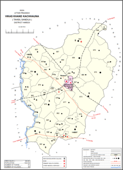 Map showing Kachhauna Patseni and Kachhauna CD block | |
 Kachhauna Patseni Location in Uttar Pradesh, India | |
| Coordinates: 27°10′N 80°21′E / 27.167°N 80.350°ECoordinates: 27°10′N 80°21′E / 27.167°N 80.350°E | |
| Country | |
| State | Uttar Pradesh |
| District | Hardoi |
| Founded by | Late Pt. Tulsi Ram Shukla |
| Government | |
| • Type | Indian |
| • Body | AAP |
| Area | |
| • Total | 6.6 km2 (2.5 sq mi) |
| Population (2011)[1] | |
| • Total | 15,647 |
| • Density | 2,400/km2 (6,100/sq mi) |
| Languages | |
| • Official | Awadhi, Urdu, Iranian, Punjabi |
| Time zone | UTC+5:30 (IST) |

Kachhauna Patseni is a town and a nagar panchayat in Sandila tehsil of Hardoi district, Uttar Pradesh, India.[1] It was first upgraded to urban status for the 1981 census.[2] As of 2011, its population is 15,647, in 2,772 households.[1] The Kachhauna community development block encompasses the rural areas surrounding the town.[1]
Demographics[]
| Year | Pop. | ±% |
|---|---|---|
| 1981 | 7,942 | — |
| 1991 | 10,268 | +29.3% |
| 2001 | 13,509 | +31.6% |
| 2011 | 15,647 | +15.8% |
| Source: 2011 Census of India[1] | ||
As of 2001 India census,[3] Kachhauna Patseni had a population of 13,504. Males constitute 54% of the population and females 46%. Kachhauna Patseni has an average literacy rate of 61%, higher than the national average of 59.5%: male literacy is 69%, and female literacy is 52%.
Economy[]
As of 1981, Kachhauna Patseni's three main imports were sugar, fertilizer, and kerosene oil.[2] The three main commodities manufactured in town were rice, mustard oil, and tin boxes.[2] The three largest exports were paddy, groundnut, and wheat.[2]
Villages[]
Kachhauna block contains the following 46 villages:[1]
| Village name | Total land area (hectares) | Population (in 2011) |
|---|---|---|
| 281.8 | 2,120 | |
| 518.9 | 4,038 | |
| 1,022.6 | 7,093 | |
| 250.1 | 1,241 | |
| 481 | 2,379 | |
| 561.6 | 4,228 | |
| 277.1 | 2,097 | |
| 449 | 3,529 | |
| 412.1 | 3,134 | |
| 122.3 | 852 | |
| 689.8 | 4,794 | |
| 1,626.6 | 7,371 | |
| Gaju | 1,299.4 | 8,912 |
| 346.6 | 4,206 | |
| 514 | 3,487 | |
| 275.6 | 1,654 | |
| 67.9 | 713 | |
| 426.7 | 2,561 | |
| 907.9 | 4,518 | |
| 567.6 | 2,653 | |
| 1,569.1 | 7,188 | |
| 2,173.3 | 10,123 | |
| 939.8 | 6,167 | |
| 224.1 | 2,084 | |
| 894 | 3,989 | |
| 427.9 | 1,743 | |
| 576.6 | 4,467 | |
| 27 | 287 | |
| 151.1 | 1,024 | |
| Balamu | 701.4 | 4,749 |
| 165.8 | 748 | |
| 175.2 | 1,022 | |
| 332.1 | 2,315 | |
| Gausganj | 696.8 | 11,384 |
| 469.3 | 3,917 | |
| 196.4 | 1,755 | |
| 306.9 | 1,466 | |
| 84.6 | 1,082 | |
| Terwa Dahigawan | 501 | 3,597 |
| 527.2 | 2,699 | |
| 314.2 | 2,624 | |
| 207 | 2,767 | |
| 203.1 | 1,900 | |
| 167 | 1,483 | |
| 733.2 | 5,376 |
References[]
- ^ Jump up to: a b c d e f g "Census of India 2011: Uttar Pradesh District Census Handbook - Hardoi, Part A (Village and Town Directory)" (PDF). Census 2011 India. pp. 407–16, 578–81. Retrieved 15 June 2021.
- ^ Jump up to: a b c d Census 1981 Uttar Pradesh: District Census Handbook Part XIII-A: Village & Town Directory, District Hardoi (PDF). 1982. pp. 12, 360–1, 372–3. Retrieved 15 June 2021.
- ^ "Census of India 2001: Data from the 2001 Census, including cities, villages and towns (Provisional)". Census Commission of India. Archived from the original on 16 June 2004. Retrieved 1 November 2008.
This Hardoi district location article is a stub. You can help Wikipedia by . |
- Cities and towns in Hardoi district
- Lucknow division geography stubs