Bellicourt
From Wikipedia, the free encyclopedia
show This article may be expanded with text translated from the corresponding article in French. (December 2008) Click [show] for important translation instructions.
|
Commune in Hauts-de-France, France
Bellicourt | |
|---|---|
Commune | |
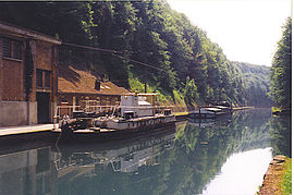 St. Quentin Canal | |
 Bellicourt  Bellicourt | |
Coordinates:  49°57′42″N 3°14′12″E / 49.9617°N 3.2367°E / 49.9617; 3.2367Coordinates: 49°57′42″N 3°14′12″E / 49.9617°N 3.2367°E / 49.9617; 3.2367 49°57′42″N 3°14′12″E / 49.9617°N 3.2367°E / 49.9617; 3.2367Coordinates: 49°57′42″N 3°14′12″E / 49.9617°N 3.2367°E / 49.9617; 3.2367 | |
| Country | France |
| Region | Hauts-de-France |
| Department | Aisne |
| Arrondissement | Saint-Quentin |
| Canton | Bohain-en-Vermandois |
| Intercommunality | |
| Government | |
| • Mayor (2020–2026) | Marcel Leclère[1] |
| Area 1 | 9.77 km2 (3.77 sq mi) |
| Population (Jan. 2018)[2] | 598 |
| • Density | 61/km2 (160/sq mi) |
| Time zone | UTC+01:00 (CET) |
| • Summer (DST) | UTC+02:00 (CEST) |
| INSEE/Postal code | 02065 /02420 |
| Elevation | 94–194 m (308–636 ft) (avg. 132 m or 433 ft) |
| 1 French Land Register data, which excludes lakes, ponds, glaciers > 1 km2 (0.386 sq mi or 247 acres) and river estuaries. | |

Bellicourt is a commune in the department of Aisne in Hauts-de-France in northern France. It lies on the N44 road between Cambrai and Saint-Quentin and over the principal tunnel of the St. Quentin Canal. It was the site of numerous intense combat actions and battles during World War I.
Population[]
| Year | Pop. | ±% |
|---|---|---|
| 2006 | 643 | — |
| 2007 | 644 | +0.2% |
| 2008 | 638 | −0.9% |
| 2009 | 637 | −0.2% |
| 2010 | 636 | −0.2% |
| 2011 | 635 | −0.2% |
| 2012 | 632 | −0.5% |
| 2013 | 634 | +0.3% |
| 2014 | 624 | −1.6% |
| 2015 | 614 | −1.6% |
| 2016 | 604 | −1.6% |
See also[]
References[]
- ^ "Répertoire national des élus: les maires". data.gouv.fr, Plateforme ouverte des données publiques françaises (in French). 2 December 2020.
- ^ "Populations légales 2018". INSEE. 28 December 2020.
| Wikimedia Commons has media related to Bellicourt. |
show
| |
|---|---|
| Prefecture |
|
| Subprefectures |
|
| Other |
|
| show Authority control | |
|---|---|
| General |
|
| Other | |
This Saint-Quentin arrondissement geographical article is a stub. You can help Wikipedia by . |
- v
- t
Retrieved from ""
Categories:
- Communes of Aisne
- Saint-Quentin arrondissement geography stubs
Hidden categories:
- CS1 French-language sources (fr)
- Articles to be expanded from December 2008
- All articles to be expanded
- Geography articles needing translation from French Wikipedia
- Articles with short description
- Short description is different from Wikidata
- Infobox mapframe without OSM relation ID on Wikidata
- Coordinates on Wikidata
- Pages using infobox settlement with image map1 but not image map
- Commons category link is on Wikidata
- Articles with VIAF identifiers
- Articles with NARA identifiers
- Articles with WorldCat-VIAF identifiers
- Aisne communes articles needing translation from French Wikipedia
- All stub articles
- Pages using the Kartographer extension